

Severe Weather possible Wednesday
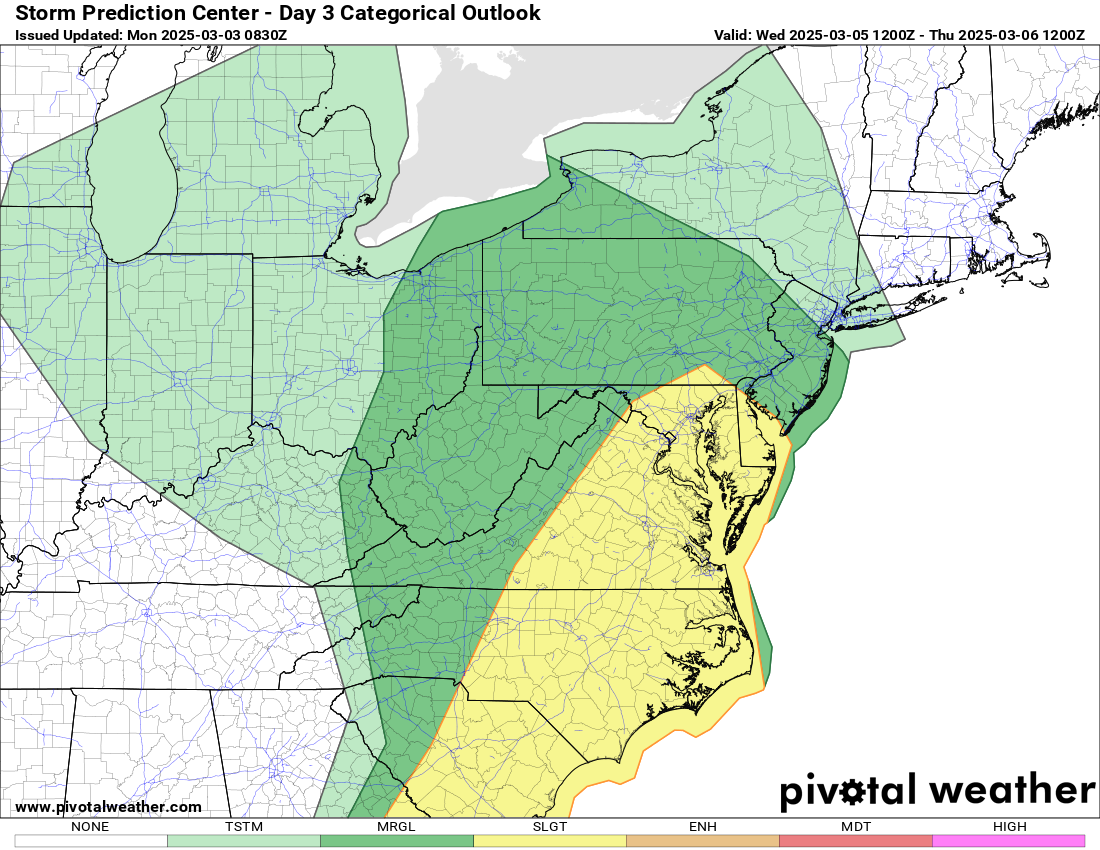
Severe thunderstorms capable of producing damaging winds and a few tornadoes are possible across parts of the southern and middle Atlantic Seaboard on Wednesday.
Models continue to indicate that the center of a broad and deep, occluding surface cyclone will migrate from the Upper Midwest through the lower Great Lakes region into Quebec during this period. Associated strong lower/mid-tropospheric wind fields are likely to impact a broad area east of the Rockies through the Atlantic Seaboard. Models indicate that this may include, south to southwesterly flow on the order of 50-90+ kt within a moistening warm sector, east of deepening surface troughing to the lee of the Blue Ridge, and perhaps ahead of an eastward surging cold front across parts of the Allegheny Plateau into lower Great Lakes vicinity. Although more favorable low-level moisture return from the Gulf may become cut off by early Wednesday, moistening may be augmented somewhat by a developing return flow off a modifying boundary-layer offshore of the southern Atlantic Seaboard. Models still indicate that this may only become supportive of weak destabilization. However, given the strength of the wind fields and areas of stronger forcing for ascent, there appears at least a conditional risk for severe thunderstorm activity across a broad area.