
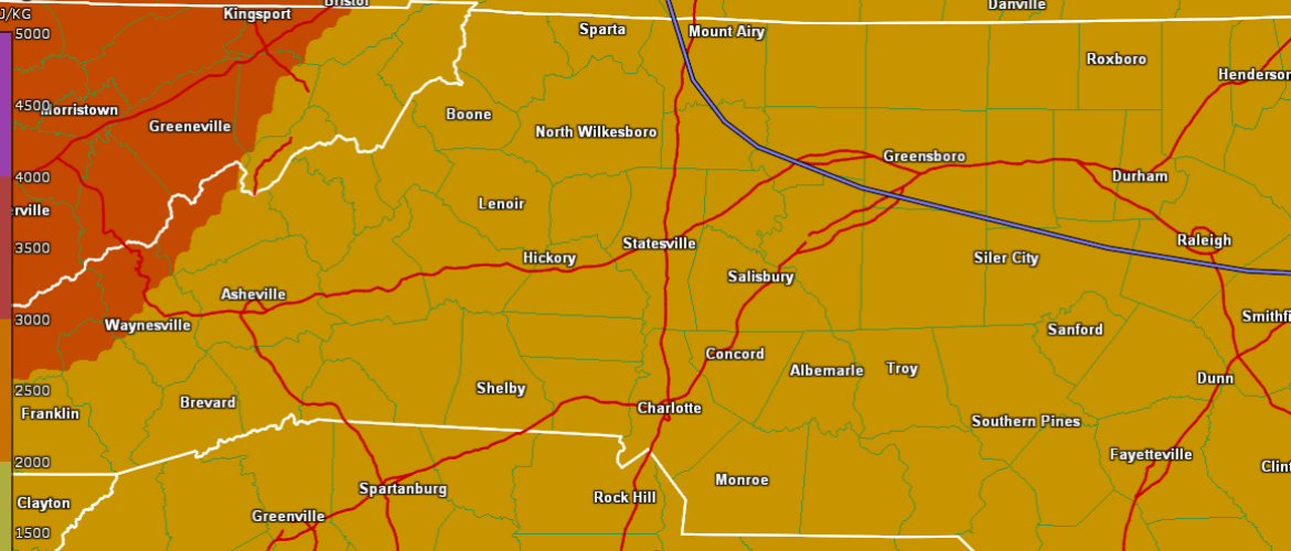
Severe Storms Possible This Afternoon Through Tonight
At least two rounds of thunderstorms are expected to impact our area this afternoon through Thursday morning. Each round of storms will pose a threat for at least isolated damaging wind gusts and large hail. Additionally, locations that happen to receive heavy rainfall with each round of storms will face a threat for flash flooding
TIMING
▪ Scattered thunderstorms are expected to develop this afternoon into the evening, especially across western NC. Isolated severe storms are expected during this time.
▪ An organized complex of thunderstorms is expected to move into the area overnight into Thursday morning. This could pose a threat of more widespread damaging wind gusts, especially across the NC mountains.
▪ While localized flash flooding is possible at any time, the main threat will be overnight.
HAZARDS & IMPACTS
▪ Damaging wind gusts (58+ mph).
▪ Large hail (1 inch or greater)...One or two storms this afternoon could produce hail larger than golf balls.
▪ Localized flash flooding.
▪ A couple of brief tornadoes are also possible.
FORECAST CHALLENGES
▪ Forecast confidence is low regarding the extent of coverage of storms this afternoon and evening.
▪ Confidence is low-to-moderate regarding the intensity of the overnight storm complex. There will be some potential for widespread damaging wind gusts, especially across the mountains.
POST-EVENT OUTLOOK
▪ Additional scattered thunderstorms posing a threat for severe weather and excessive rainfall are possible Thursday afternoon, but confidence in this is low at this time.