
A STRONG THUNDERSTORM WILL IMPACT NORTHWESTERN CATAWBAWESTERN DAVIEALEXANDERIREDELLEASTERN CALDWELLNORTHWESTERN ROWAN AND EAST CENTRAL BURKE COUNTIES THROUGH 1000 PM EDT.
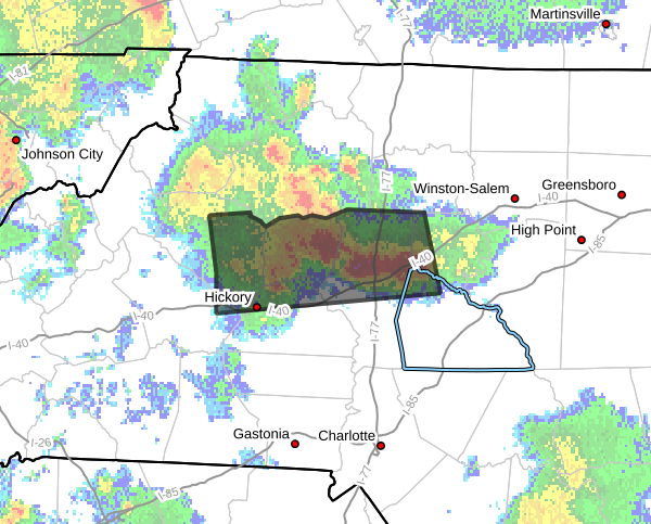
...A STRONG THUNDERSTORM WILL IMPACT NORTHWESTERN CATAWBA...WESTERN
DAVIE...ALEXANDER...IREDELL...EASTERN CALDWELL...NORTHWESTERN ROWAN
AND EAST CENTRAL BURKE COUNTIES THROUGH 1000 PM EDT...
At 918 PM EDT, Doppler radar was tracking a strong thunderstorm 7
miles east of Lenoir, or near Cedar Rock, moving east at 40 mph.
HAZARD...Wind gusts of 50 to 55 mph and nickel size hail.
SOURCE...Radar indicated.
IMPACT...Gusty winds could knock down tree limbs and blow around
unsecured objects. Minor hail damage to outdoor objects is
possible.
Locations impacted include...
Hickory, Statesville, Lenoir, Taylorsville, St. Stephens, Longview,
Sawmills, Granite Falls, Bethlehem, and Hudson.
PRECAUTIONARY/PREPAREDNESS ACTIONS...
If outdoors, consider seeking shelter inside a building.
Please let our local sponsors know that you appreciate their support of our blog. Take a moment to visit their website linked at the top of this post.
Share this:

Announcements & Events
Check back often for important announcements and events that I'll be involved in!