
STRONG THUNDERSTORMS WILL IMPACT CABARRUSSOUTHEASTERN MECKLENBURGSOUTH CENTRAL ROWAN AND CENTRAL UNION COUNTIES THROUGH 815 PM EDT.
...STRONG THUNDERSTORMS WILL IMPACT CABARRUS...SOUTHEASTERN
MECKLENBURG...SOUTH CENTRAL ROWAN AND CENTRAL UNION COUNTIES THROUGH
815 PM EDT...
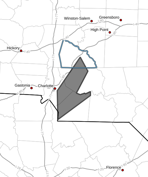
At 729 PM EDT, Doppler radar was tracking strong thunderstorms along
a line extending from 5 miles southeast of Uptown Charlotte to 6
miles southeast of Indian Land. Movement was northeast at 35 mph.
HAZARD...Wind gusts up to 50 mph and pea size hail.
SOURCE...Radar indicated.
IMPACT...Gusty winds could knock down tree limbs and blow around
unsecured objects. Minor hail damage to outdoor objects is
possible.
Locations impacted include...
Downtown Concord, Monroe, South Charlotte, East Charlotte, Matthews,
Mint Hill, Indian Trail, Weddington, Stallings, and Unionville.
PRECAUTIONARY/PREPAREDNESS ACTIONS...
If outdoors, consider seeking shelter inside a building.
A Tornado Watch remains in effect until 1100 PM EDT for the Piedmont
of North Carolina.
Please let our local sponsors know that you appreciate their support of our blog. Take a moment to visit their website linked at the top of this post.
Share this:

Announcements & Events
Check back often for important announcements and events that I'll be involved in!