
Heavy Rain and Windy Conditions Sunday
A low-pressure system will move northward out of the Gulf of Mexico Saturday night. The system is expected to develop into a Nor'easter off the coast of the Carolinas. Heavy rainfall and very windy conditions from this system may cross our region primarily on Sunday.
TIMING
Rain and easterly winds will increase Saturday night. The heaviest rainfall and strongest wind gusts are likely on Sunday. Heavy rain could linger into Sunday night, and windy conditions could persist through Monday.
HAZARDS &
IMPACTS
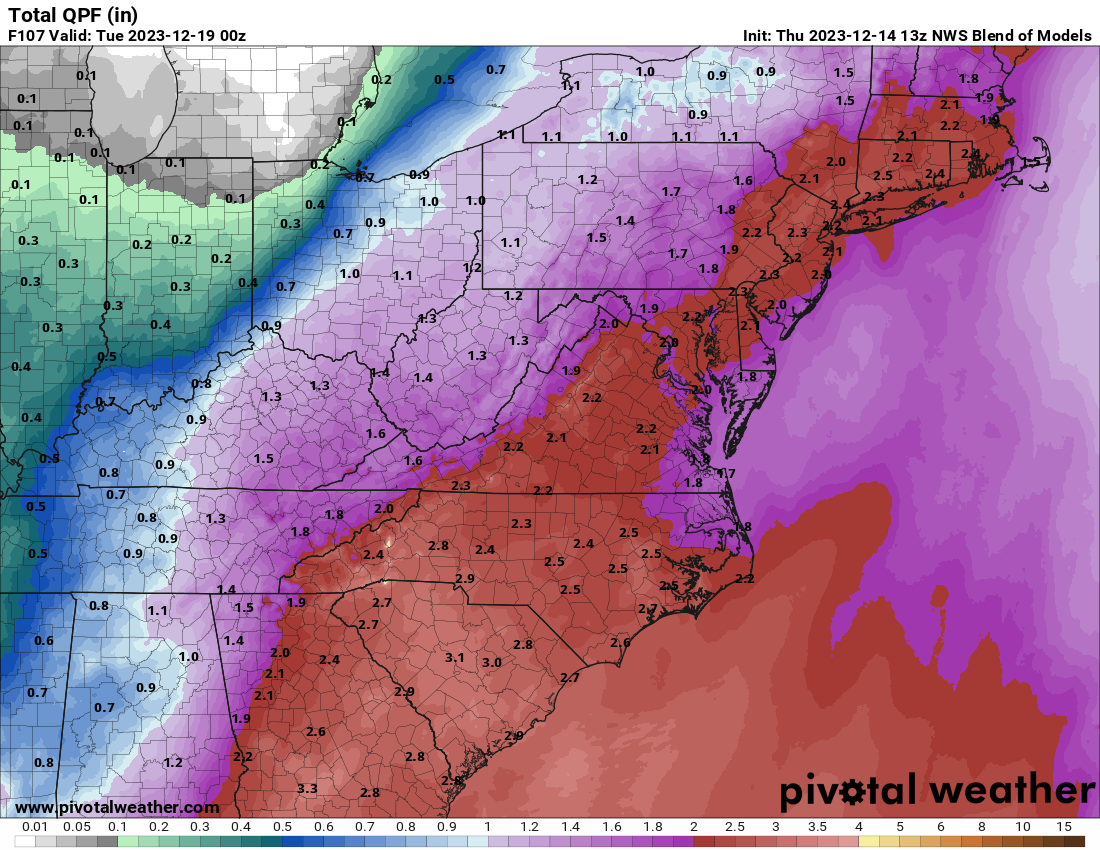
Heavy rainfall may cause flooding of any streams and creeks repeatedly affected by bands of rain. We could see as much as 2 - 3 inches of rainfall by the time the system moves out of the county and the area.
Windy conditions will develop on easterly flow Saturday night/Sunday and likely turn westerly Sunday night through Monday. Tree limbs or weak trees could be blown down and power outages may result.
Thunderstorm potential presently looks limited, but this could change sharply depending on the low center track.
FORECAST
CHALLENGES
This system is being driven by a complex interaction of low-pressure systems to the west. This makes the eventual track and strength of the low emerging from the Gulf of Mexico quite uncertain. These factors will ultimately drive the rain, flooding, wind, and storm threats.