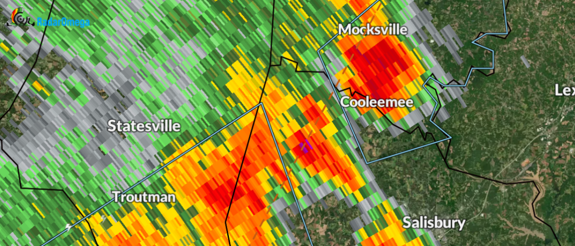
A strong thunderstorm will impact portions of central Davie and north central Rowan Counties through 415 PM EDT.
...A strong thunderstorm will impact portions of central Davie and
north central Rowan Counties through 415 PM EDT...
At 349 PM EDT, Doppler radar was tracking a strong thunderstorm 4
miles southeast of Mocksville, or near Cooleemee, moving northeast at
25 mph.
HAZARD...Wind gusts up to 50 mph and pea size hail.
SOURCE...Radar indicated.
IMPACT...Gusty winds could knock down tree limbs and blow around
unsecured objects. Minor damage to outdoor objects is
possible.
Locations impacted include...
Mocksville, Bermuda Run, Cooleemee, Fork Church, Advance and
Woodleaf.
PRECAUTIONARY/PREPAREDNESS ACTIONS...
If outdoors, consider seeking shelter inside a building.
This storm may intensify, so be certain to monitor local radio
stations and available television stations for additional information
and possible warnings from the National Weather Service.
Please let our local sponsors know that you appreciate their support of our blog. Take a moment to visit their website linked at the top of this post.
Share this:

Announcements & Events
Check back often for important announcements and events that I'll be involved in!