
Marginal Risk for Excessive Rainfall Thursday
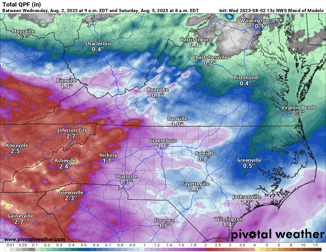
I am monitoring the potential for excessive rainfall around the county and the area on Thursday. The setup remains favorable for heavy rainfall and flash flooding both Thursday morning and again late Thursday night into Friday morning as shortwave energy moves through the region within the northwest flow regime. At the surface, an area of low pressure slides southeastward, advancing a warm front into the region. Strong southwesterly low-level flow will bring a surge of moisture into the region, we could see as much as a half an inch to an inch of rainfall accumulation around the county by early Friday morning. Locations in the mountains and foothills could see as much as 1 -2 inches of rainfall in that same period of time. Should the system slow down we could see most of this activity on Friday. On the other hand if the system speeds up we could see more accumulation for the county and the area on Thursday.

Additional rainfall is expected during the day on Friday which will add to our rainfall totals before we start to dry out on Saturday. Including the additional rainfall on Friday we could see as much as 1 -2 inches of tainfall overall around the county and the area by early Saturday with locations to our west seeing as much as 2 -3 inches of rainfall accumulation in that same period.
Rowan County Weather will continue to monitor the forecast closely and keep you informed before, during and after the rain moves through the county and the area. Stay with us for more details.