
Weather Wednesday: This Summer is on Pace to Break a Record
This summer has not been very kind to the farmers here in Rowan County. The lack of rain has had a devastating effect on their crops. If you look around it’s easy to see we are getting into some early stages of drought with no relief in sight. The chart below issued by the National Weather Service shows the ten driest summers on record since 1893. This year has the distinction of being the driest.

We have only had 1.14” of rainfall. This is almost 3 inches below the summer of 1921, when for the entire summer Rowan County had only 4.02” of rainfall around the county.
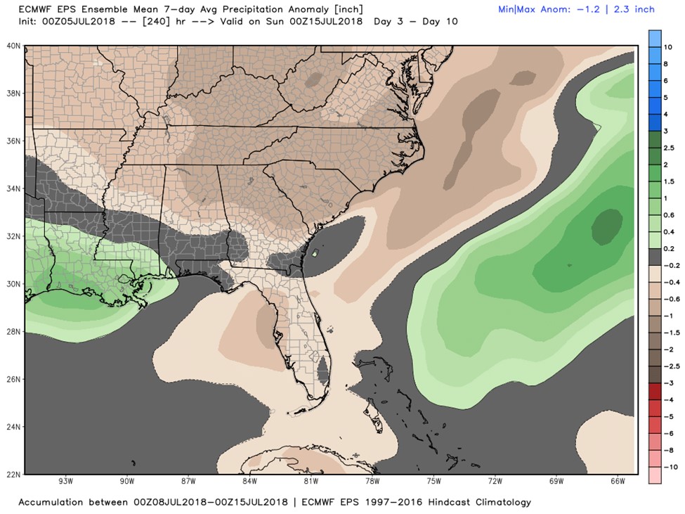

The 10-day outlook pictured above shows that things are probably going to get worse before they get better. We are forecasted to get very little in the way of accumulative rainfall through July 15. Last Thursday, the North Carolina Climate Office had Rowan County listed in the very first stage of drought conditions with abnormally dry conditions around the county.
Not only are we experiencing a very dry summer, but we are having record heat as seen in the chart below. This is currently the 6th warmest summer on record for Rowan County.


The scary thing is we are not far from the top spot on the list. Less than a degree separates this summer from the summer of 1943, the hottest on record for Rowan County. We did have some cooler temperatures for the first half of this week, which did offer us a bit of relief.
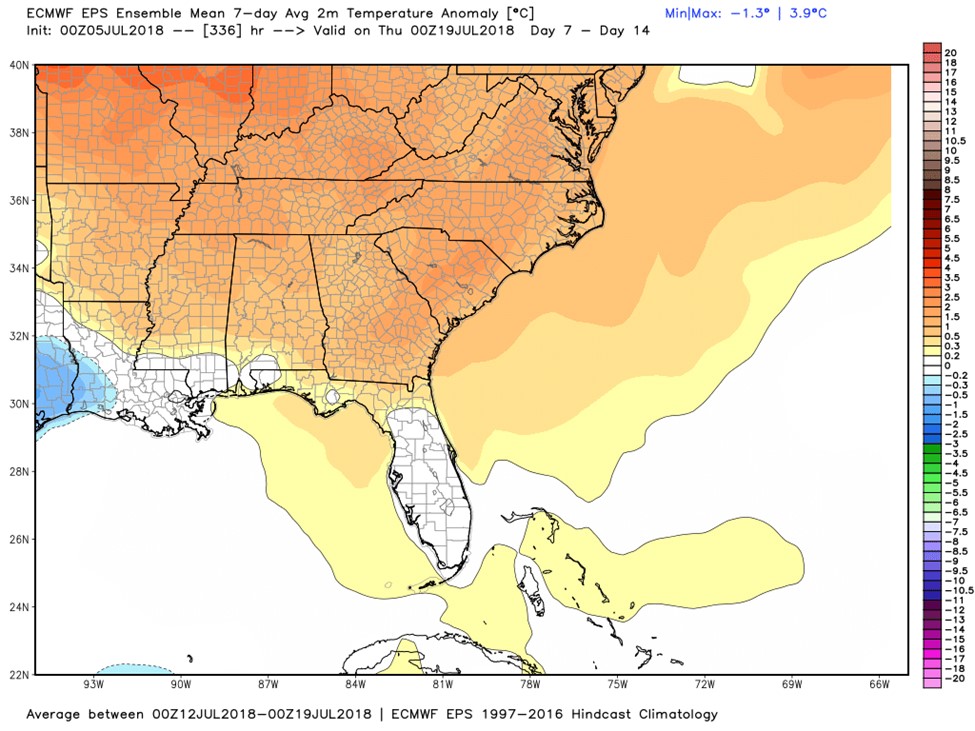

However, as you can see from the (7-14) day outlook above, the heat is going to make a comeback. We have had 18 days this summer with highs of 90° or more around the county.
The good news is that rain will come and the heat will eventually move out. We just have to be patient. Continue to follow the Salisbury Post and Rowan County Weather for the latest updates as we try to stay cool this summer.