

Sunday evening update on Monday Snow Chances
I have been tracking this system for the past several days and as we close in on Monday there are still some questions this system is posing. Will we see snow? The answer is likely yes. Will we see snow accumulating? That answer is likely however, the totals continue to be somewhat of a mystery. The biggest hurdle is the amount of rainfall coming before the snow will arrive. Additionally the timing of the cold air aloft. How long it will stay in place before warm air nudges its way back in. How much moisture will still be available when the cold air is here. Those are all things that we will see play out as we move through the day on Monday. Let's take a look at when the snow is likely to move in. The timing has changed once again as this system appears that it will speed up just a bit to get back on track for some daytime snow chances.
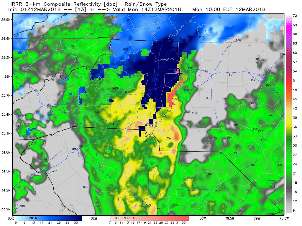
By around 10am Monday morning we could see a transition from rain to snow starting to occur in the northwestern portion of the county around the Cleveland area. The cold air and the location of the low appear to be setting up for the I-40 Corridor to somewhat be the dividing line for the cold air and warm air to battle it out.
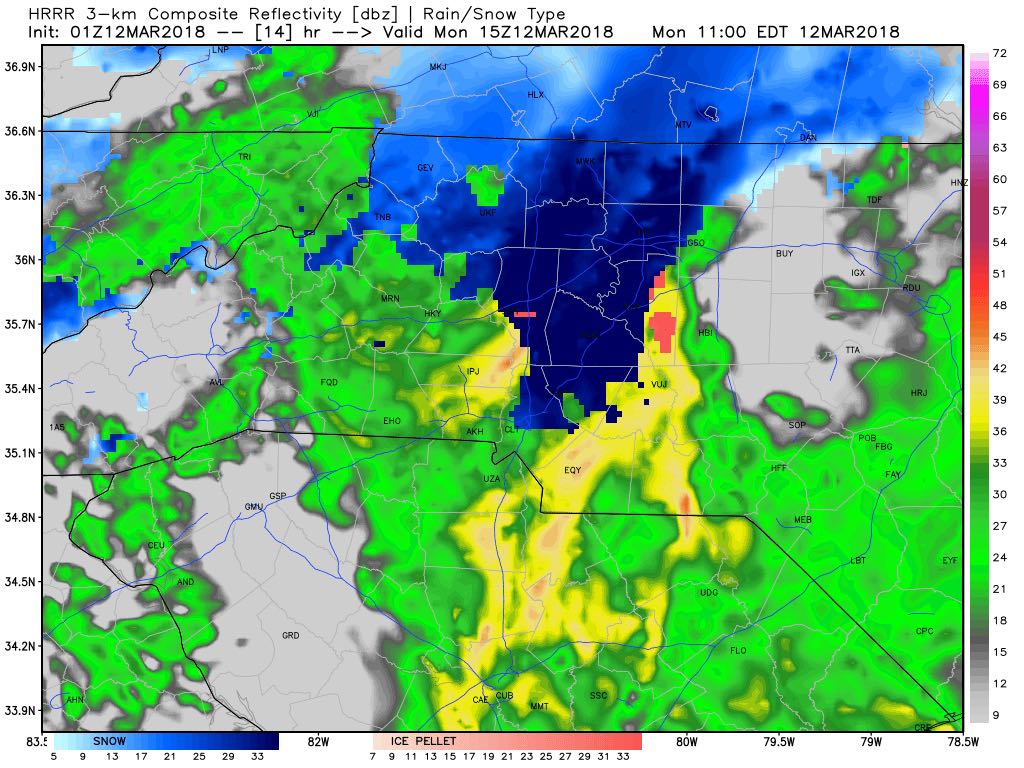
By around 11am on Monday we could start to see snow mixing in with rain throughout most of the county as the colder air starts to dip further south. We could see a few burst of all snow as the transition occurs during the day. I am not expecting any accumulation on the roadways as the snow begins to fall. Ground temps will be a bit to warm at first.
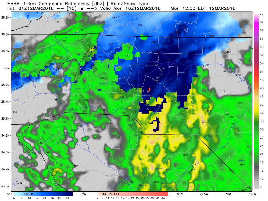
By the noon hour I believe we could see all snow as the cold air may be firmly in place. I think that will be the peak time for snowfall to potentially begin to accumulate as we head into the afternoon hours. If roads are going to become slick it will likely begin to occur around this timeframe.
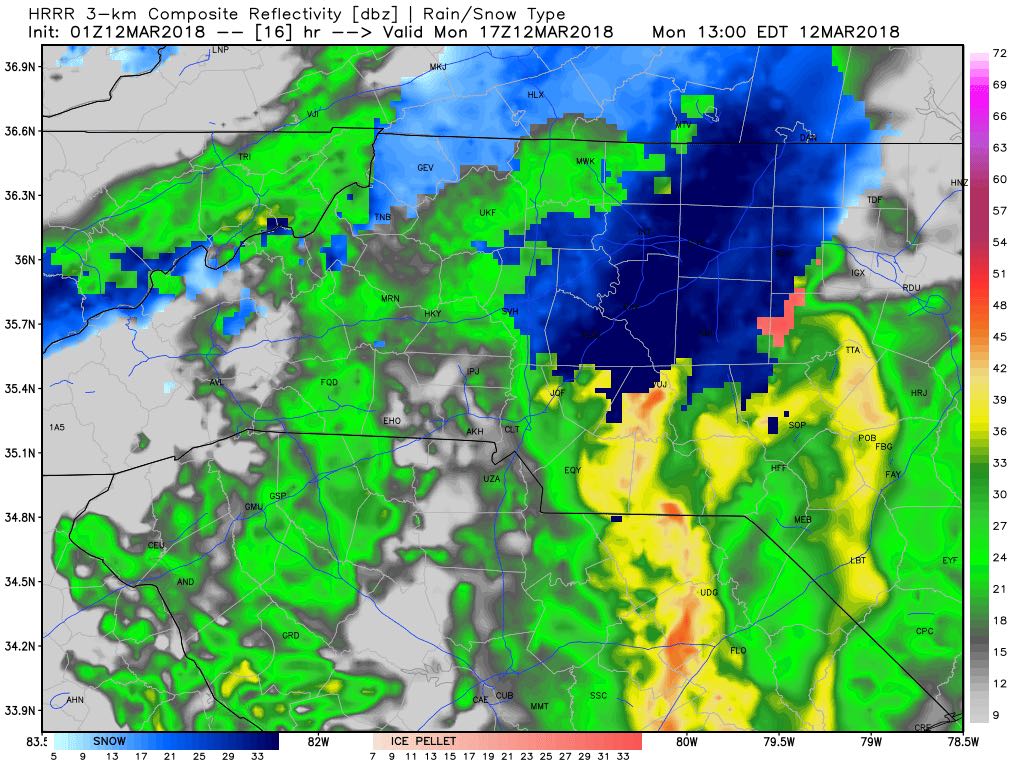
By around 1pm we will likely begin to see the snow transition back to all rain as warm air starts to push its way back in from the south. This could be a very fast transition or we could see the mix of rain and snow for a period of time as warm air starts to win out.
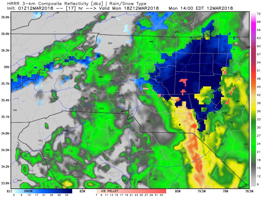
By 2pm most of the areas west of I-85 in the county are likely going to be seeing all rain. The areas to the east of 85 could continue to see the transition of snow back to rain taking place.
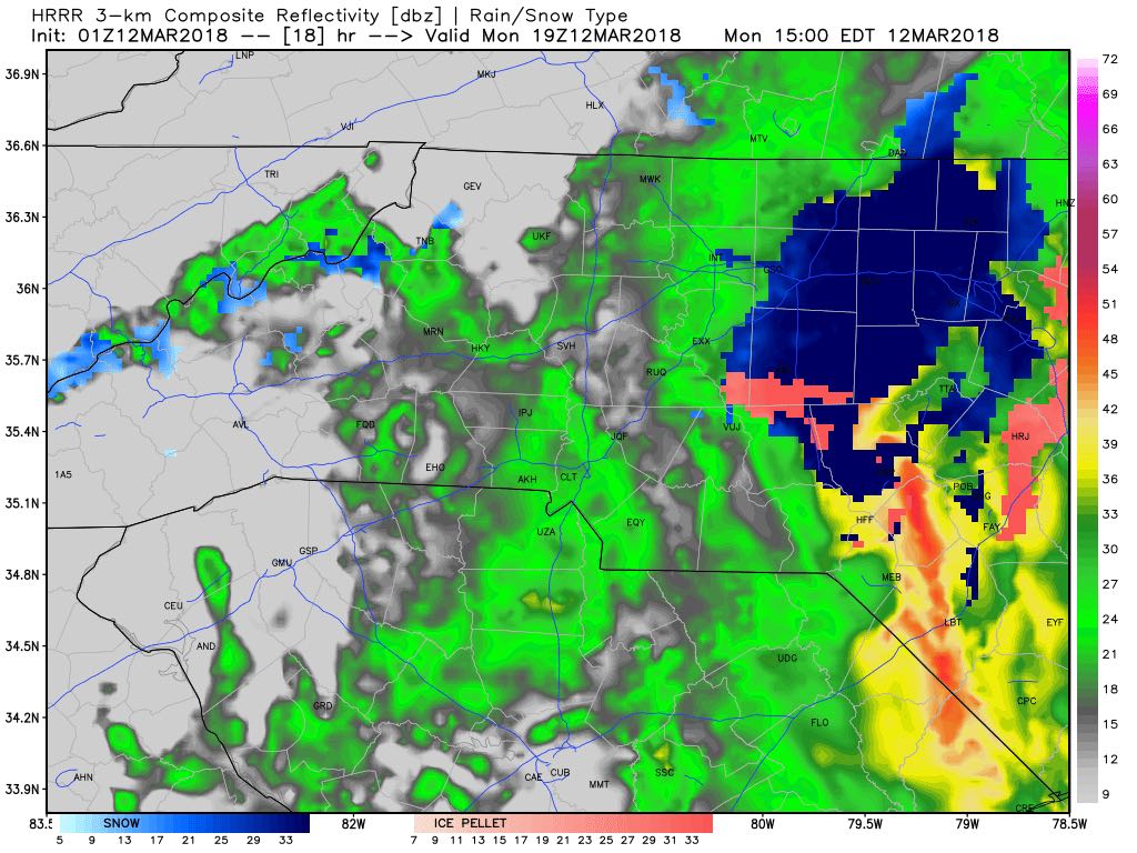
By 3pm we should be back to nothing but rain as warm air will have won out by this point and any snowfall that is occurring will likely be to our north and east as the system begins to move the cold air out of the county.

As as as snowfall accumulation goes I am continuing to stick with the trace to around a half of an inch in the county. The cold air will be in place for such a brief period of time it will be hard for the snow to stick at first. I will of course continue to monitor the system and the models as we move through the night and into the day tomorrow. I will provide updates right here and on social media. My next update will be between 5 & 6am Monday morning with the latest on this system. As always thank you for following Rowan County Weather!