

We are talking snow one more time
If you keep up with my daily forecast updates. You know that on Wednesday night I forecasted we could see a rain/snow mix during the overnight hours of Sunday into Monday. That is still looking like a possibility. So I wanted to take a few moments this morning to give you a first look at how much accumulation we could see based on the model data that is out there currently. I will be providing updates all weekend as we get closer to Sunday evening so you can make an informed decision on travel for Monday morning.
GFS
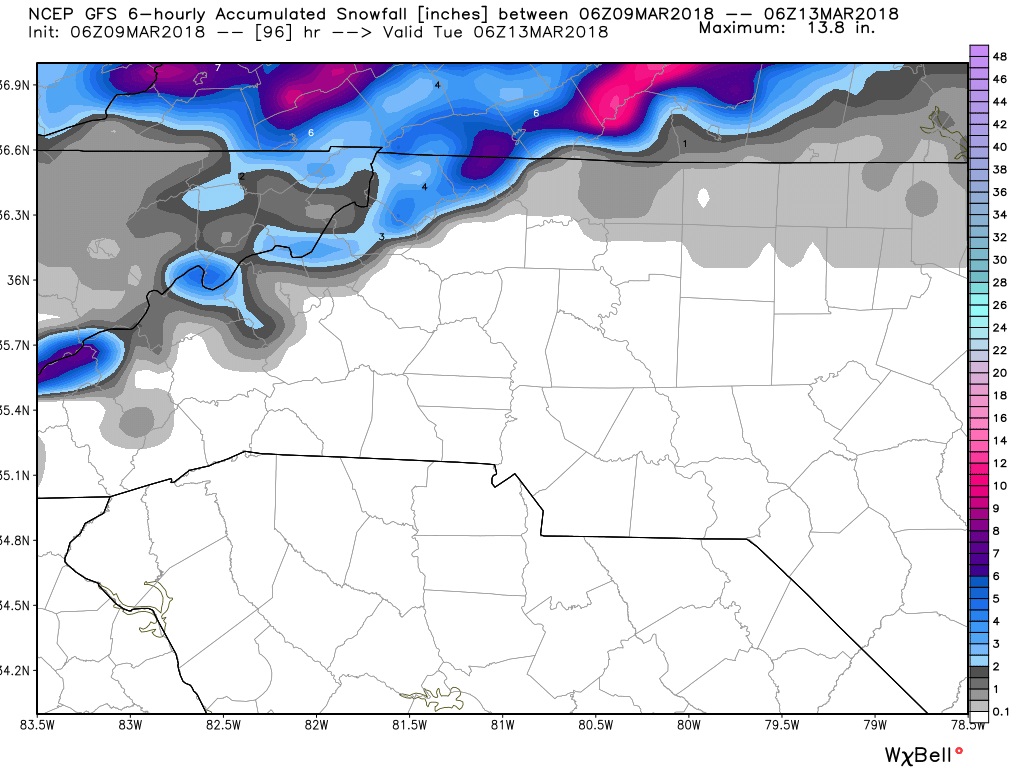
So when it comes to the model data I will show you. I can all but guarantee one thing. Everyone who reads this blog update will pick their favorite scenario and that's what they will hope happens. I am going to give you date from all the models and tell you my thoughts on what is likely to happen. The GFS Model data above shows all of the potential accumulation staying to our north and in the mountains. That doesn't mean we will not see snow mixing in with rain late Sunday and early Monday. This model is just stating any snow we see is not going to stick and accumulate.
The European Model
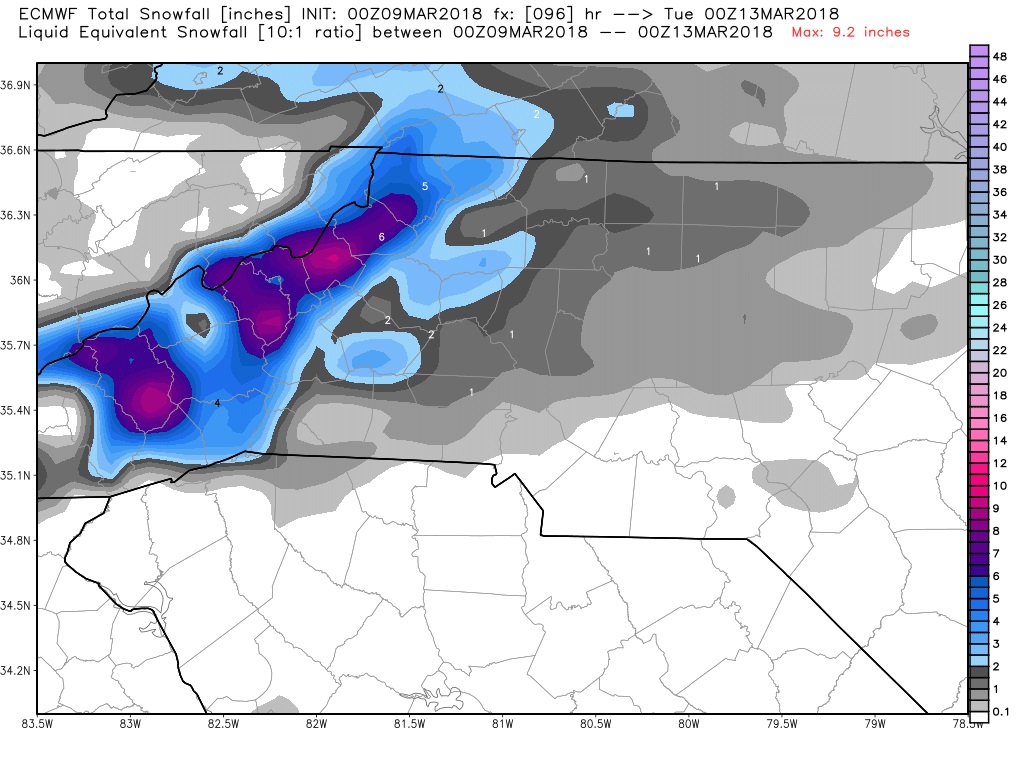
Now if you are one who likes to play the odds. No model has performed better this winter at predicting accumulations as the European Model has. In the data above the model is showing we could see anywhere from a trace to an inch of snowfall accumulation around the county from this event. Now please keep in mind the models do not take into account the warming of the ground prior to the event and the rain before hand taking some of the accumulation away as the snow will melt at first. So realistically this could be more like a trace to a half an inch of accumulation being more likely around the county.
My Thoughts
Based on the model data above with other model data available and probabilistic guidance. I feel we could see a period of all snowfall late Sunday into Monday. I think it will be a quick blast. enough to provide mainly a dusting of snowfall around the county. We could see a few areas in the county get up to a half of an inch. The main factor right now is the soil temps and the rain coming in before hand that will warm the ground up some. A warm nose of air will also play into this system as the freezing line will meander back and forth during the event making the transitions short lived. I will of course keep you updated right here and on social media throughout the weekend. As always thank you for following Rowan County Weather!