

Wintry Mix is likely on Sunday Morning
As we move closer to the weekend the chance for wintry weather is looking more likely on Sunday morning. Not to worry this will only be for a few hours and then rain will take over. Rain will start late Saturday evening and continue into the overnight hours. Around 7am Sunday morning we could see a mix of rain, snow, and sleet. The mix is likely to occur throughout the morning until around midday. We will see a warm nose of air move in to help the transition to rain occur.
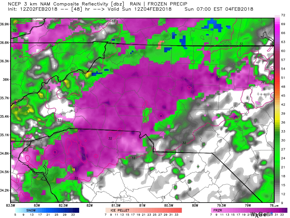
Around 7am Sunday morning we will see a thin layer of cold air develop in the atmosphere. This will allow for a period of rain, snow, and sleet to occur during the morning hours. Accumulation will be limited. However, roads could become slick in spots while this is occurring.
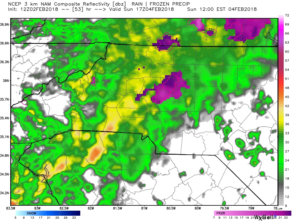
By midday rain will begin to take over as a warm nose of air will move into the area and the county. This will bring an end to the wintry mix. Conditions will continue to remain slick, but icing should be very limited over the morning hours and thaw in the afternoon. I will of course keep you updated right here and on social media throughout the weekend as the system moves through. As always thank you for following Rowan County Weather!