
A recap of yesterday's snow storm and what to expect today
Yesterday certainly came as a shock to many of us in the fields of Meteorology and Forecasting fields as this system did something the models weren't expecting and that was slow down and almost stop. A new low developed in the system pumping in more moisture. That immediately took predicted totals of the initial trace to an inch from me for most of the week. To 2-4 inches late Wednesday night as the system began to show signs of slowing down. This was certainly a miss for those of us working in the field and it was also a learning lesson. This storm system was pretty miraculous.
I was honored to be interviewed by Mark Wineka of the Salisbury Post yesterday about this system and the upcoming conditions you can read the story here
So now we begin the thawing process. Here i how we are going to get there. The sun is going to shine all day today. We are looking for a high of around 38º
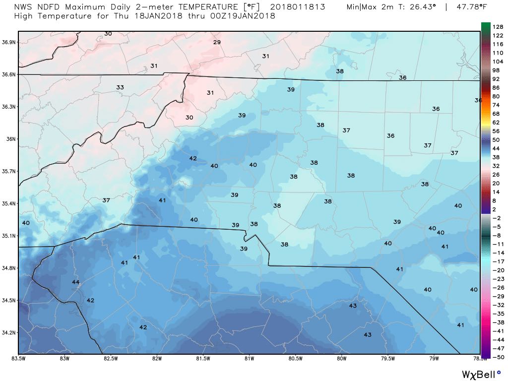
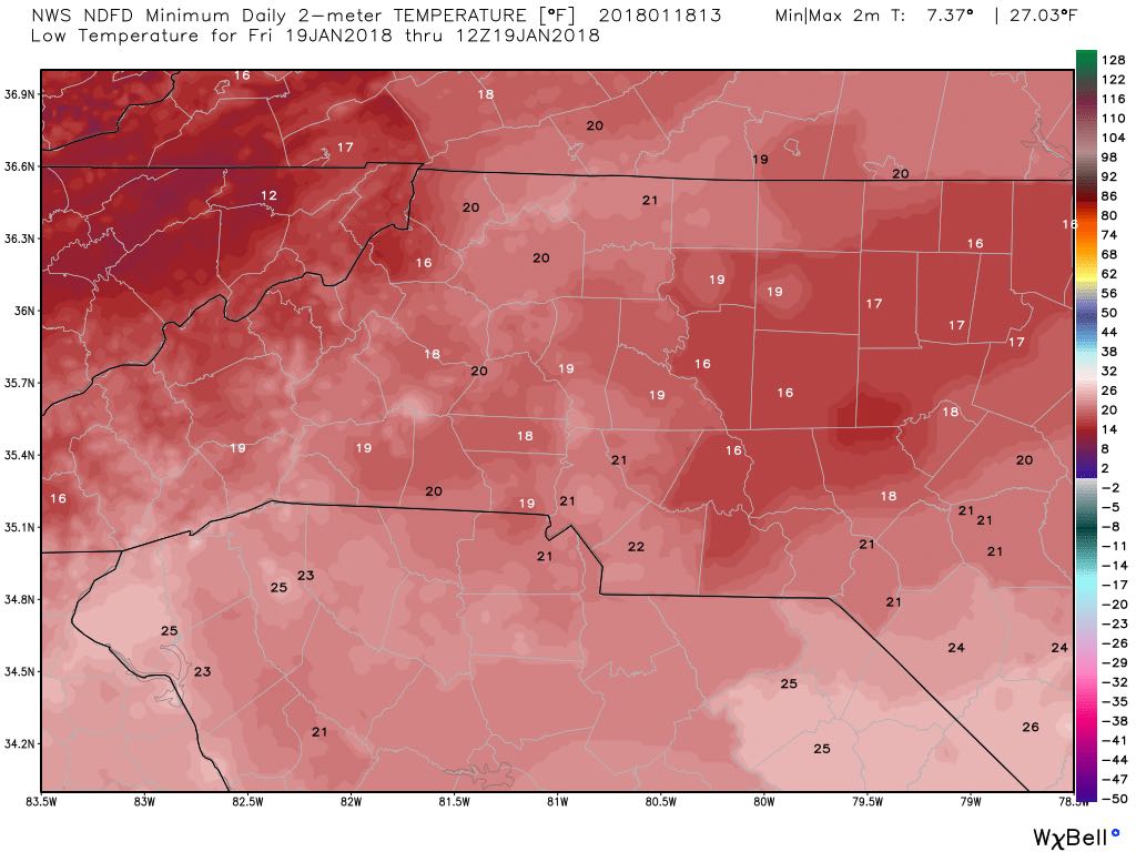
We will see melting during the day today with the combination of sun and above freezing temperatures. The issue will be what happens during the late evening and overnight hours that will set the stage for tomorrow. The low tonight will drop down to around 19º causing anything that melted to refreeze. Black Ice will be an issue in the morning. So don't be surprised if they are delays in the morning.
I will continue to provide updates on delays and closings throughout the day. You can get that information under the events section of this website. As always thank you for following Rowan County Weather!