
Snow chances during the overnight hours tonight going into Wednesday morning
The much anticipated time is approaching for the county as snow is on the way. I will be providing a lot of information in this blog today so please read all the way to the end. So let me start by saying I am giving us a 70% chance of snow falling during the overnight hours tonight and into the mid morning hours tomorrow. We have to go through some transitions to get there so let me fill you in on what to expect as we move through the day today. We will see a high of around 46º today and after we reach that point the cold front begins to approach and temperatures will start to drop.
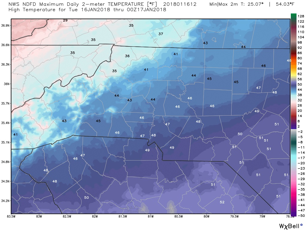
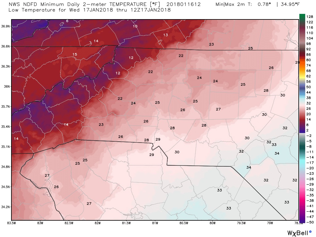
As we move into the evening hours we will drop to a low of around 26º The temperature as we move through the evening not only at ground level but also in the atmosphere will begin to have an impact on the precipitation as it begins to move through the county.
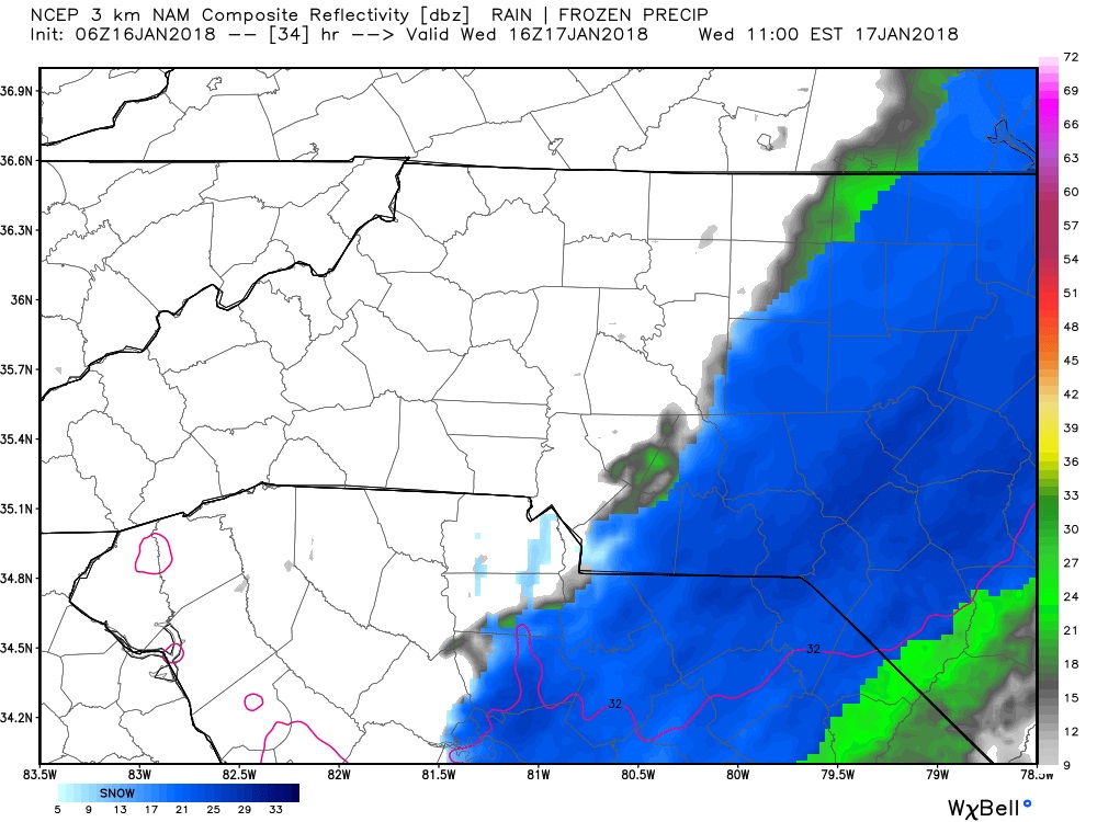
As precipitation moves into the county it will begin as all rain as the air aloft will be to warm for snow to reach the ground. The key difference in this system as opposed to the last one that came in is the air is much more favorable for moisture to reach the ground as we are not nearly as dry as the last event. As we move into the 9-10pm hours this evening rain will begin to move through the county. Rain will likely continue for a few hours into the overnight

The rain will slowly start to mix with snow as the upper levels of the atmosphere go through evaporational cooling and the freezing line in the air moves higher into the atmosphere around 1-2AM we will begin to see the rain transition to all snow and I expect snow showers at that point to continue off and on for several hours into the mid morning of Wednesday.

Snow showers will begin to move out of the county around the 11AM - !2PM hours and we could see this event end with the snow transitioning back to rain for a brief period. During the period while it is snowing I do expect roads to become slick as some light icing is possible form the rain base that will begin this event.
Now lets talk totals. First of all as I stated this event will start with all rain for a few hours before transitioning to snow. Then we could see it end with a brief period of rainfall as well. The rainfall accumulation will take away from snowfall totals on both ends if that holds true. As rain on the ground will make it harder for the snow to stick at first and then it could pack it down on the back side as the system moves out. I am forecasting around a tenth of an inch of rainfall form this system.

As far as snowfall accumulations go the models are really starting to come into agreement as they are calling for around an inch to possibly 2 inches in some areas of the county. I think the farther east in the county you go the higher the totals will be. Again keep in mind models don't do a good job of accounting for the rain impact that will occur.
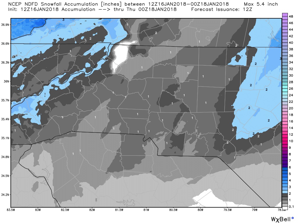
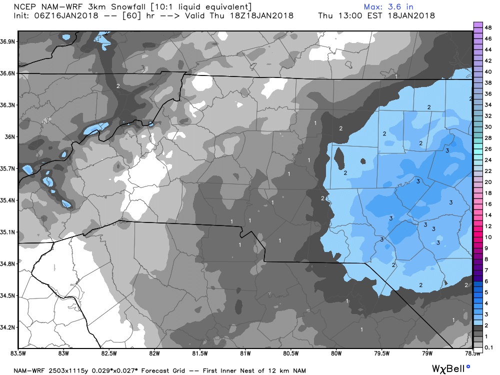
I am sticking to the totals I have been forecasting all along for this event. I feel we will see anywhere form a trace to an inch of snowfall with this system. There could be some areas in the county that may get a quick burst of snow that could see more. I think those areas will be east of I-85. I will of course keep you updated right here and on social media throughout the event. As always thank you for following Rowan County Weather!