
Snow continues to be likely for late Tuesday and early Wednesday
We are now just about 36-48 hours away from seeing the chance of some snow here in the county. The models continue to show the likelihood of snow falling here in the county. They continue to disagree on how much accumulation we could see. The models also show that we could see this event start out as rain before completely transitioning to all snow. Lets take a look at the different models and I will summarize at the end how I think things will go.
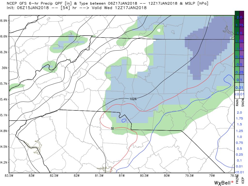
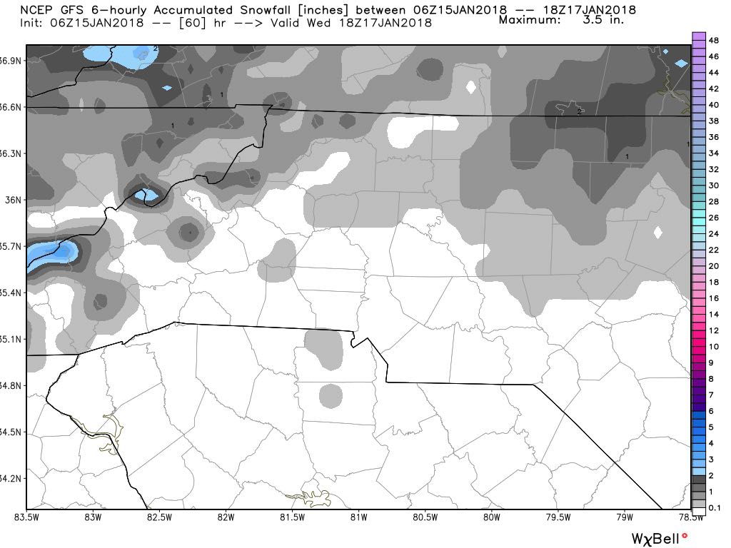
The GFS Model data above shows snow falling around the county early Wednesday morning. the data before this shows the event starting as all rain before making the transition. Now with the GFS the period for rainfall last a little longer than the other models indicate so accumulation levels with the GFS are no snowfall accumulation as you can see below.
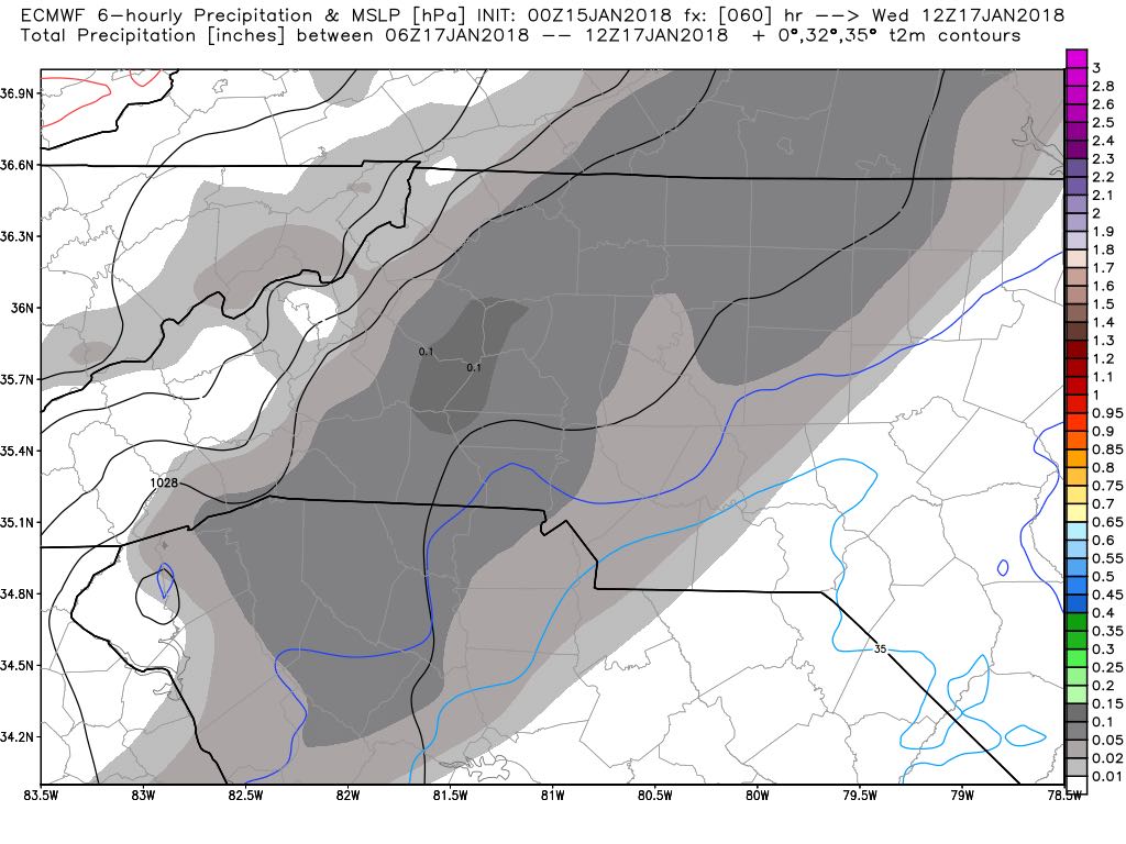
Now lets take a look at how the European Model sees this event unfolding. Remember the European Model tends to overshoot on accumulation totals. The image below shows snowfall occurring around the county and as the GFS model data indicated starting out as rain. The difference between the two models is how quickly the transition to all snow occurs.
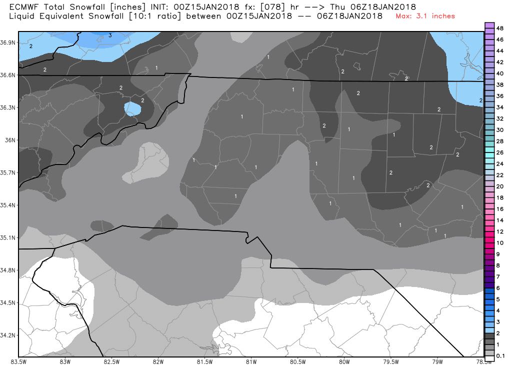
The amount of accumulation being predicted by the European Model for the county is anywhere from 1-2 inches depending on location. Most of the higher totals look to be east of I-85
Now lets take a look at the NAM which is a short range model that starts to yeld data within 2-3 days of an event. The NAM also shows the event starting as all rain as you can see in the green below.
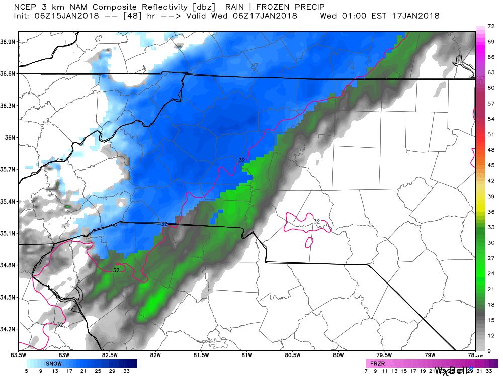
The rain will transition over to all snow based on the NAM and stick around through around midday here in the county.

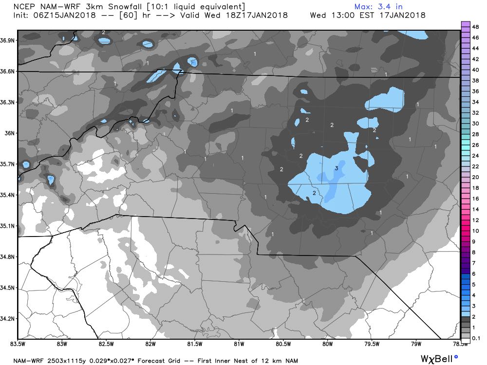
The image above is showing how the snowfall will be exiting the county to the east around midday. As far as accumulation goes the NAM data below shows we could see 1-3 inches of snowfall with the higher accumulations out toward the Rockwell and Gold Hill areas of the county.
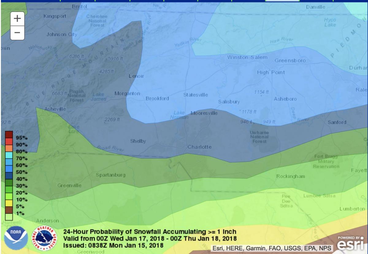
Now if we look at the WPC data below we have a 50% chance of seeing at least 1 inch of snowfall based on the data they have collected.
So here is how I see things shaking up. We will see rain start to move into the county late Tuesday evening. The rain will transition over to snow around 1-2 in the overnight hours. Snow will start to move out of the county on Wednesday morning.
I am only forecasting a Trace to an inch at this point. I just do not see enough data yet that would lead me to believe we could see more. The biggest reason is the rain on the front end of the system. The rain will pull away some of the accumulation totals for snow. I will of course keep you updated right here and on social media as we continue to move closer to Tuesday evening. As always thank you for following Rowan County Weather!