
Thursday Weather Update and if we see snow on Friday
Good Thursday Morning! The hype continues to build on the internet for snowfall around the area. I will give you my latest update for the county in just a few moments. First lets take a look at what to expect for today. We will continue to be very chilly outside with a high of only around 48¹ today
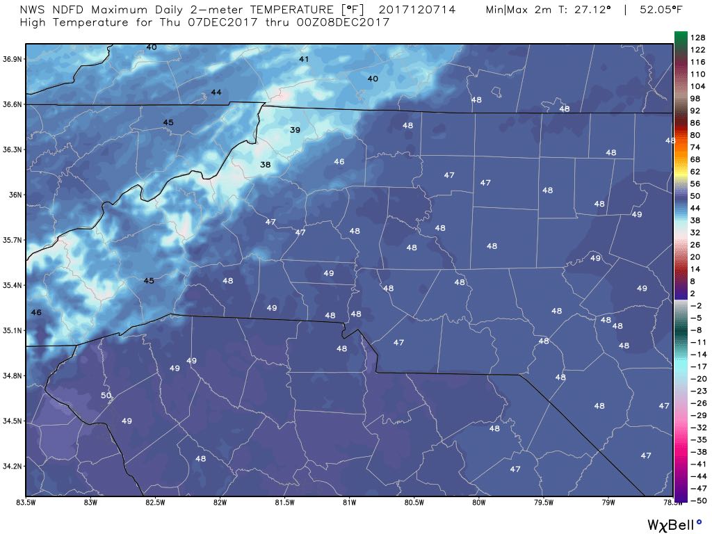
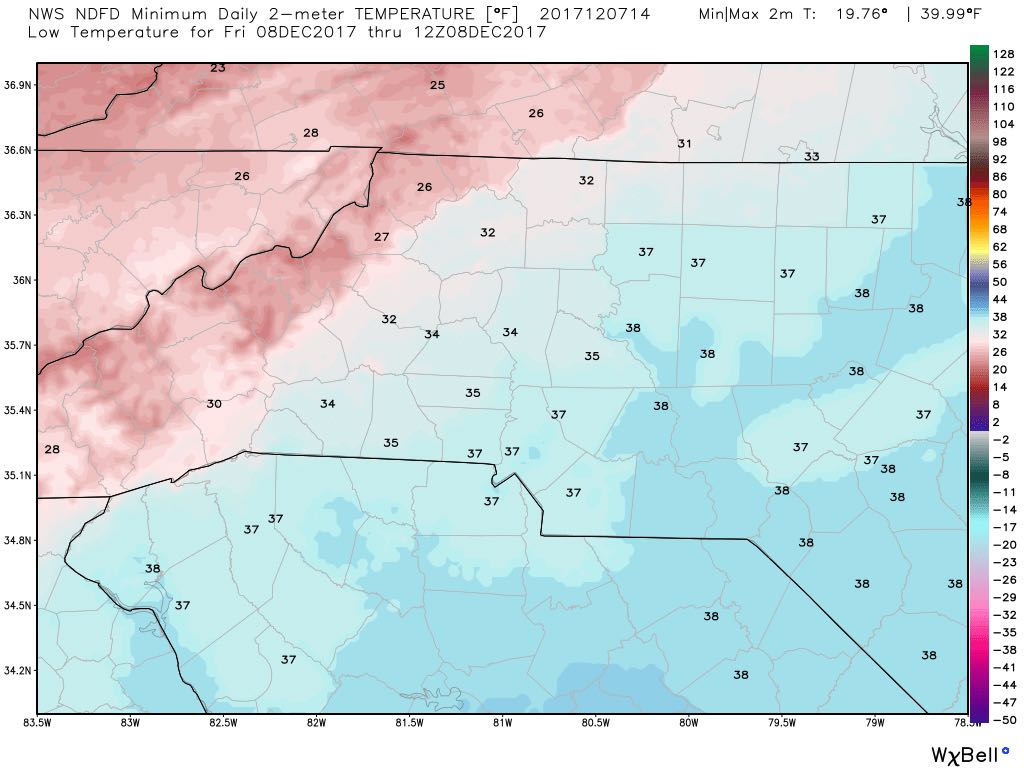
This evening we drop down to the 30's at around 35¹ for the low.
We could see some light rain or drizzle at times today but I am not expecting much in the way of accumulation.
Now lets talk about Friday. The hype continues to build around the internet for the chance of snow in the area on Friday. Here are my latest thoughts. As I have stated we could see some wet snowflakes build in but mostly a cold rain. I still believe that to be true even at this point. remember wet snow is nothing more than a pretty version of cold rain. It will hit the roadways and melt. Accumulations if they occur will be on grassy areas or elevated surfaces. Based on model data and other factors such as the SREF Plume and probabilistic data I am not expecting much. The moisture is just not there. So lets take a look at what is driving my forecast.
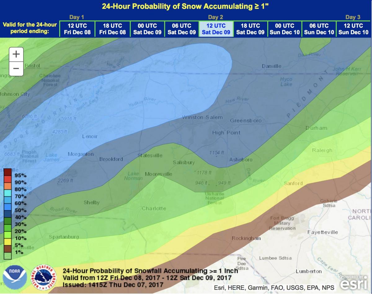
First of all the probabilistic mapping above only gives us a 30% chance of seeing at least an inch of snow around the county. You have to take into account the soils temp is still going to be fairly warm so if snow starts to fall it will mainly melt on contact to start off until those soil temps drop.
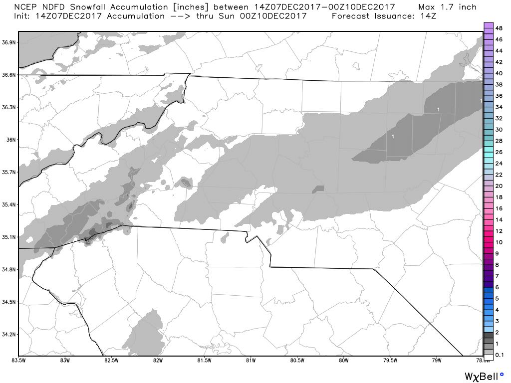
Short range model data above shows us with basically a trace of snowfall around the county and most of the area. There are some factors in play that I think will contribute to this. What will the temps be near the surface and at the ground. Based on some of the data I am seeing temps are going to be above freezing which will cause snow to melt as it falls to the surface.
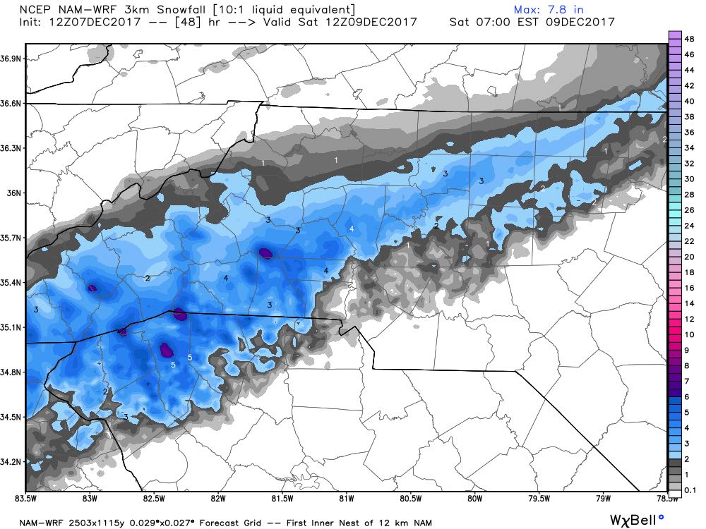
The North American Model even shows us with a trace to around a half of an inch with most of the accumulation along the I-40 corridor which is where I think we will se most of the accumulation as well. So here is my. summary.
I am looking for mainly a cold rain on Friday with some wet snow mixing in as we go through the day. I think most of the snowfall will occur in the evening hours closer to 7pm. We could see some accumulation build on grassy surfaces and elevated surfaces but roadways will just be wet. As far as accumulation goes I will say we could see a trace to a half of an inch. However, Most of the accumulation will be in northwest Rowan County near the i-40 corridor. This is mainly going to be a wet cold rain event that could look pretty at times but don't panic and raid stores for bread and milk.
I will of course provide updates throughout the day right here and on social media. As always thank you for following Rowan County Weather!