The Long Range Winter Forecast
The time has come! Every year on Halloween I release my Long Range Winter Forecast. We are finally here and I know all of you reading this either want to see lots of snow or no snow. There is no in between. People either love it or they hate it. So let's dive right in. The Long range models for winter are being driven by La Nina and a pretty strong setup that is in place. This will cause us to see 2 dominant factors around for the winter season.

The above image from NOAA shows us having a drier winter this season. That is typically true of a La Nina setup for our area, region and county. However, there will likely be some periods during the winter where a setup is favorable for a winter storm. Remember this is an overall picture. Not the entire picture.
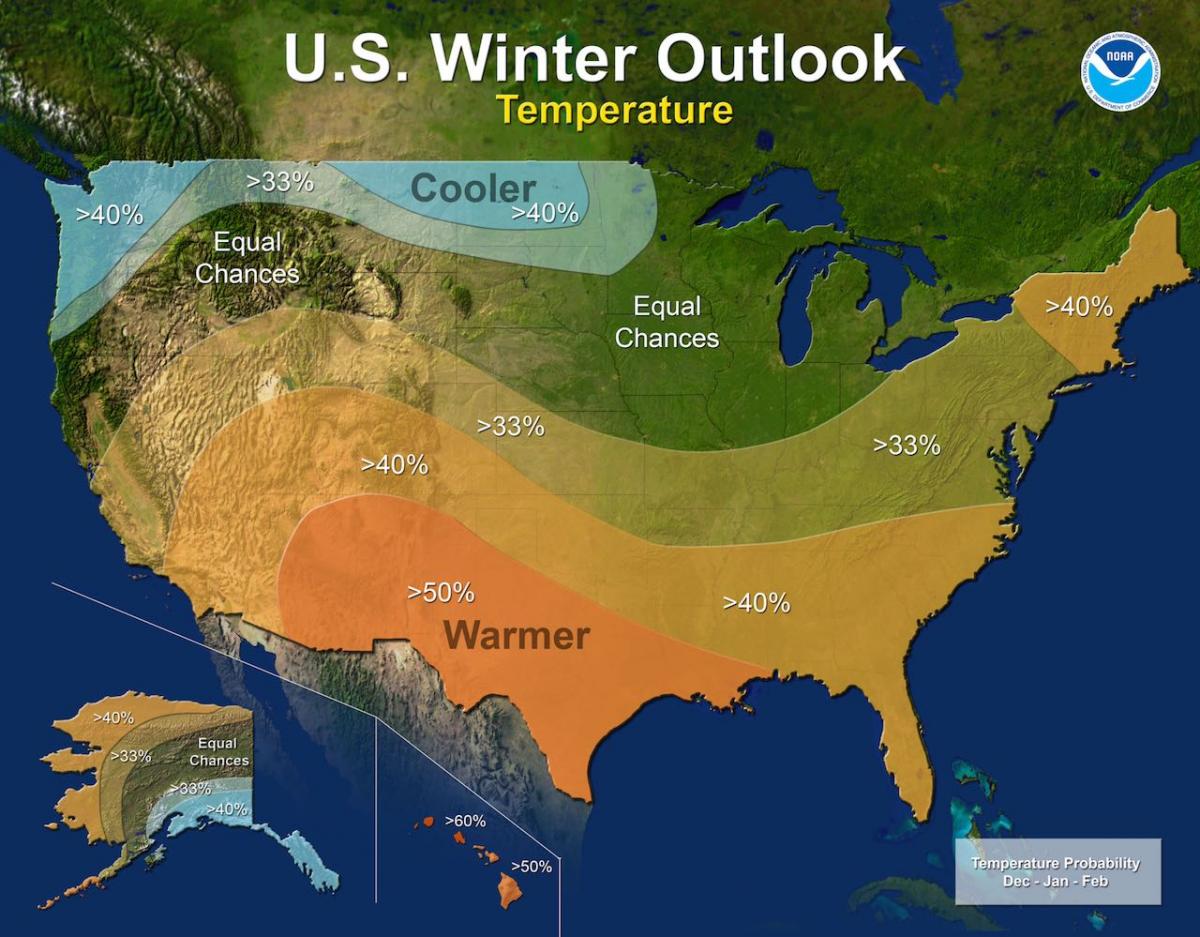
As you can tell form the above image we are also looking at a setup for a warmer winter season than normal as well. Again this does not mean we will see a few periods of below average temperatures and cold enough setups that we would not see some snow chances and storm setups.
The reason we are seeing a chance for warmer temperatures and drier conditions is when La Nina is in place. It keeps the jet stream over the northern portion of the country. There will be some occasional dips in the jet stream and of course the occasional hype of the Polar Vortex.
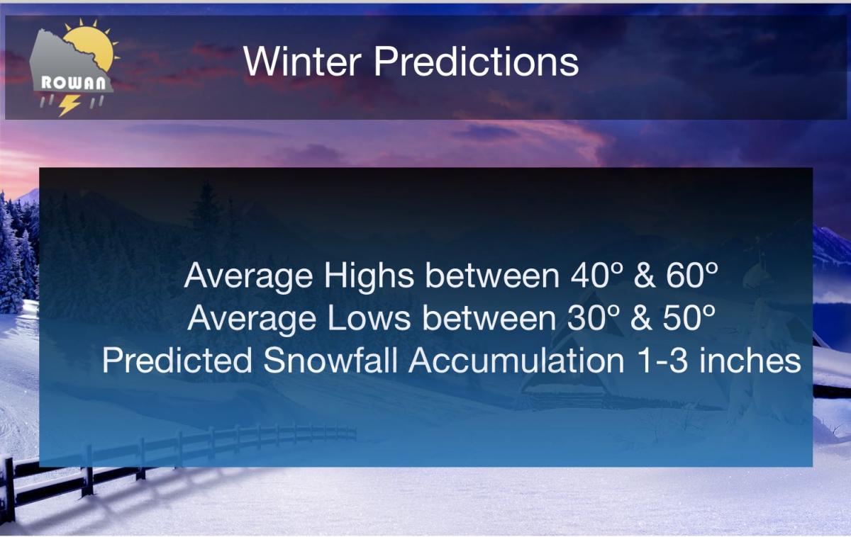
Here is how things are looking for us at the beginning of the winter season here in the county.
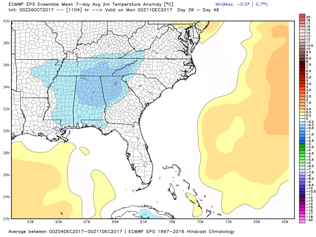
Temperatures to kick off the winter season currently looks to be around average for the beginning of the season which would put highs around 54º and a low of around 31º
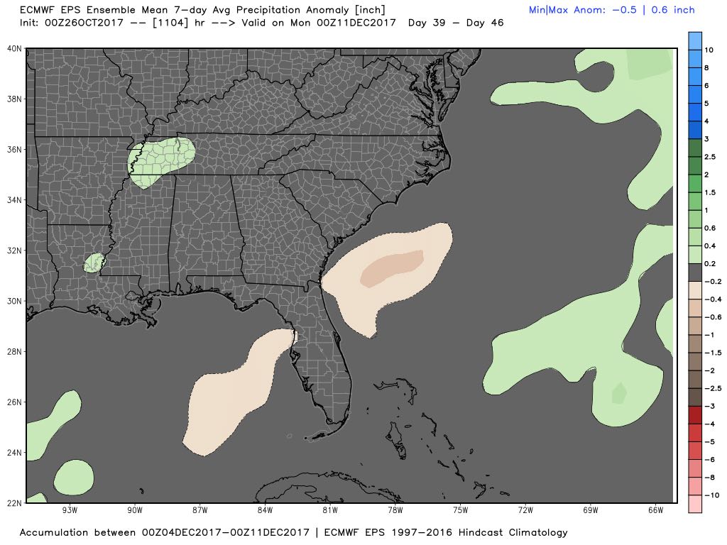
Precipitation for the beginning of the winter season looks to be below average. which by that point we typically see rainfall accumulations of around a tenth of an inch and no snowfall by that point. Now I am not going to show you model data beyond this point simply because I am not a fan of long range forecast. That is why I only post forecast for 5 days here at Rowan County Weather. Anything beyond that is like trying to hit a spot on the side of a barn with a marble. When you are around 5 days out its more like trying to hit a spot on a barn with a beach ball. Your chances get more accurate. Here is my summary of what I think we will see this winter here in the county.
No matter what kind of weather this winter brings. I will of course keep you updated right here and on social media. As always thank you for following Rowan County Weather!