
Saturday Weather Update and Hurricane Nate Update
We are off and running for the weekend. There is some encouraging news with the latest track for Hurricane Nate that I will get to in a moment. Lets talk first about what to expect for the day. We will see a high of around 79º

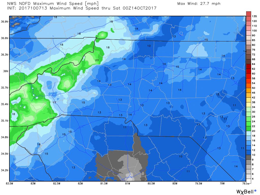
We will see winds sustained at over 10 miles per hour
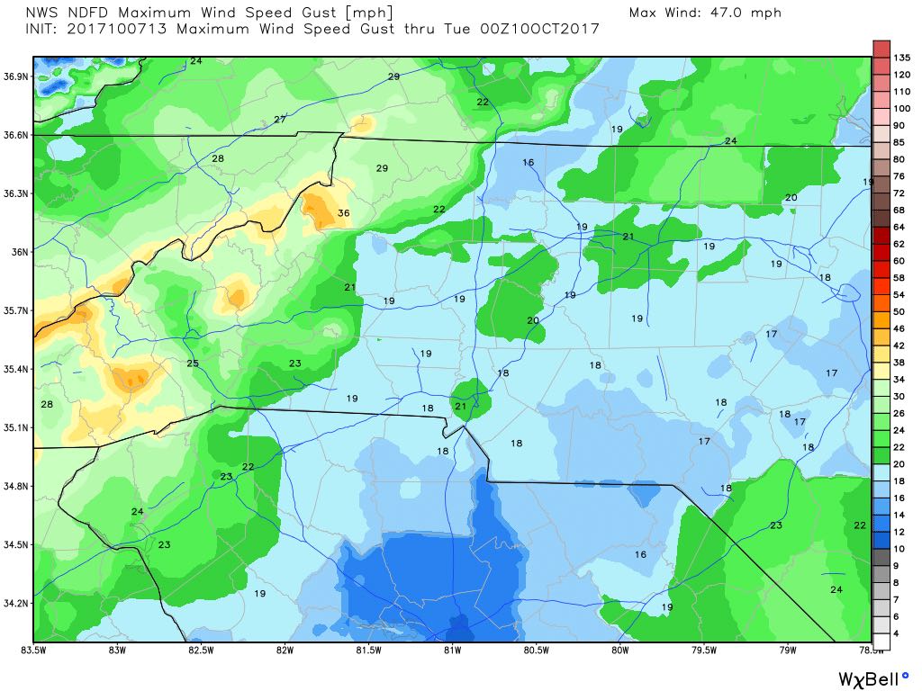
We could see wind gust of around 20 miles per hour throughout the day as well.
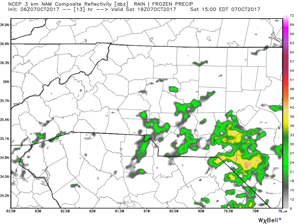
We will see some isolated rain showers move into the county around 3pm this afternoon and evening. Not a washout by any means so I would not cancel any outdoor plans. Just keep the rain gear handy.
Rainfall accumulations by midnight will only be around a tenth of an inch around the county.

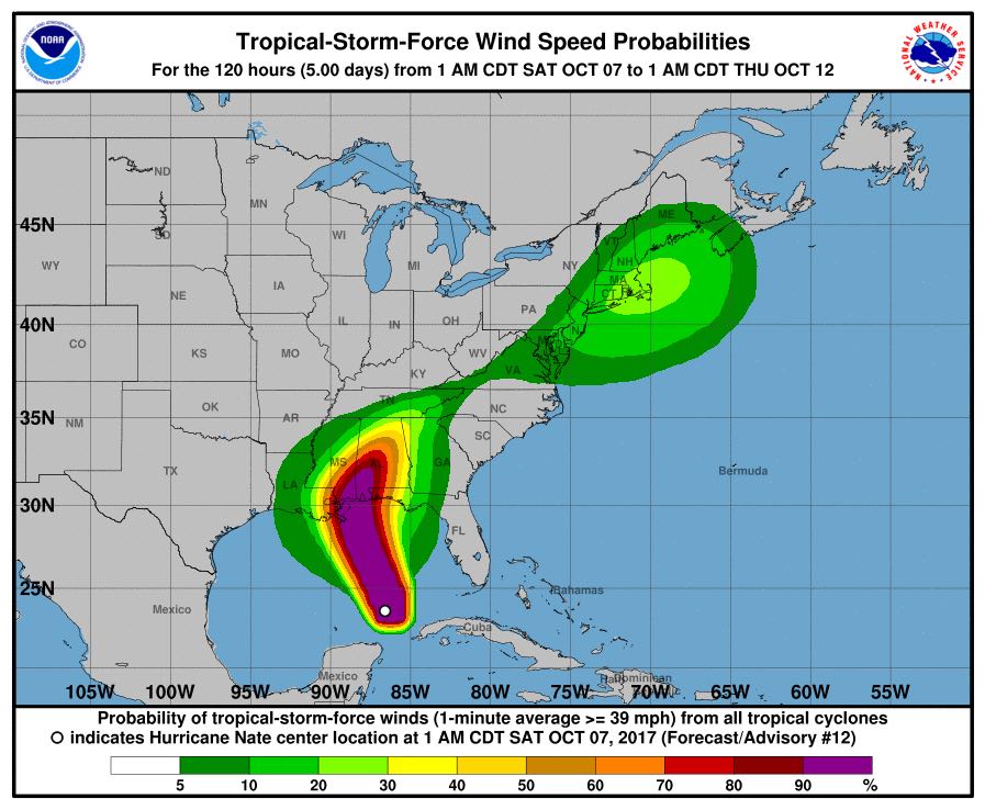
Now lets take a look at the latest on Hurricane Nate and the impacts I expect it will have on the county.
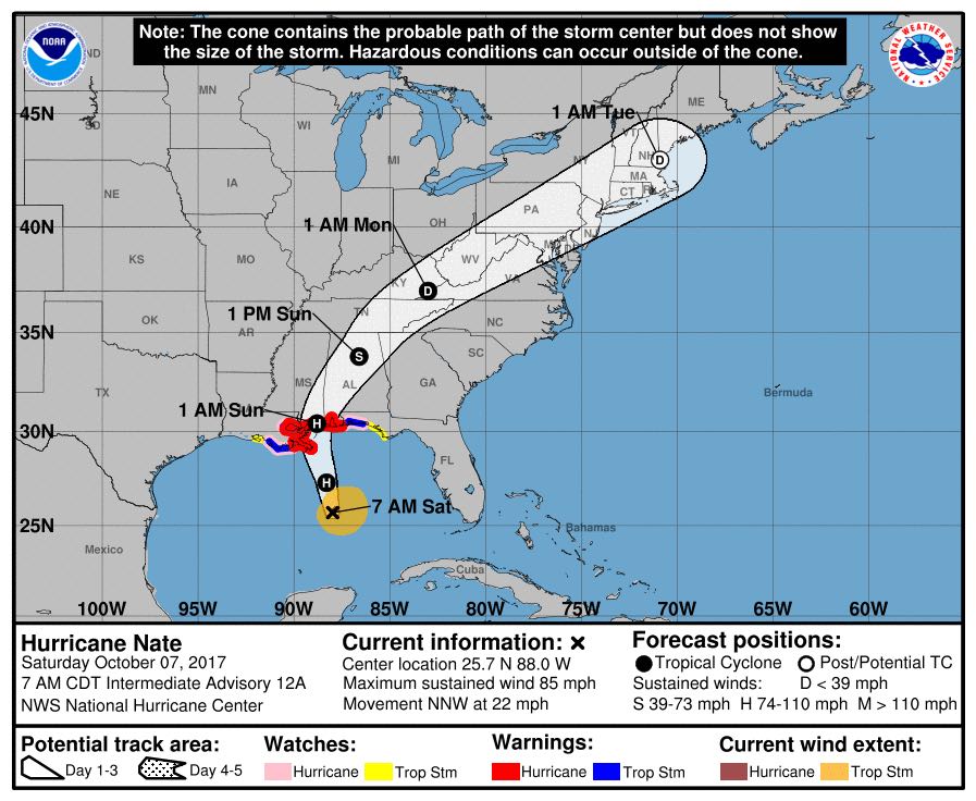
The track for Nate has shifted further west and that is a trend we have observed over the model runs. I feel confident the models have a pretty good grasp on this system. With that said I think the wind and rain threat will stay to our west. We will get some rain but nothing to the extent of some of the high totals being reported by other weather outlets. Rain from Nate may not even arrive to the county until the overnight hours of Monday morning.
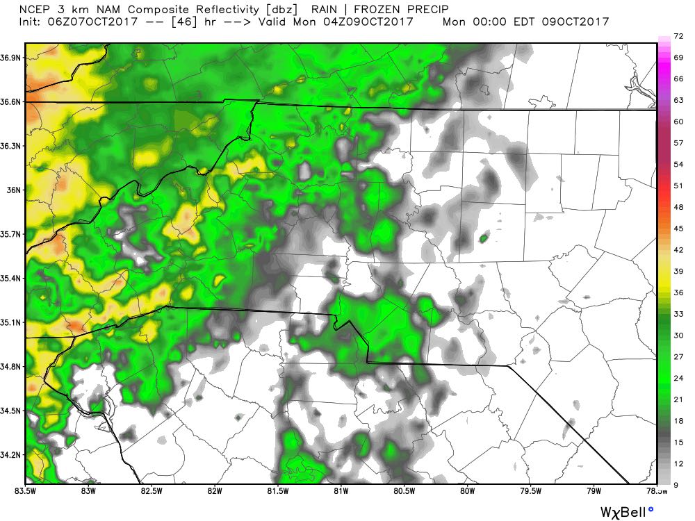
The rain fall accumulations through end of day Monday only look to be around an inch for the county. This is down from my latest report of around an inch and a half. The heaviest rainfall looks to be in the western mountains with some areas getting over 5 inches of rainfall.

The winds are not any concern as far as Tropical Storm force winds from Nate as they will certainly stay to our west.
I will continue to keep an eye on the models and radar over the weekend and keep you updated. I will post updates right here and on social media. As always thank you for following Rowan County Weather!