
Tropical Storm Nate Update
All eyes for this weekend are on Tropical Storm Nate. The track continues to remain the question. I will say this depending on the models things are very widely scattered in terms of impacts here in the county. The GFS seems to have the storm bringing us quite a bit of rainfall while the European Model has us getting far less in terms of rainfall with most of the rainfall confined to the mountains. Lets take a look at the breakdown.
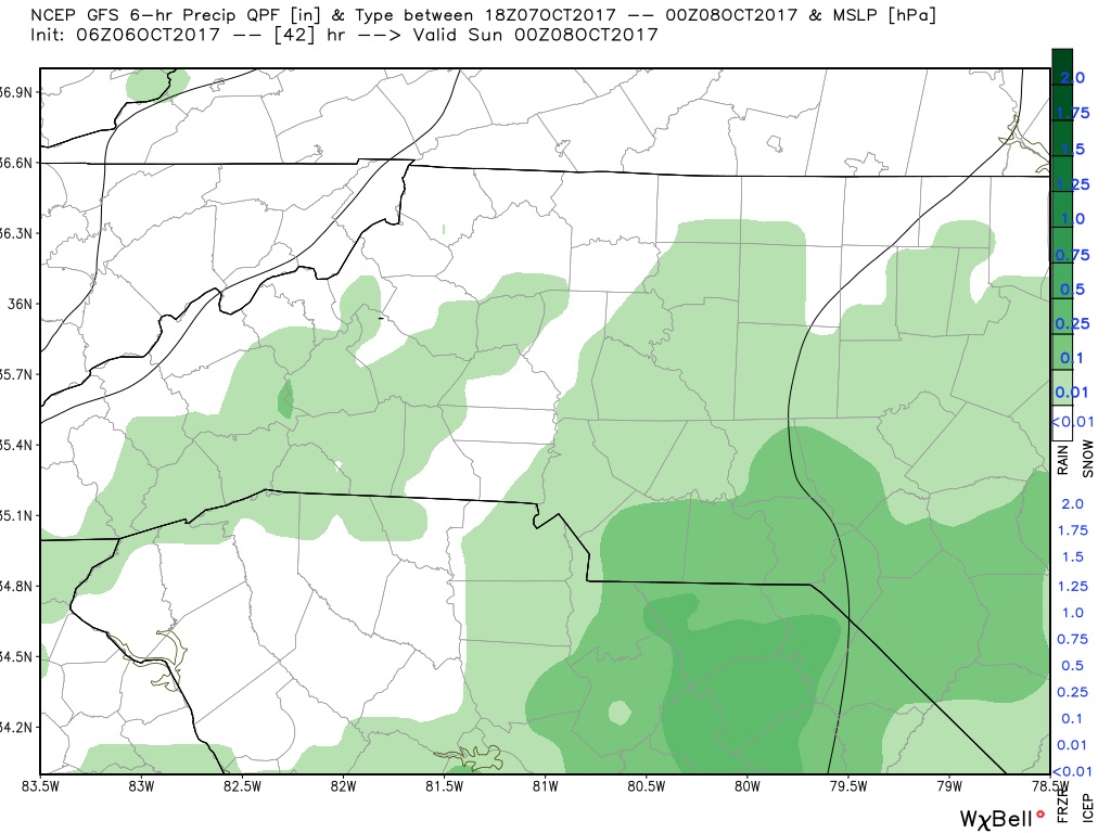
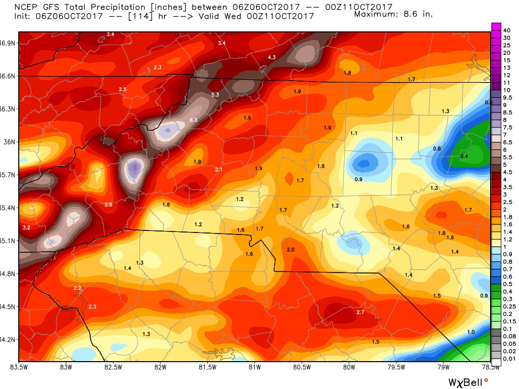
The GFS
The GFS Model is being very bullish with this system. Bringing quite a bit of rainfall to the county. The rainfall based on the GFS is expected to start late Saturday evening.
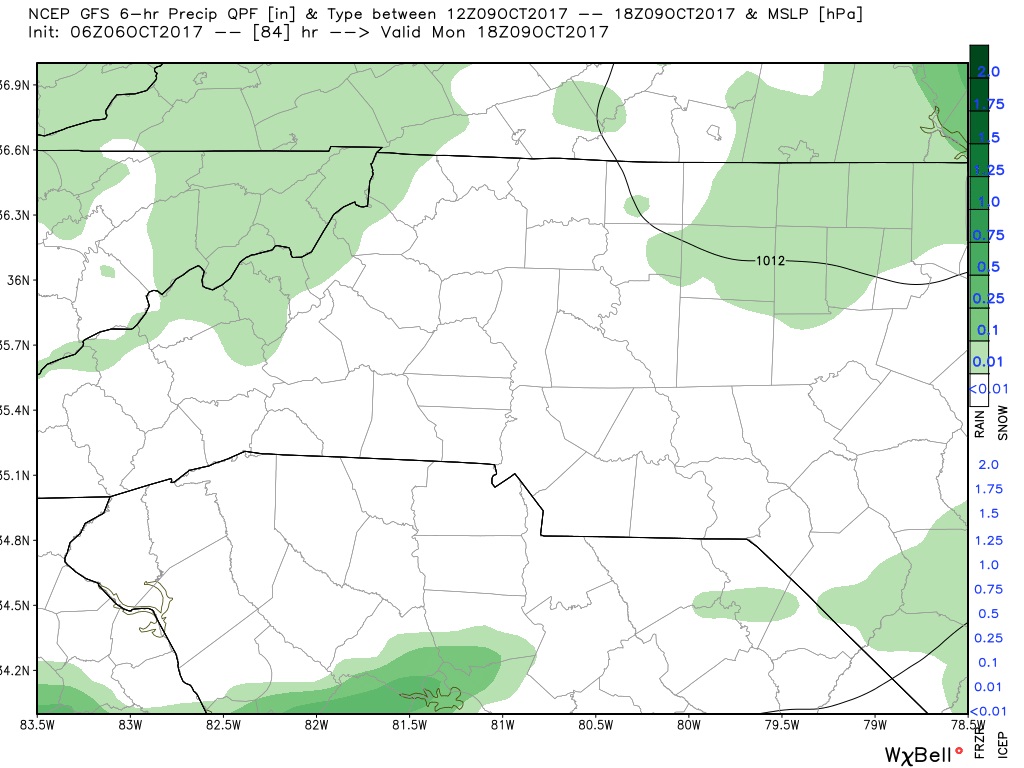
The rainfall looks to stick around with some breaks coming Monday afternoon.
The GFS has around 1.5 - 2 inches of rainfall coming for the county through Tuesday.
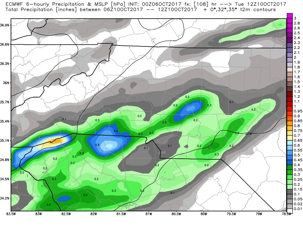
The European Model
The European Model is far less active with this system as it is seeing very light amounts of rainfall with only around a quarter to a half of an inch of rainfall expected by Tuesday.
As you can see there is still a lot up in the air on how this system will play out. As we move into the weekend things will start to become much clearer on impacts form Nate. I will of course keep you updated right here and on social media. As always thank you for following Rowan County Weather!