
Monday Weather Update
Good Monday Morning! As we begin to move through the next 36 hours we will start to feel the effects of Hurricane Irma here in the county. The good news is those affects are far better than they were near the end of last week. Lets take a look at the latest on Hurricane Irma and what we can expect today.
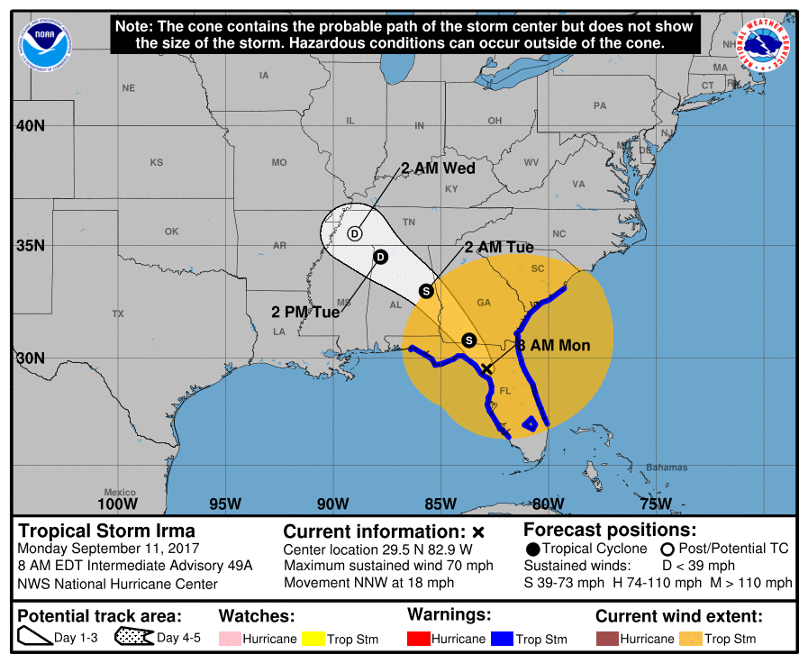
As of 8am this morning Irma has been downgraded to a Tropical Storm with maximum sustained winds of 70mph. The yellow circle on the map shows how far our away form the storm you could be feeling Tropical Storm Force Winds right now. The track has the storm shifting northwest as it moves into the state of Georgia later this evening.
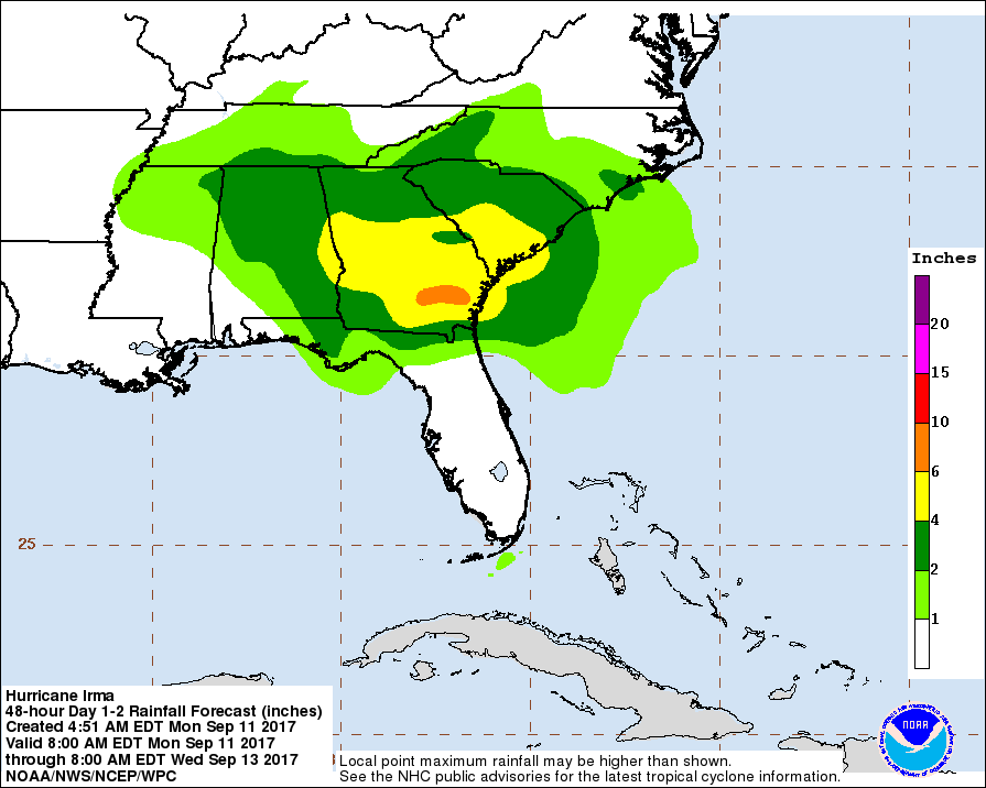
The National Hurricane Center currently feels we will see around an inch or more of rainfall from this storm. Now lets take a look at how I feel the forecast is going to shake out for us today.
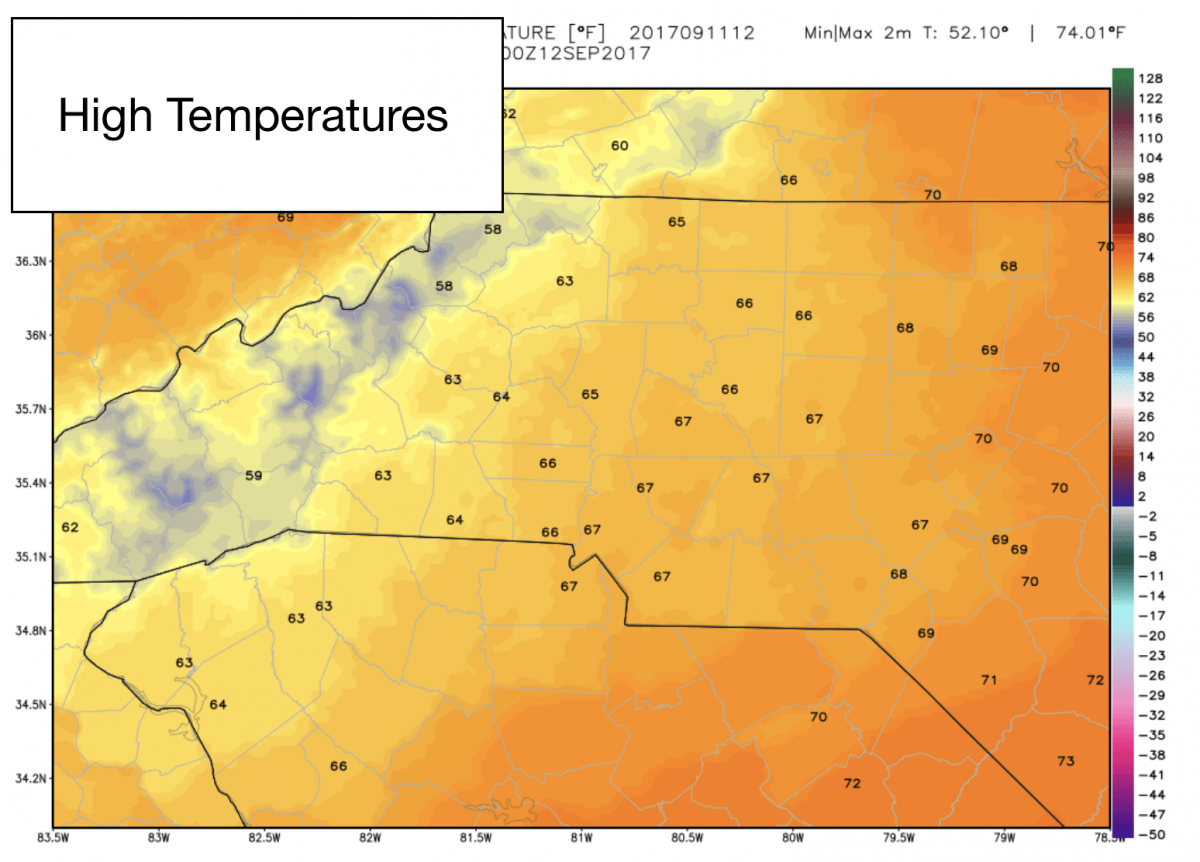
The high today will be unseasonably cool as we struggle to reach a high of around 67º
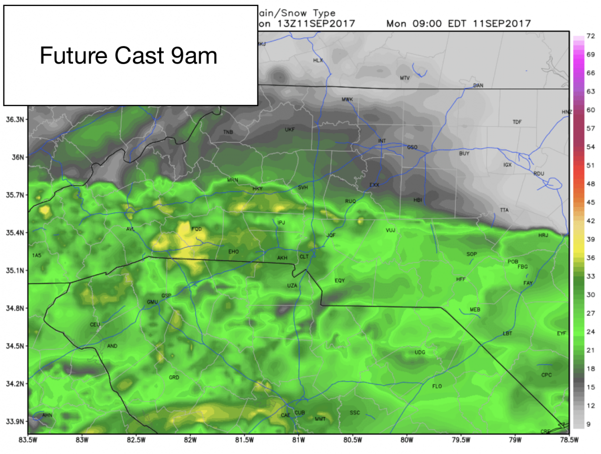
We will start to see rainfall associated with Irma begin to move into the county over the next 20-30 minutes around 9am. Rainfall will continue off and on throughout the day. It may be more of an annoying mist at times. Heavier rainfall moves in during the overnight and early morning hours on Tuesday.
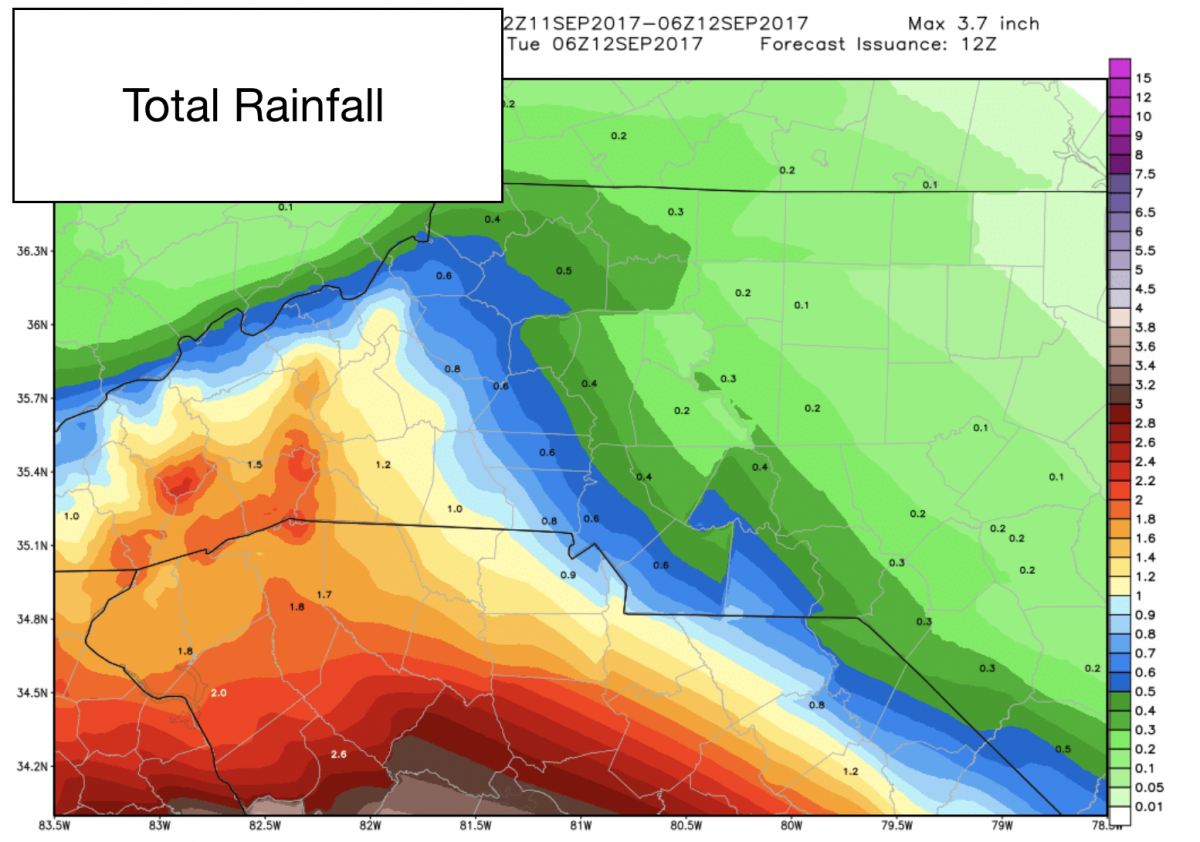
Accumulations of around a quarter to a half of an inch are possible around the county today and this evening. Most of the heavier amounts will be in the south and southwest portions of the county.
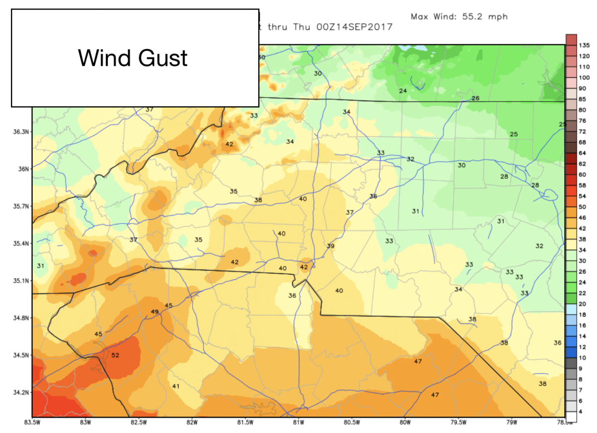
The real story for us over the next 36 hours will be the sustained winds and the wind gust we will feel around the county. We will see gust ranging from around 30-40mph around the county as this storm continues to move through the region. This winds will increase throughout the day.
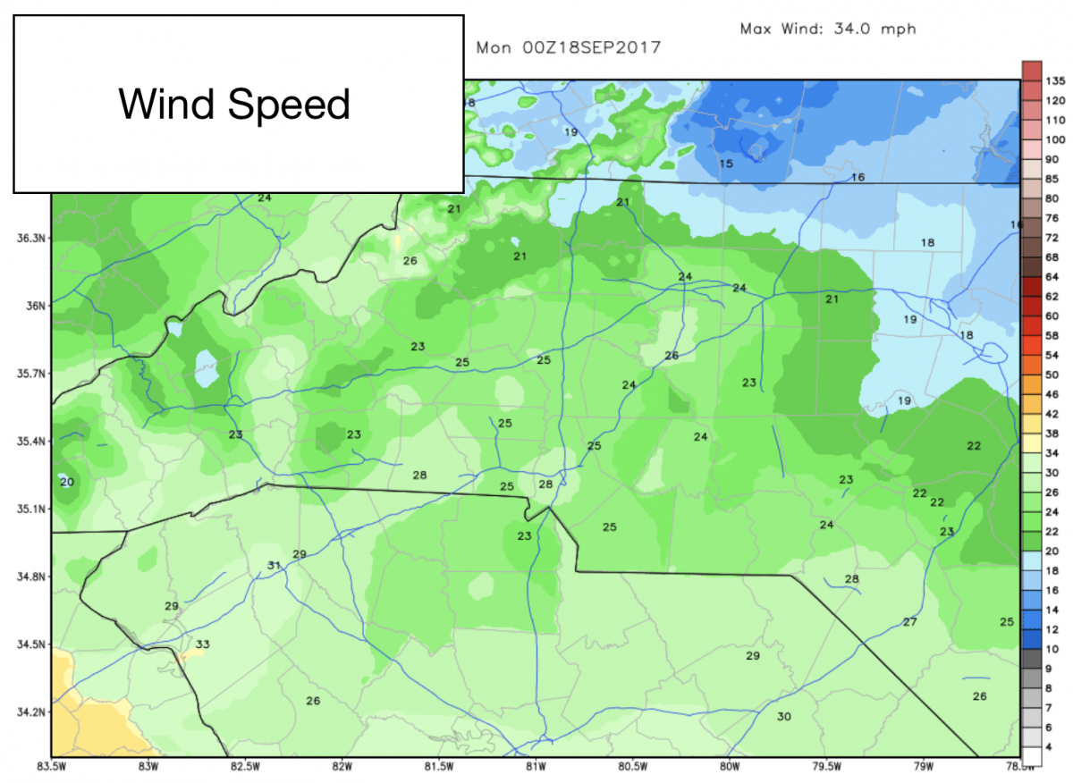
We will see sustained winds of around 20-30mph throughout the day and evening around the county. This winds will continues to increase throughout the day. Now you may think well that's not a lot. The best way for you to replicate this is to get in your vehicle. Drive down the road. Roll your window down and stick your head out while driving 20-30mph. That constant force you feel would be similar to the force trees and power lines will feel constantly over the next 36 hours or so.
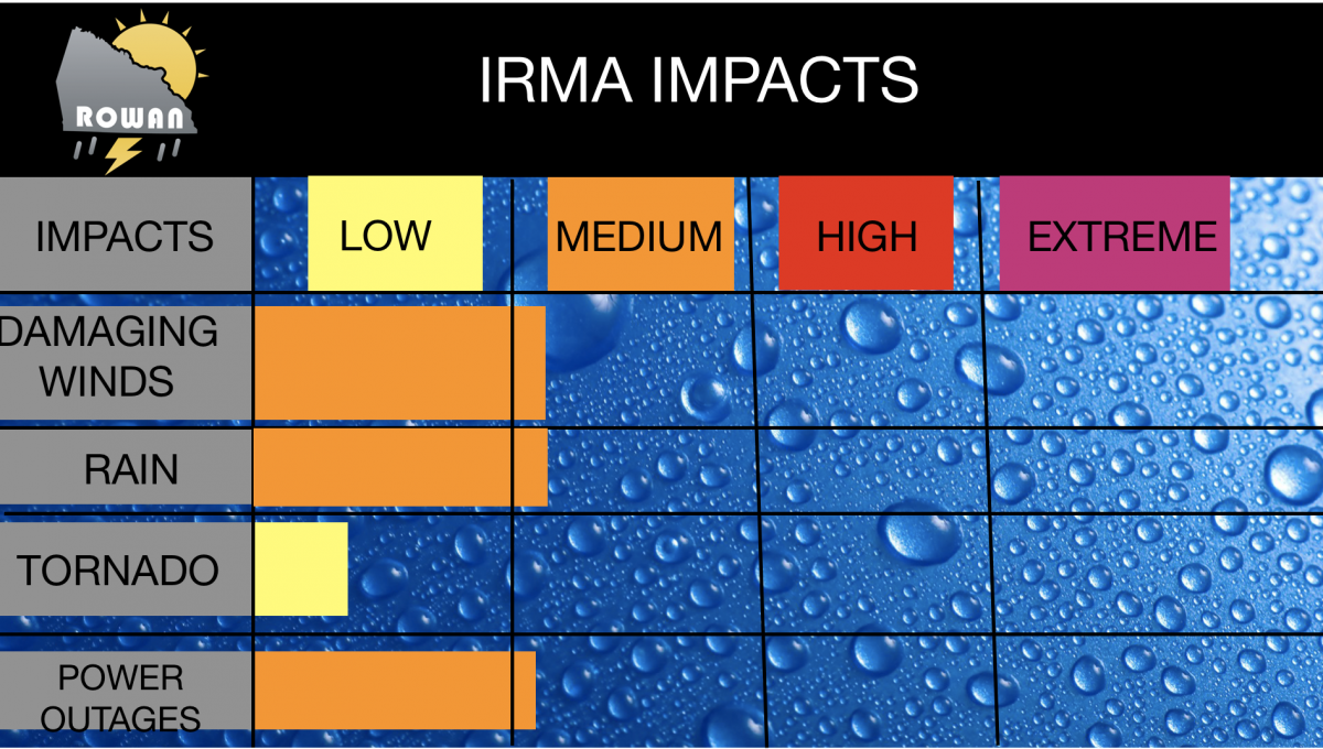
Impacts for the county have not changed from my forecast. They are listed in the chart below.
I will continue to keep you updated right here and on social media throughout the day and evening as conditions continue to worsen. As always thank you for following Rowan County Weather!