
Saturday Weather Forecast and latest on Hurricane irma
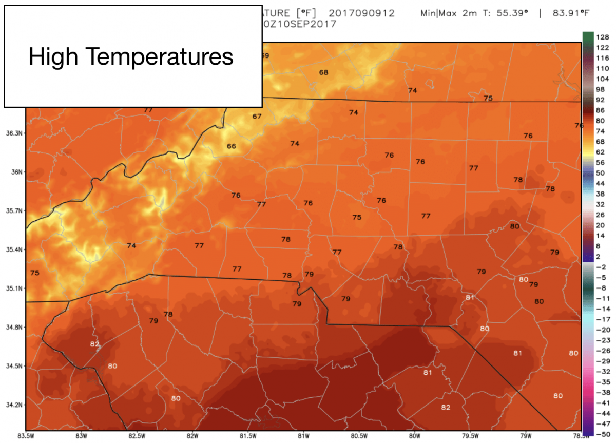
Good Saturday Morning! We are in store for yet another nice day around the county. Sunny skies and highs of around 75º No reason not to get outside and enjoy your Saturday.
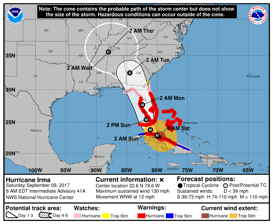
Now lets take a look at the latest on Hurricane Irma. The good news for us is there has been some shifts in the track overnight. This is taking the storm a little further west. However, it is still not enough to reduce the impacts we will see from this storm. Heres the latest Advisory as of 8am. The storm is still a Category 4 storm. The winds are down a little bit. I would expect after the storm takes the turn north. It is going to strengthen again as it moves over some water that is sitting at around 90º
The storm is going to slow down a bit as it moves over the state of Florida. That is not good news for that state as the rainfall potentials will be enough for flooding throughout the state of Florida. The potential for Tropical Storm Force Winds in our area is still an issue as we could see gust of around 60mph sill.
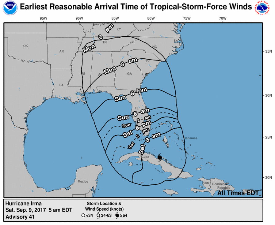
We will see those winds start to move into the area during the day on Monday. This will cause us to see sustained winds of around 30-40 miles per hour with gust of around 60 miles per hour. The potential for power outages is still there when you combine the estimated winds with the rainfall potential for the area and the county.
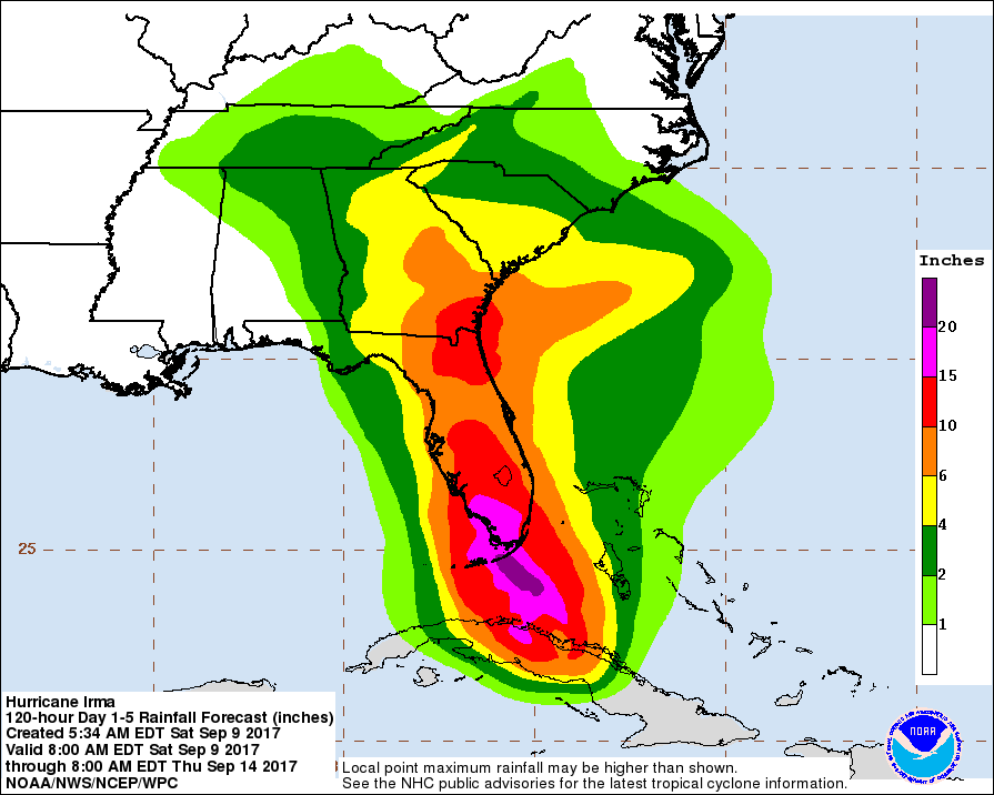
We are looking to see around 2 inches of rainfall around the county from Irma. You have to remember the track only shows the center of the storm. This storm is over 700 miles wide so the outer edges of it will pass over us unless this storm takes a big shift to the west.
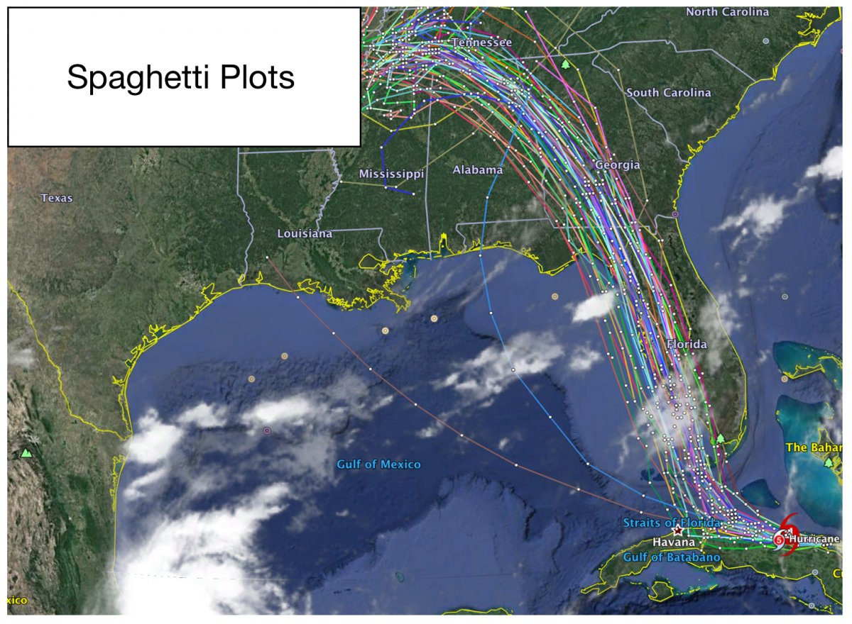
Now lets take a look at how the models are starting to become in agreement. The Spaghetti Plots this morning are really starting to tighten which helps build confidence the track of this storm is almost solid.
The Big Models for Comparison will not be listed below. Lets take a look first at the winds.
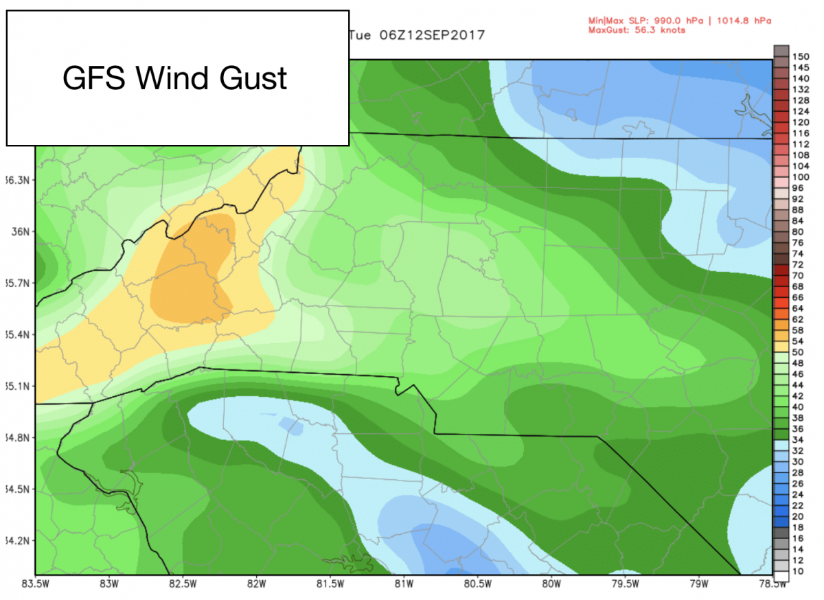
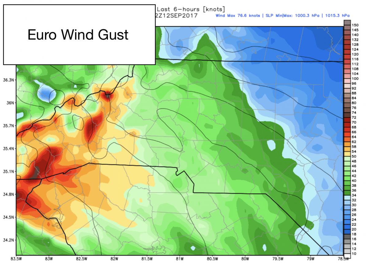
The GFS Model pictured above is showing us with the chance continuing for wind gust of around 60 miles per hour. The mountain areas could see gust of over 70 miles per hour. The ridge tops could be closer to 80mph. The higher you go in a tropical storm the faster the winds get. Now the European Model below is also in agreement with the 60mph gust for us as well.
Now lets take a look at how the models are in agreement for rainfall totals in the area and the county.
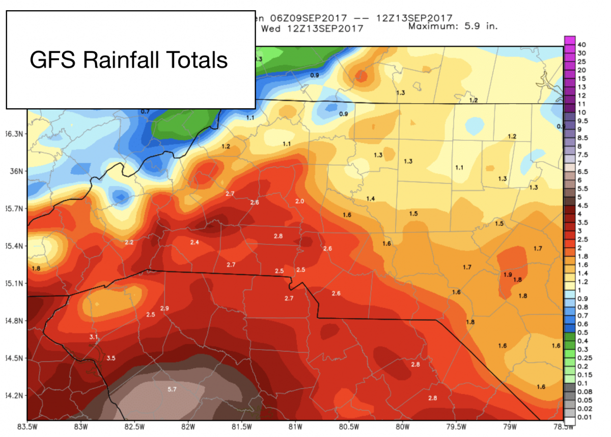
The GFS Model above shows how we could see rainfall totals of around 2 inches or more around the county from Irma based on the current track. All of the other models you will see pictured below are in agreement and this continues to help build confidence the models are starting to get a strong handle on the path of this storm.
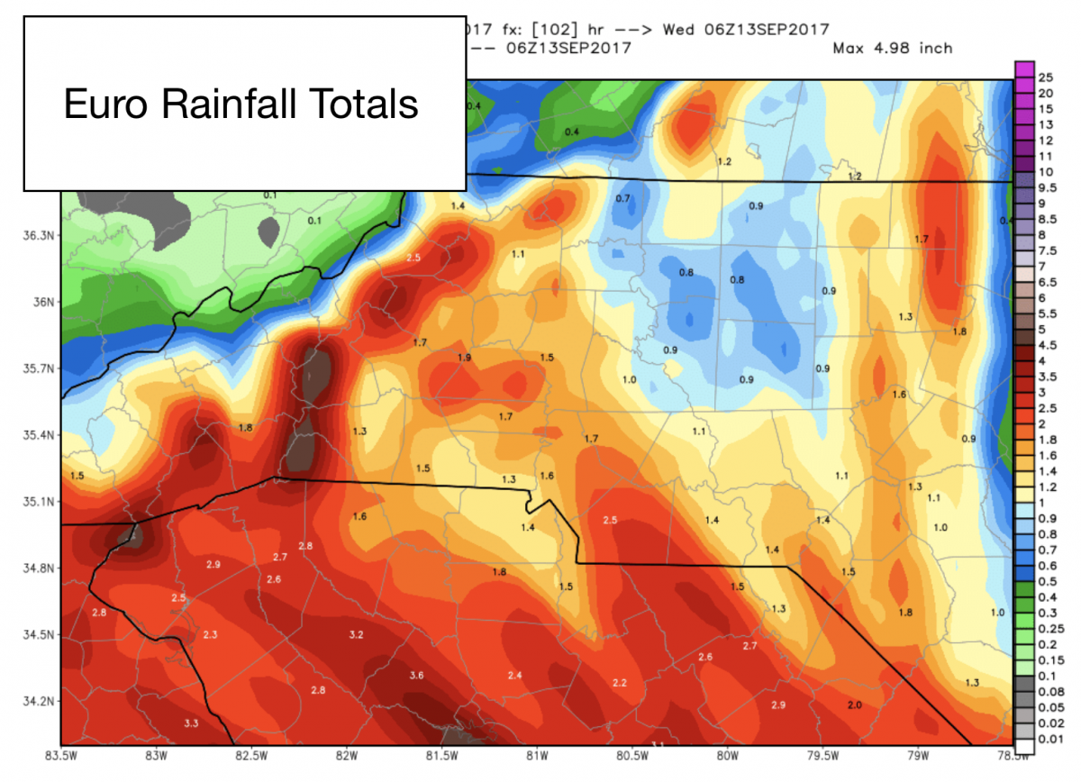
The European Model above is the only model that has totals a little lower and I believe it is simply because the totals are understated in this model.
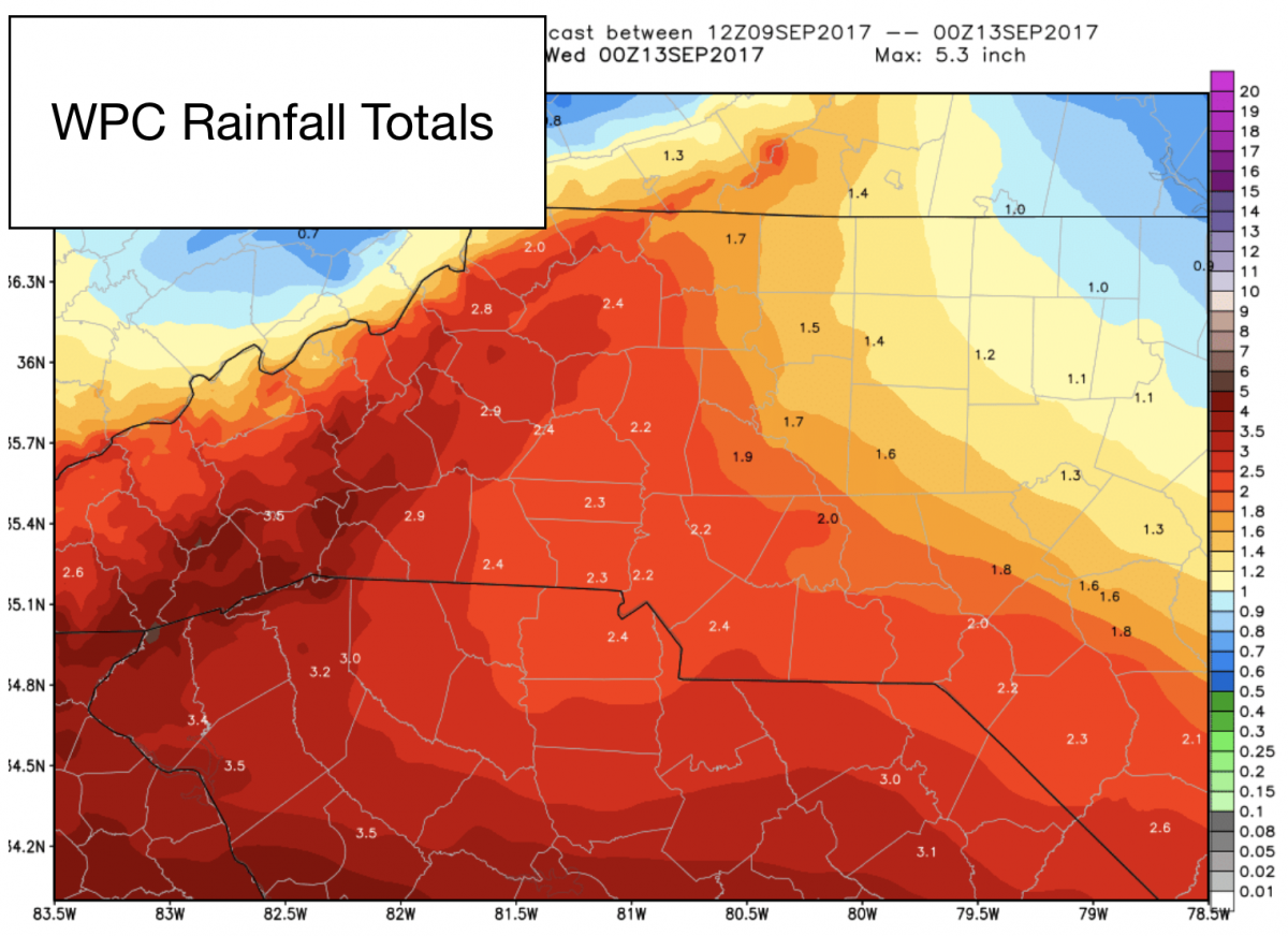
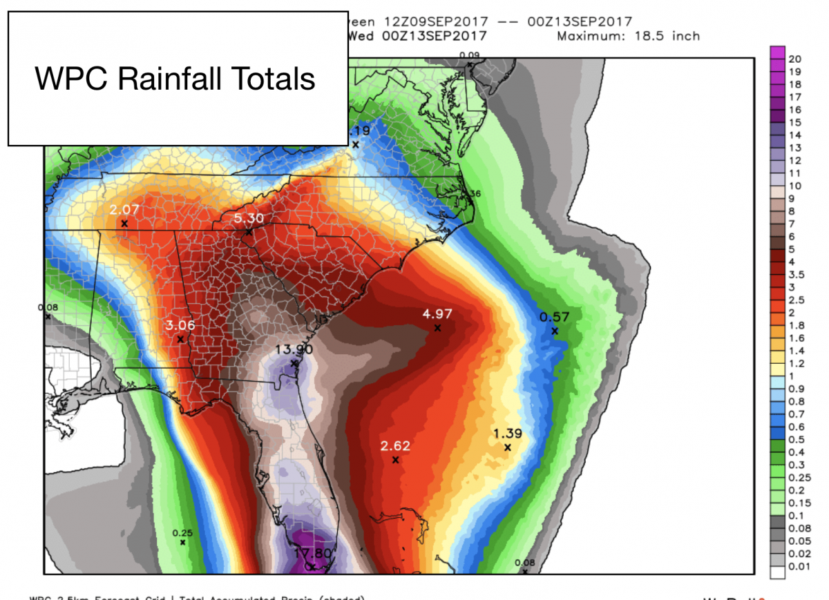
The Weather Predictions Center also shows agreement with the GFS with 2 or more inches of rainfall around the county. The image below is a southeast view of the accumulations from the WPC so you can see what other areas are expected to receive.
As we continue through the weekend I will post the level of impacts in which I think we will see here in the county rated from low to extreme. I want to give the models a few more runs to ensure the track is locked down first. A shift of 50 miles one way or the other changes things drastically. I will continue to keep you updated right here and on social media as we move through the weekend. I will also start to stream live coverage on my website from the state of Florida as the storm starts to make its way ashore there. As always thank you for following Rowan County Weather.