

Marginal Risk For Severe Weather Today. Hurricane Irma Update
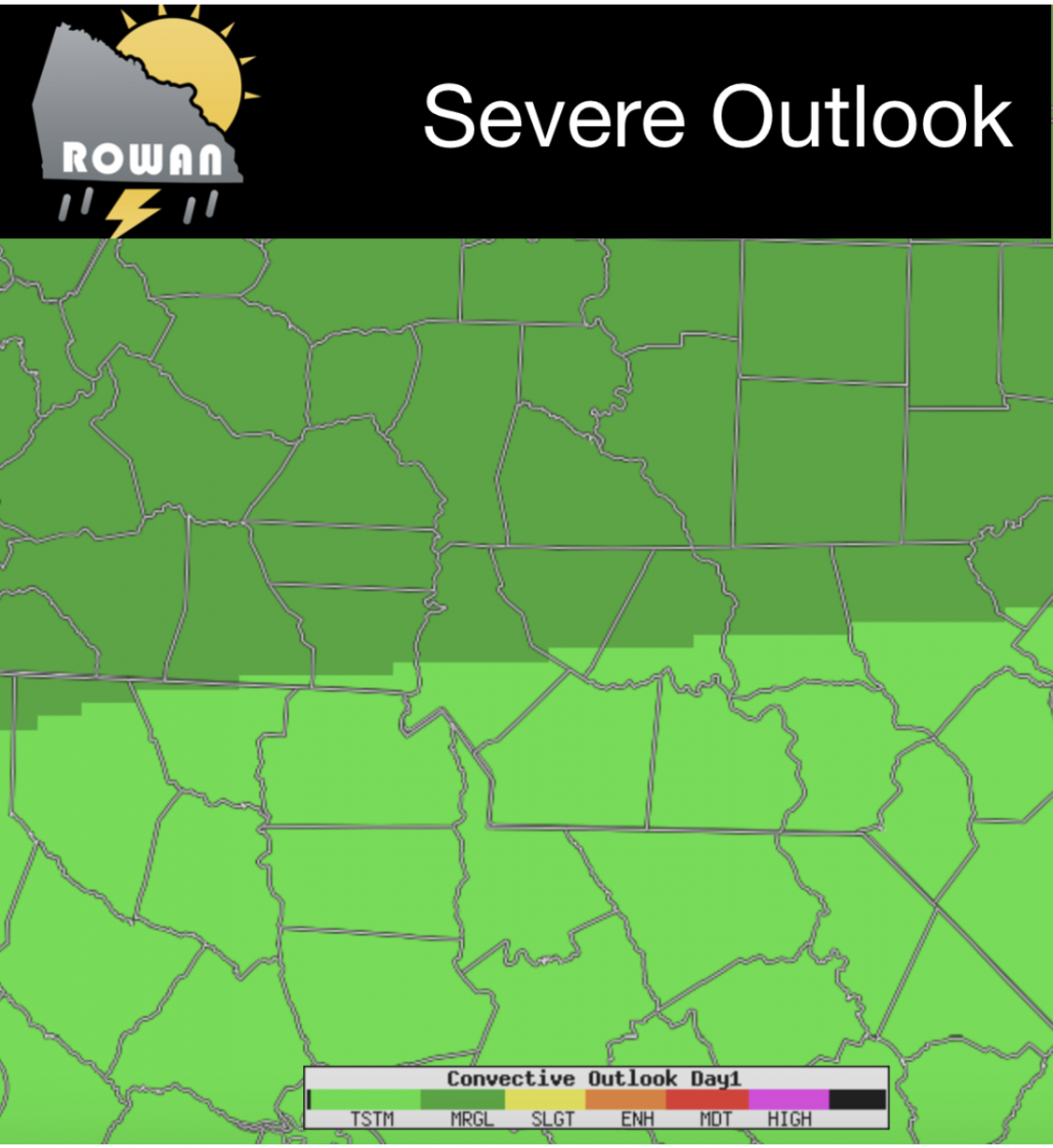
Good Morning! There is a lot going on this Tuesday morning. Let's start this blog off with what we can expect today and then move into the latest with Hurricane Irma. For today the National Storms Predictions center has us under a marginal Risk for Severe Weather in the area and the county.
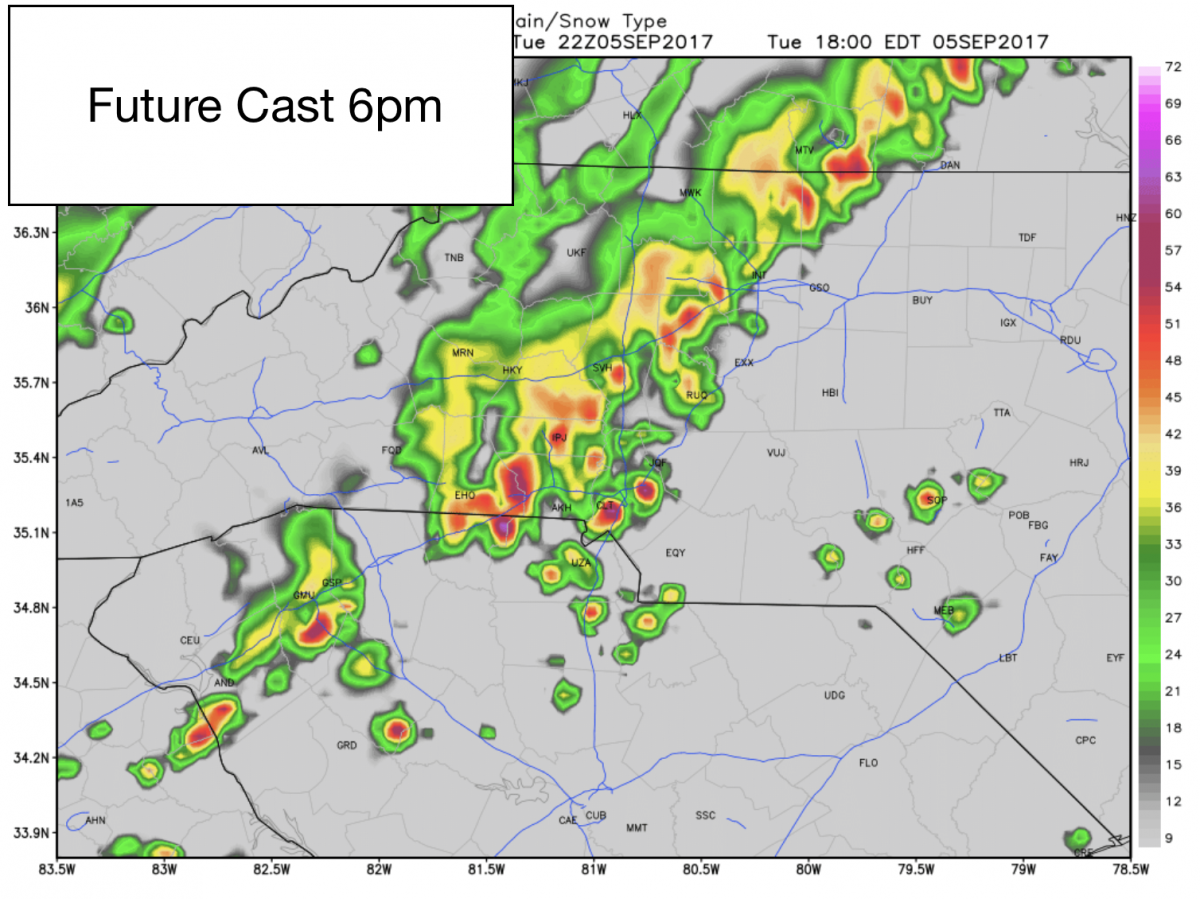
We will see some late afternoon and early evening storms move into the county around 6pm this evening. I am not concerned at this point with severe weather. However, some of these storms could be strong.
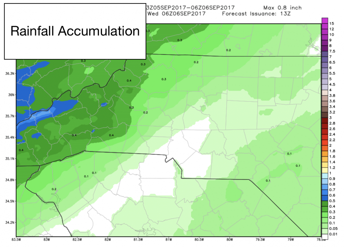
We could see rainfall accumulations of around a tenth to a half of an inch around the county as these showers and storms move through.
We will top out with a high today of around 87º

Now let's focus on Hurricane Irma. This storm as of 8am this morning has now progressed to a Strong Category 5 storm with sustained winds of 175mph. The track continues to take it into souther Florida by the weekend. After that. Things are still up in the air as to weather the storms takes a turn north or if it continues into the Gulf Coast. Here is the latest advisory form the National Hurricane Center.
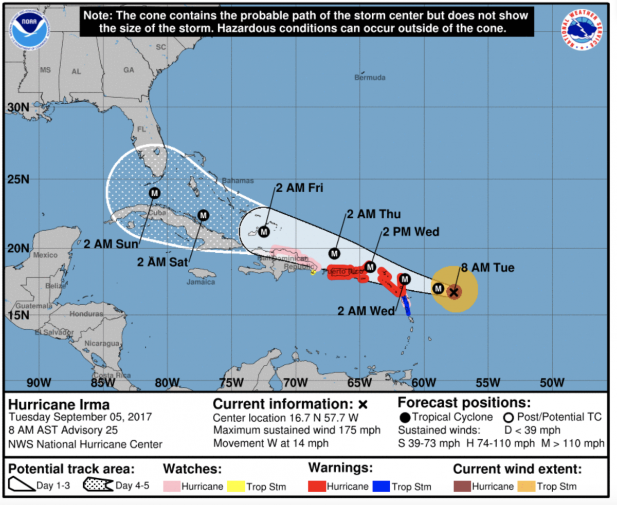
As you can see the track is pretty solid through early Sunday Morning. After that the models are making things quite difficult. Spaghetti plots have the storm all over the eastern seaboard of the United States. I am going to focus this morning on two of the bigger models and how differently they are handling the storm. First lets start with the European Model.
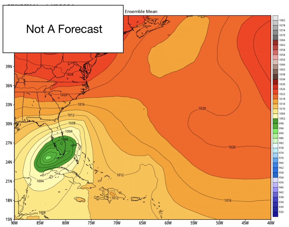
By early next week the European Model has Irma to the southwest of the Florida Gulf Coast and starting to make a track to the north. Now watch what happens with Irma in the European Model as we move ahead just a few days.
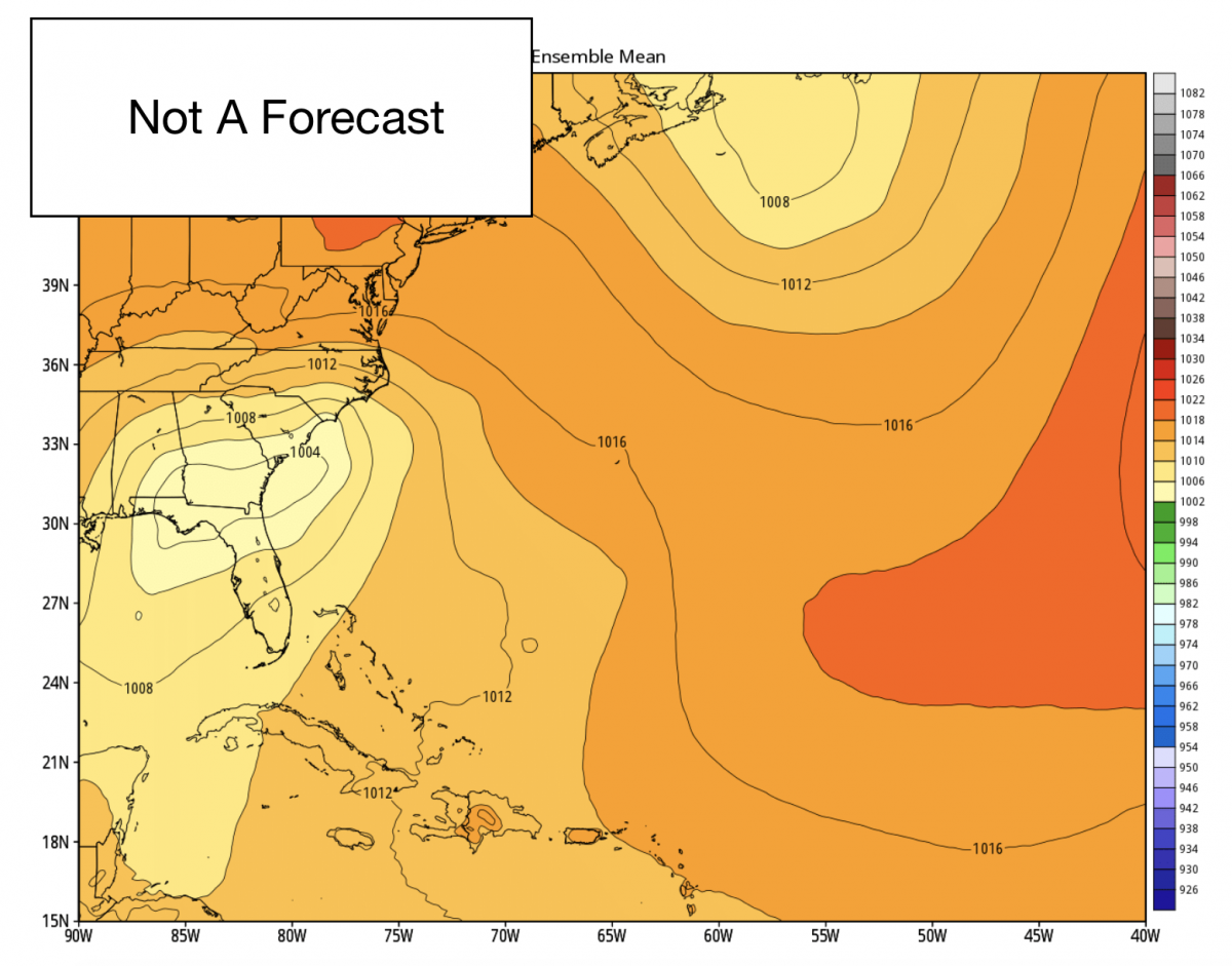
The storm simply falls apart as it makes landfall somewhere near Panama City Beach Florida. Now keep in mind that is one models interpretation on what could happen. Now let's take a look at the GFS Model and watch what it does,
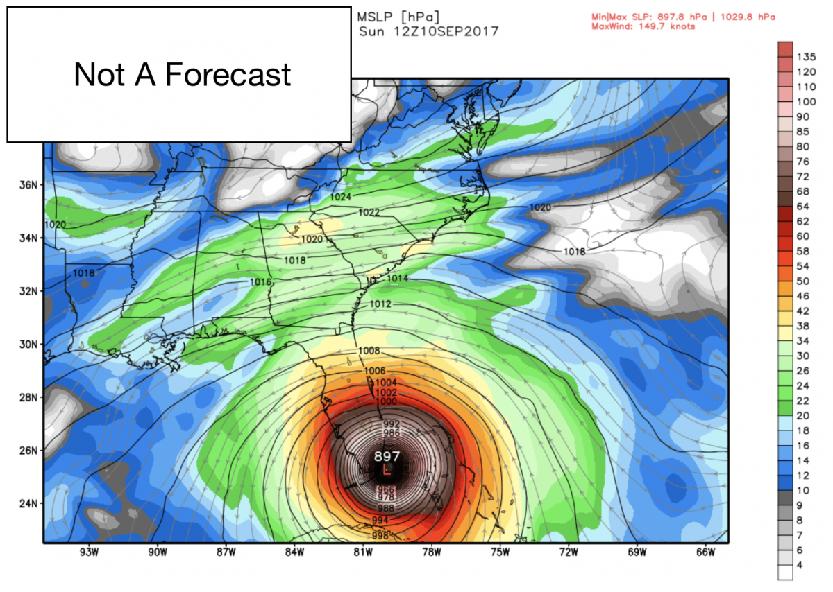
The GFS model has Irma making landfall around Miami Florida on Sunday of next week. Now if we jump ahead just a few more days in the model watch what the GFS sees.
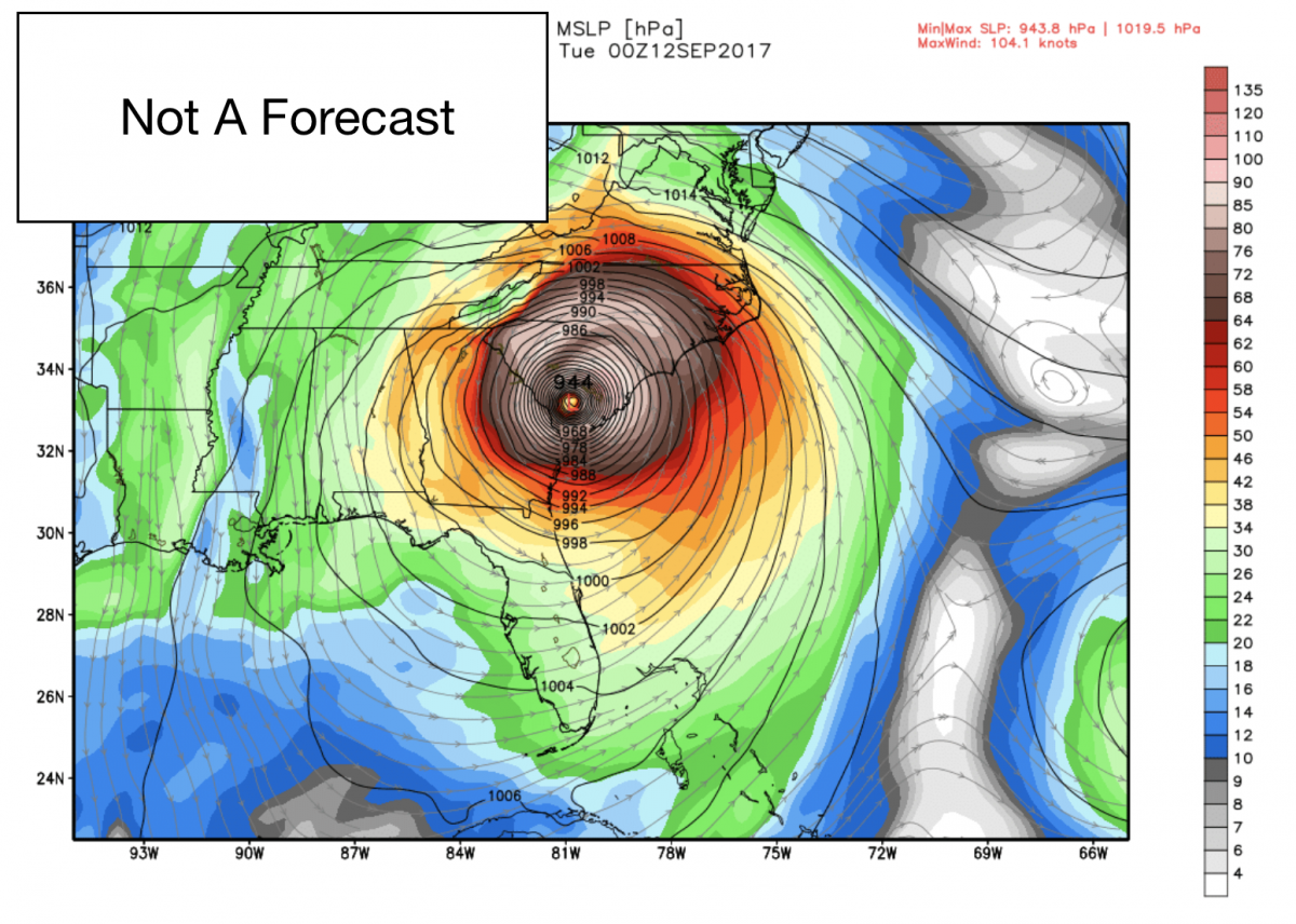
By Tuesday the storm is just south of Columbia South Carolina making its way north toward the Charlotte region. So as you can see there is a lot of uncertainty in where this storm will continue to go. I will continue to keep you updated on todays weather along with the path of Irma right here and on social media. In the meantime if you are planning any trips to south Florida this wekend have a plan B. in place. As always thank you for following Rowan County Weather!