
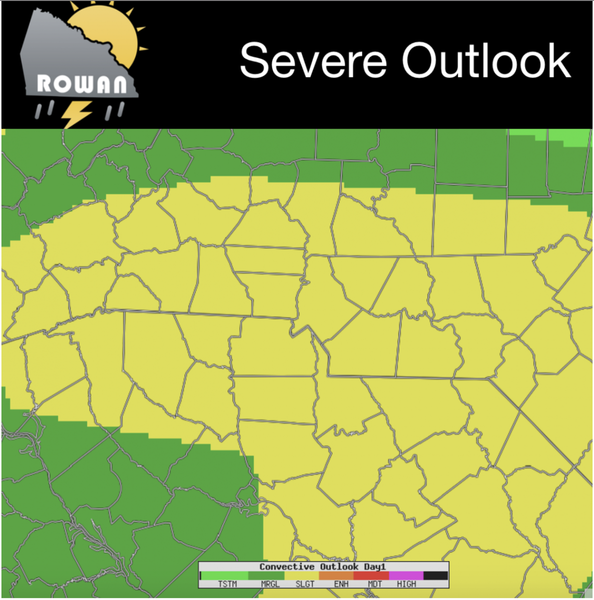
Severe Weather Threat at a slight risk today
Good Friday Morning! As we head into the Labor Day Weekend we are not doing it without the threat of severe weather around the county for today. The Storms Prediction Center has us in a slight risk for severe weather around the county today.
We will see showers and storms move through the county throughout the day with some chances of brining severe weather l along with them. The model data I will show you in todays blog is data from throughout the day. The threats seem to be viable at any given point during the day so I will certainly keep you updated right here and on social media all day long.
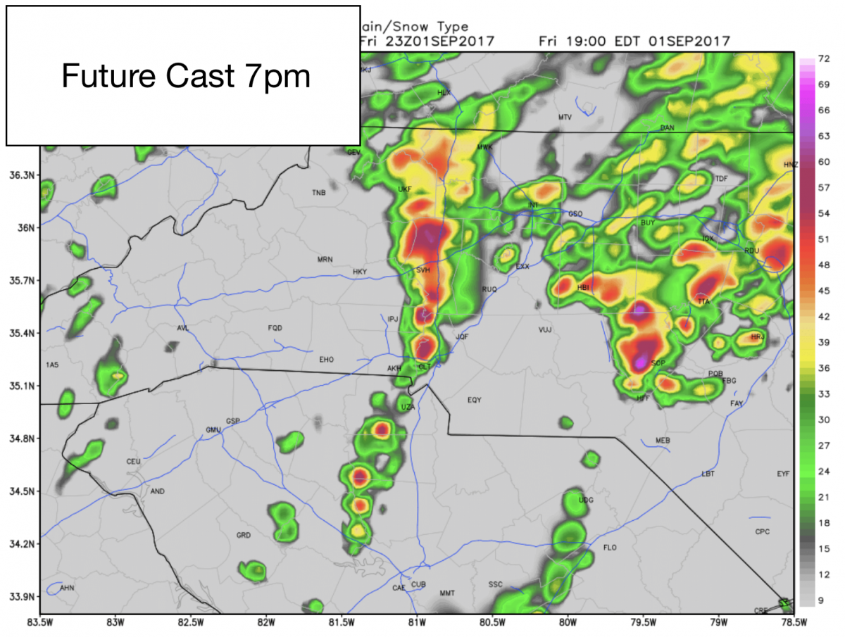
Future Cast is showing a strong line of thunderstorms moving into the county around 7pm this evening. Now please keep in mind this will likely not be the only strong thunderstorm threat we have all day long. The threat will increase as we move through the day and the remnants of Hurricane Harvey move through the region.
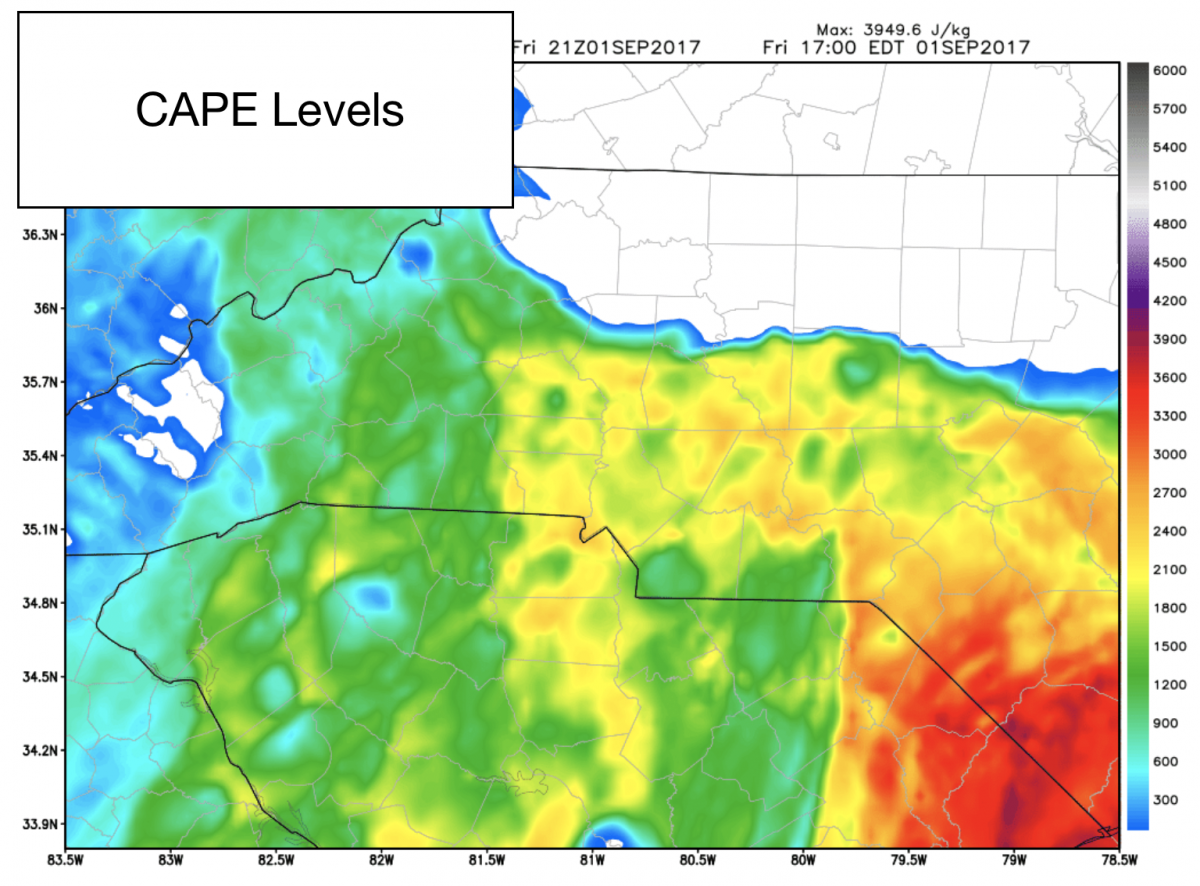
CAPE Levels or thunderstorm fuel will be at some elevated levels throughout the day. These will get several of the storms today growing in strength and increasing the severity potential.
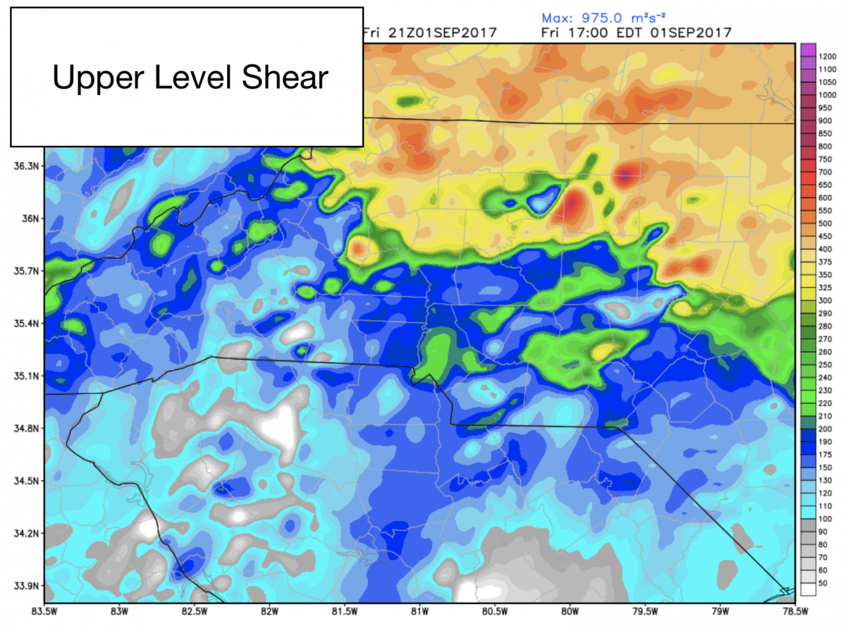
The upper level shear values will be elevated as well this will help give us a chance for some possible tornadoes around the area. We do have a slight chance of tornadoes developing here in the county today. That is not my biggest concern at this point.
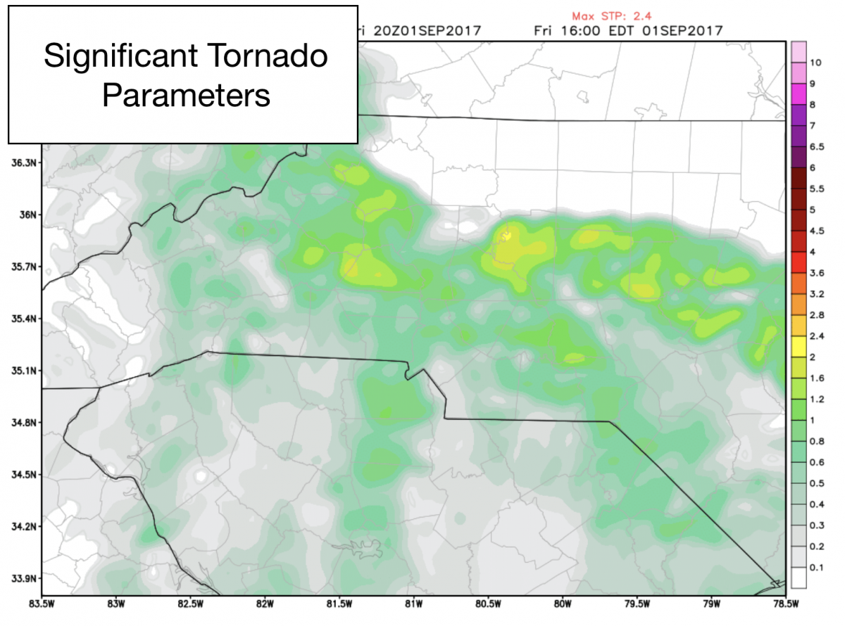
As you can see form the data above the Significant Tornado Parameters are a little elevated this afternoon and early evening. It is something I will continue to watch throughout the day. Please stay weather aware today and this evening.
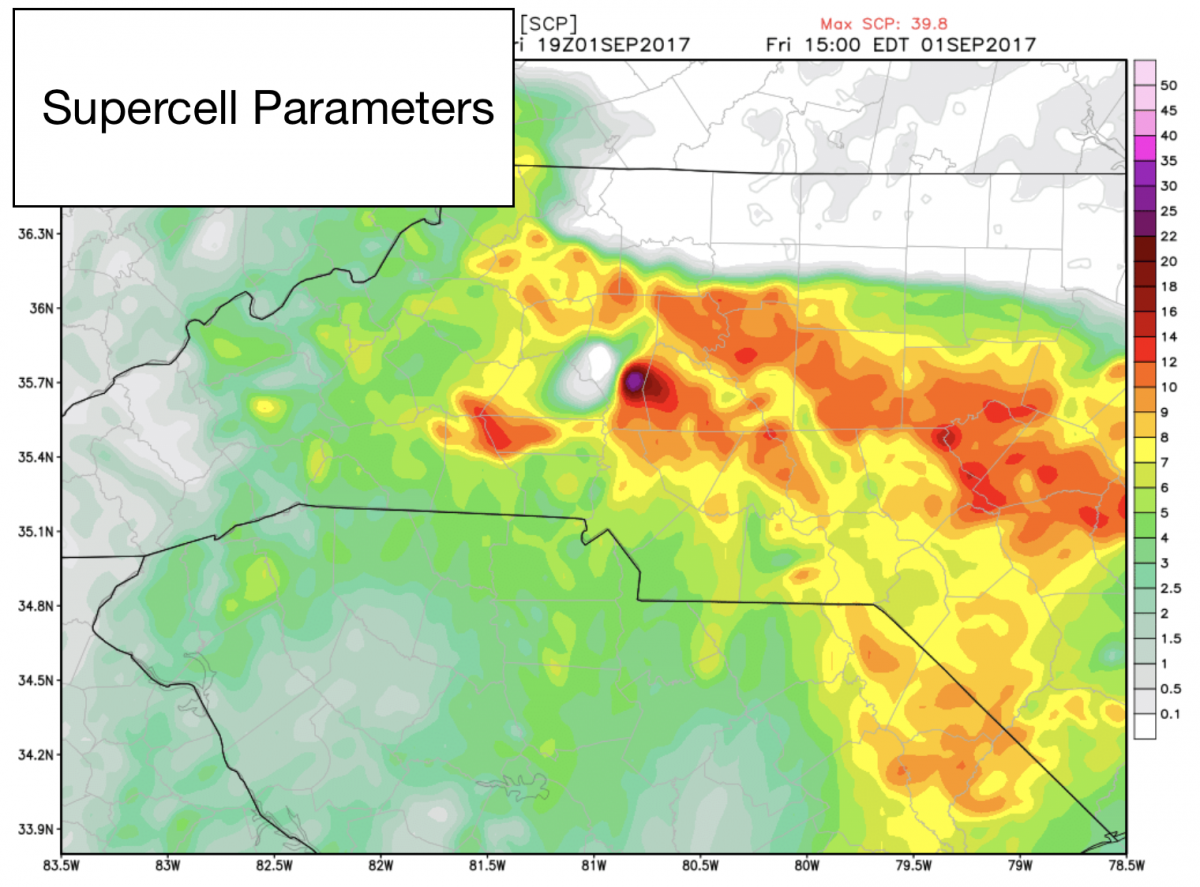
As you can see the Super Cell Parameters are also elevated later this afternoon and evening this will give us a chance for some strong storms with hail and the possibility of a tornado would exist. The biggest threat from these storms will be localized flooding.
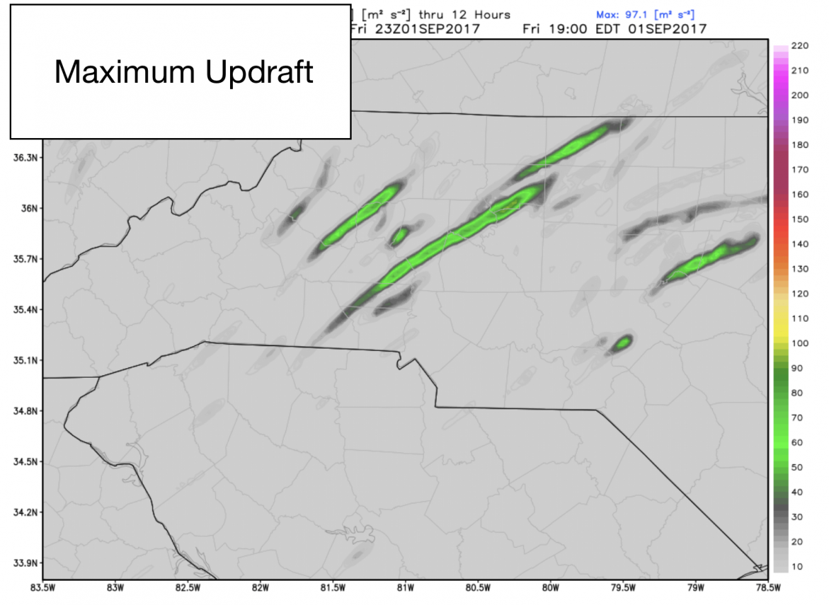
Going to have to keep an eye on the maximum updraft potential throughout the day as that will increase the chance for seeing some hail with these storms later today. I am not to concerned at this point as the area looks to be pretty slim with those updrafts.
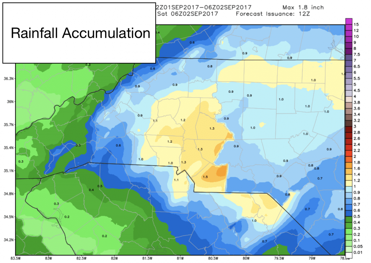
Localized flooding will be the biggest threat as we could see anywhere form an inch to an inch and a quarter with any of these storms today. The heavy rainband setup will play a big factor in who gets the most.
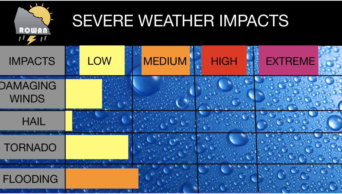
My biggest concern with all of the impacts today is the localized flooding that could occur around the county. All other impacts are low with Hail being the least of my concerns for the county today. Just stay weather aware and keep an eye out for any updates I provide throughout the day and this evening. As always thank you for following Rowan County Weather and have a great Friday!