
General Thunderstorm Risk for this evening.
Good Monday Morning! We are off and running for another work week around the area and county. The rain chances amp back up today as the front has drifted back north in our direction. With that shift we we see a chance for a General Thunderstorm Risk today

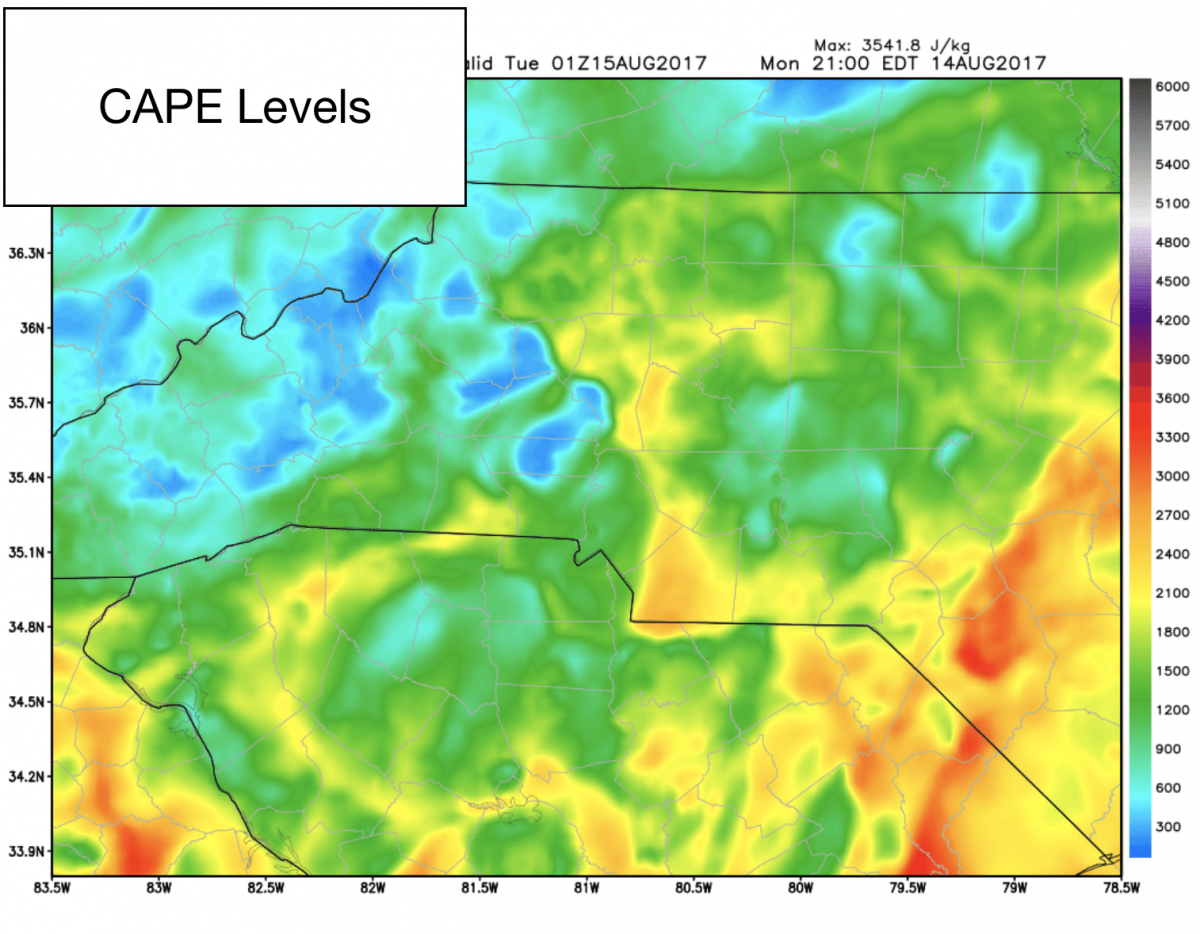
Not looking for anything severe but we could see a few strong thunderstorms later this evening as CAPE levels are a little elevated in the model data for tonight. I think just enough that we could see some heavy downpours with frequent lightning and thunder. Not looking for anything more than that at this point.
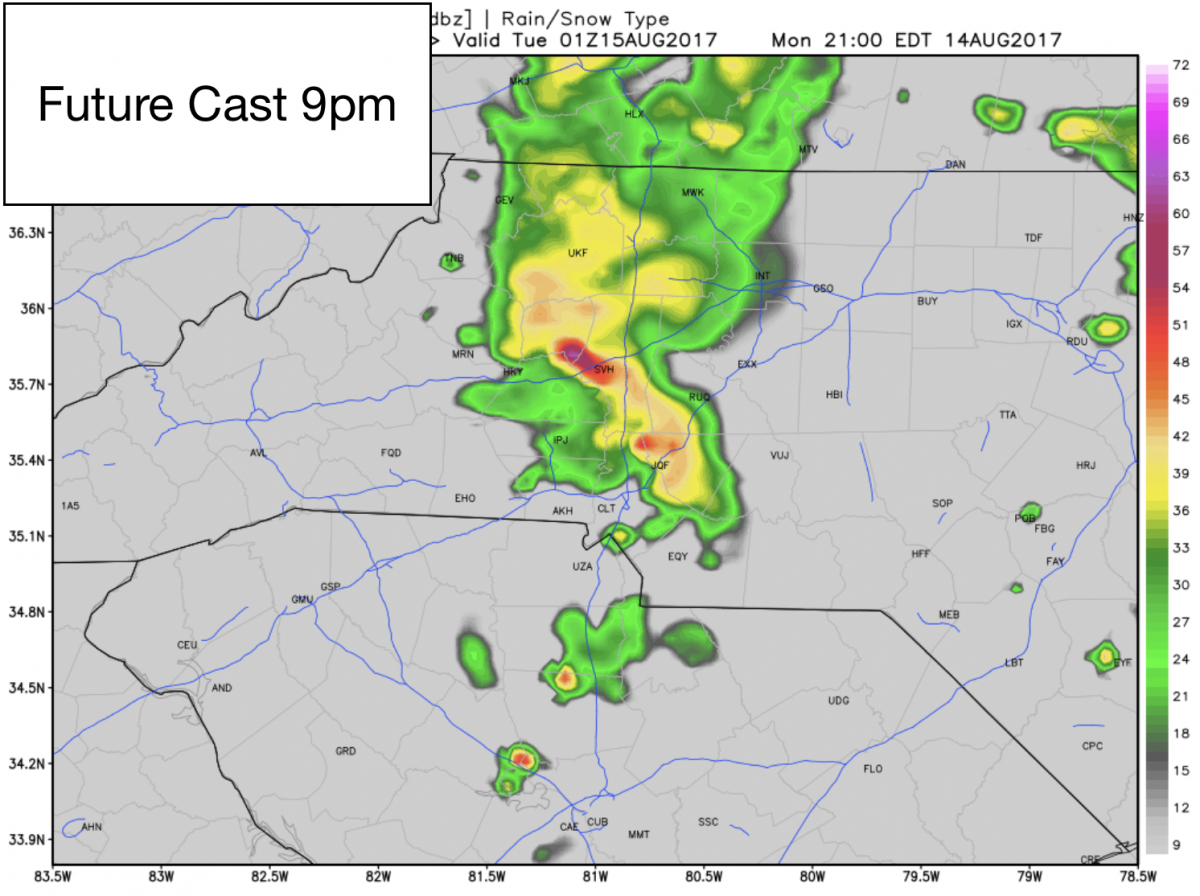
You can expect showers and storms to move into the county around 9pm this evening ad as they begin to approach and move through the county. i will keep you informed and updated right here and on social media throughout the day and evening.
As far as accumulation totals go. I am looking for the potential of around a half of an inch to an inch of rainfall around the county.

I will keep you updated right here and on social media throughout the day. As always thank you for following Rowan County Weather!