
Rain Chances Increase Today
We are at the end of the work week. The weekend is in view and it looks to be a wet weekend for us. Beginning with today. The Storms Prediction Center has us with a general thunderstorm risk. However I am keeping an eye to our north and west as the low risk for severe weather is in that area. If things shift we could easily be in a low risk for severe weather today. At this point I don't see that happening.

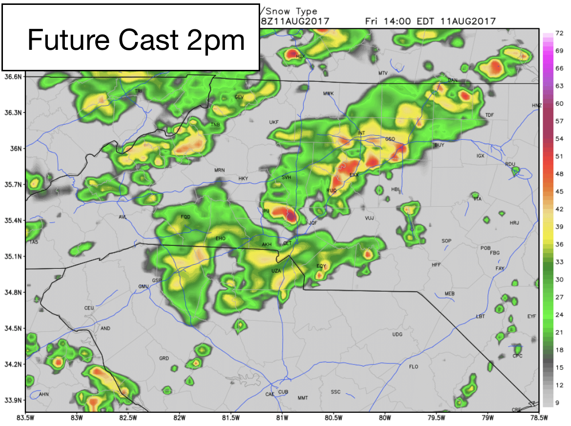
If you have plans today that involve the outside. Get them taken care of early. Around 2pm today more widespread areas of rain will be moving into the county and look to hang around most of the evening. I am not expecting anything more than general thunderstorms as the models at this point are not showing any signs of severe weather. I will monitor for changes throughout the day.
Accumulations around the county will be significantly higher today than what we saw yesterday around the county. Everyone in the county has a decent chance of seeing rainfall this evening. I am looking for accumulations ranging from a half of an inch to over two inches of rainfall around the county by midnight tonight.

There will be a chance for a very heavy downpour somewhere around the county later today. Once that sets up we will have a pretty good idea of who will see around 2 inches of rainfall today. Localized flooding is the concern with the potential for heavy downpours. I will provide updates right here and on social media throughout the day. As always thank you for following Rowan County Weather!