
Tropical Storm Cindy Update Wednesday Morning 6/21/17
Quite a bit has happened over the past 24 hours. Yesterday when I made my blog post about Potential Tropical Cyclone Three this storm was unnamed. Yesterday afternoon we had Tropical Storm Cindy. Let's take a look at the latest advisory for this storm and the possible track.
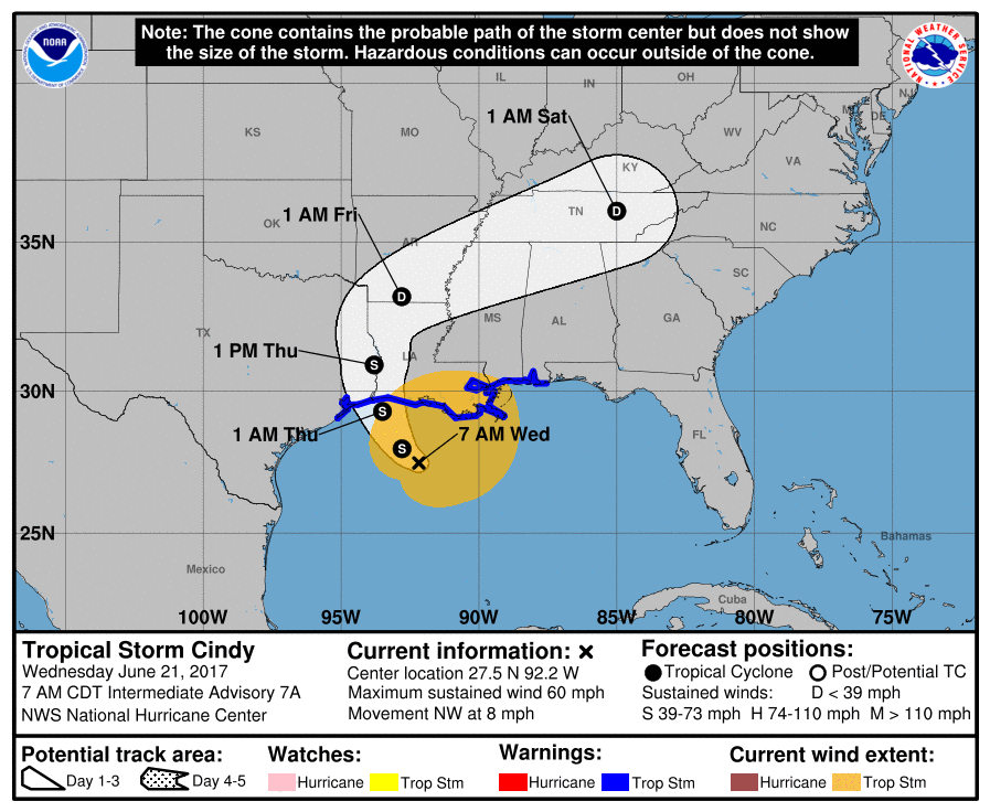
As you can see with the latest advisory Cindy is expected to make landfall somewhere along the Louisiana and Texas border sometime early Thursday morning. The track brings the storm as a Tropical Depression into the North Carolina Mountains during the overnight hours Saturday morning. As I stated in my previous post yesterday the track is not the real story here. The rainfall factor will be the real story. The gulf coast area will not doubt take the brunt of the storm. However we will get a fair amount of Gulf Moisture associated with this storm.
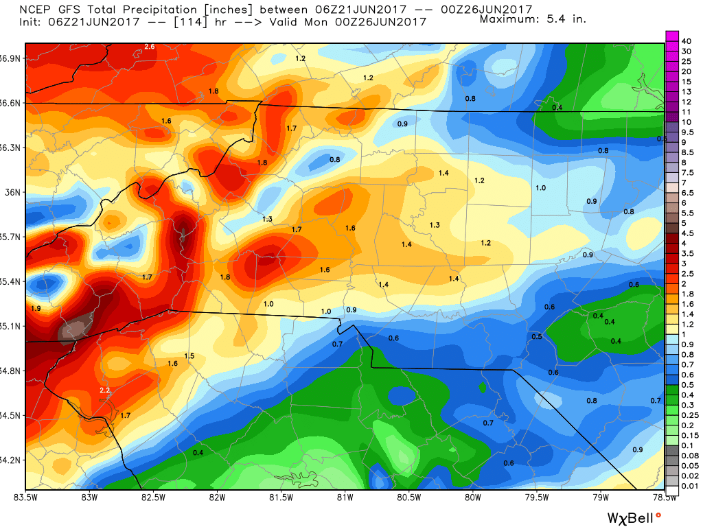
The GFS model above shows Rowan County getting around 1 and a half inches of rainfall between now and Sunday evening. Yesterday this model seemed to be aggressive in the accumulation potential. However, as of this morning the Euro is almost in agreement.
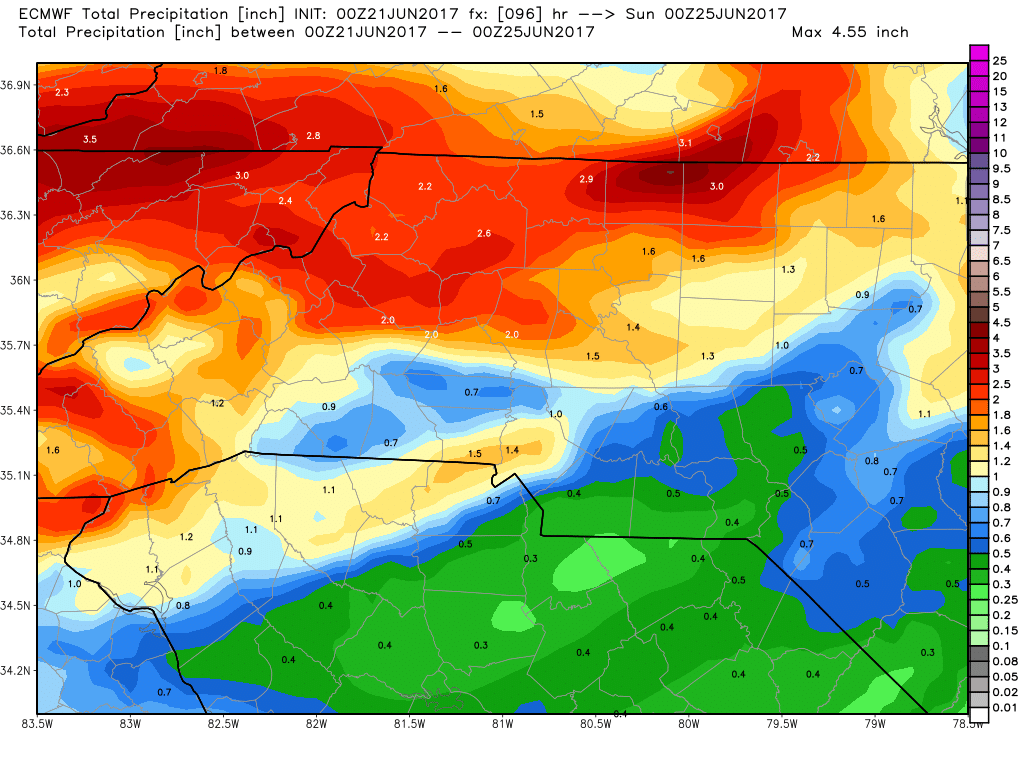
The Euro also calling for around 1 and a half inches of rainfall around the county. It is not often that these two models agree on accumulation. So this does give me some confidence we are going to get a fair amount of tropical moisture moving through the county over the next 96 hours. Most of the rainfall will arrive Thursday - Saturday. I am not expecting anything severe. The threat from this system for us will be a chance for localized flooding. We are in a surplus of rainfall for the year so the ground is already saturated. Not going to take much of a downpour to get some standing water in creek beds and rivers.
I will continue to keep you updated right here and on social media. As always thank you for following Rowan County Weather!.