
Potential Tropical Cyclone Three Update
There has been a lot of talk about Potential Tropical Cyclone Three in the Gulf Coast. So many are more concerned with the track of this storm. The concern should be more with the potential flooding impacts this storm will bring regardless of the track. The southeast over the past few months has gone from a transition of drought to a surplus of rainfall. That holds very true right here in North Carolina and closer to home here in Rowan County. So lets take a look at the latest advisory for this system.
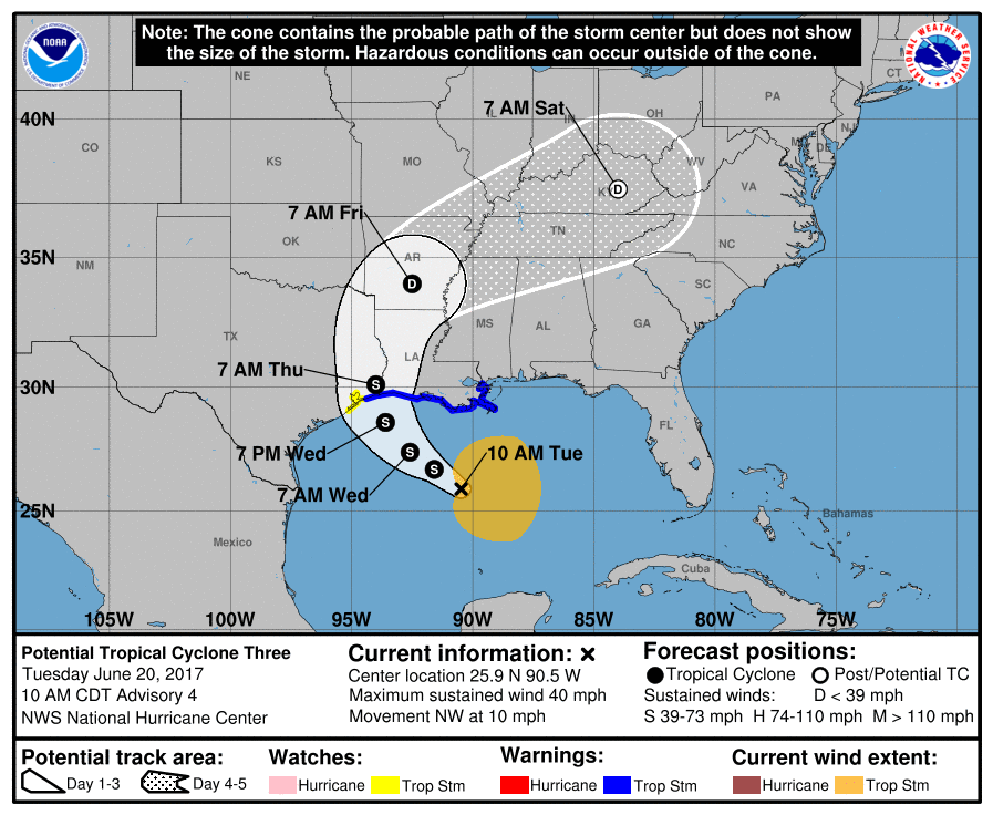
As you can see from the cone of uncertainly above in the advisory. The storm could pass very close to the North Carolina mountains by Saturday morning if all holds true. Models are starting to indicate quite a bit of rainfall around the southeast for this system. I wanted to give you an idea of what to expect right here at home.
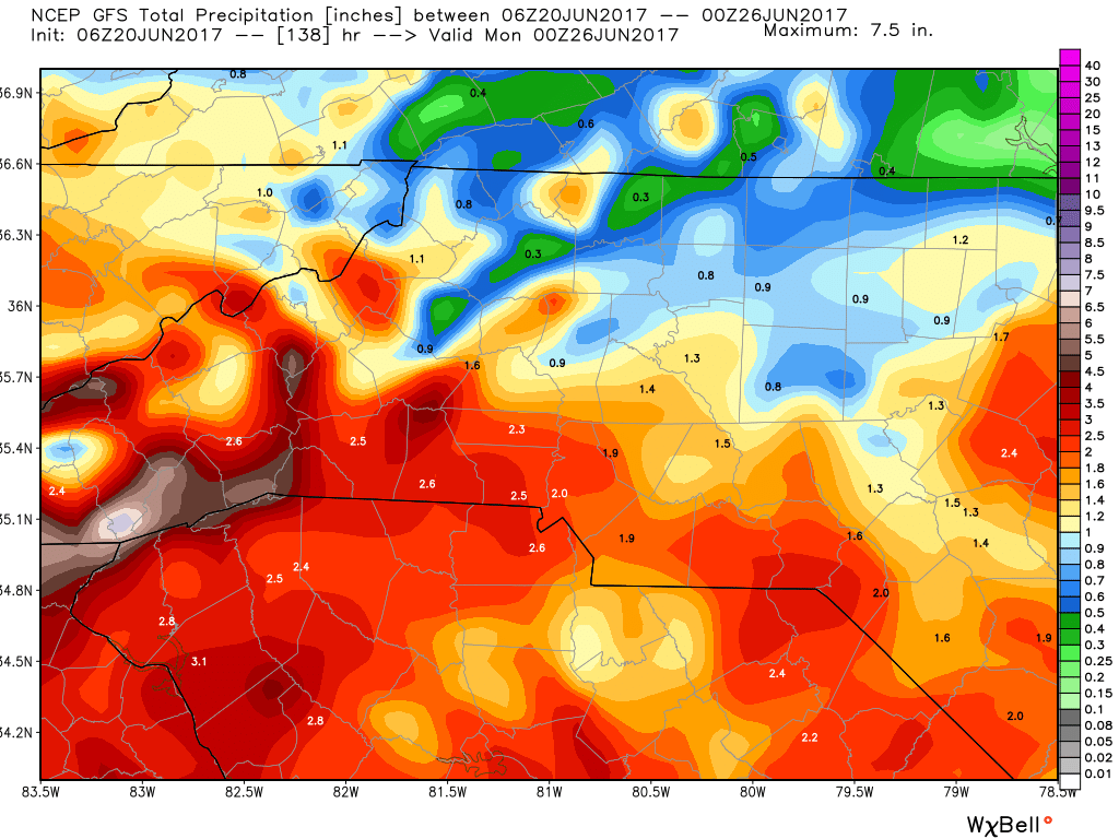
The above image is the GFS model through 7pm Sunday evening. The GFS model tens to get a little aggressive with accumulation. This model is indicating we could see an additional 1.4 inches of rainfall in the county from now through Sunday evening. Not all of this rain would be directly from this system however, it is assisting with pushing Gulf Moisture our way.
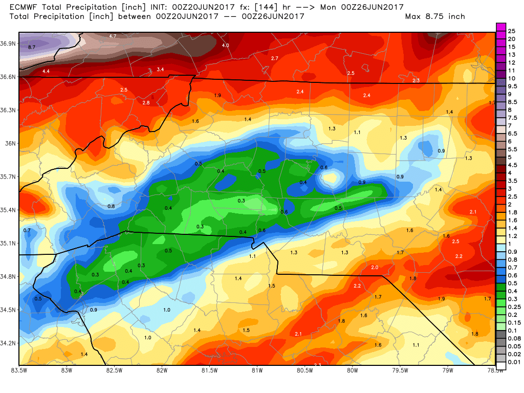
The European Model above is indicating we could see an additional half an inch to three quarters of an inch in rainfall from now through 7pm Sunday around the county. The key here is look at all of the high totals around us form the mountain to our west and the coastal plains to our east. I think the Euro is having some trouble with the exact track of this storm. If I had to toss out possible totals right now I would say do not be surprised to see at least an inch or more of rainfall around the county between now and Sunday evening. As we continue to go through the next 36-48 hours things will be come more clear on potential impacts. The one impact that will be the biggest impact regardless will be rainfall accumulations. I will provide updates right here and on social media as this system gets closer to the county. As always thank you for following Rowan County Weather!