
Slight chance for severe weather in the county this afternoon and evening
. Good Morning everyone! We have some active weather that will move through the area and the county later this afternoon and evening. A cold front will approach the area from the west today, bringing an increased chance for storms today. The front should then slowly push into the Carolinas tonight through Tuesday, before stalling across the Midlands.

The Storms Prediction Center had issued a slight risk for severe weather across much of the area today. Rowan County is pretty close to the center of the area where severe weather is likely to occur.
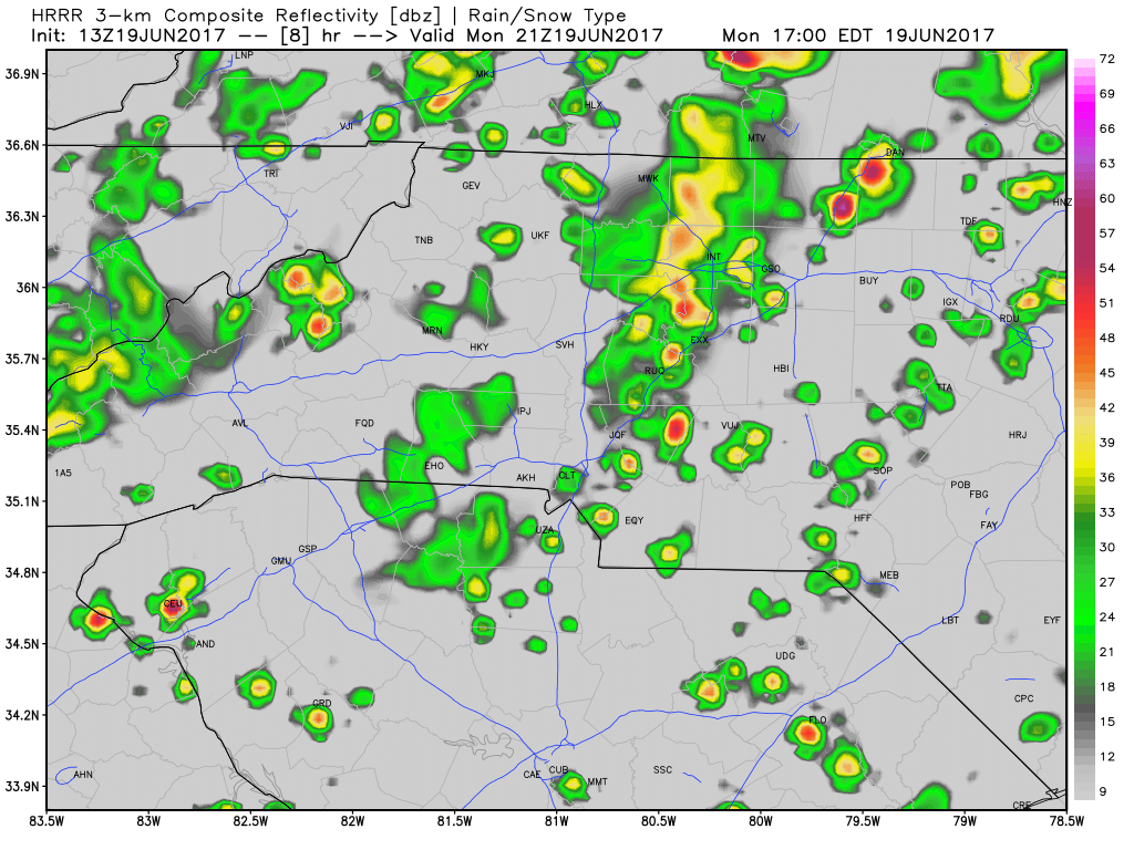
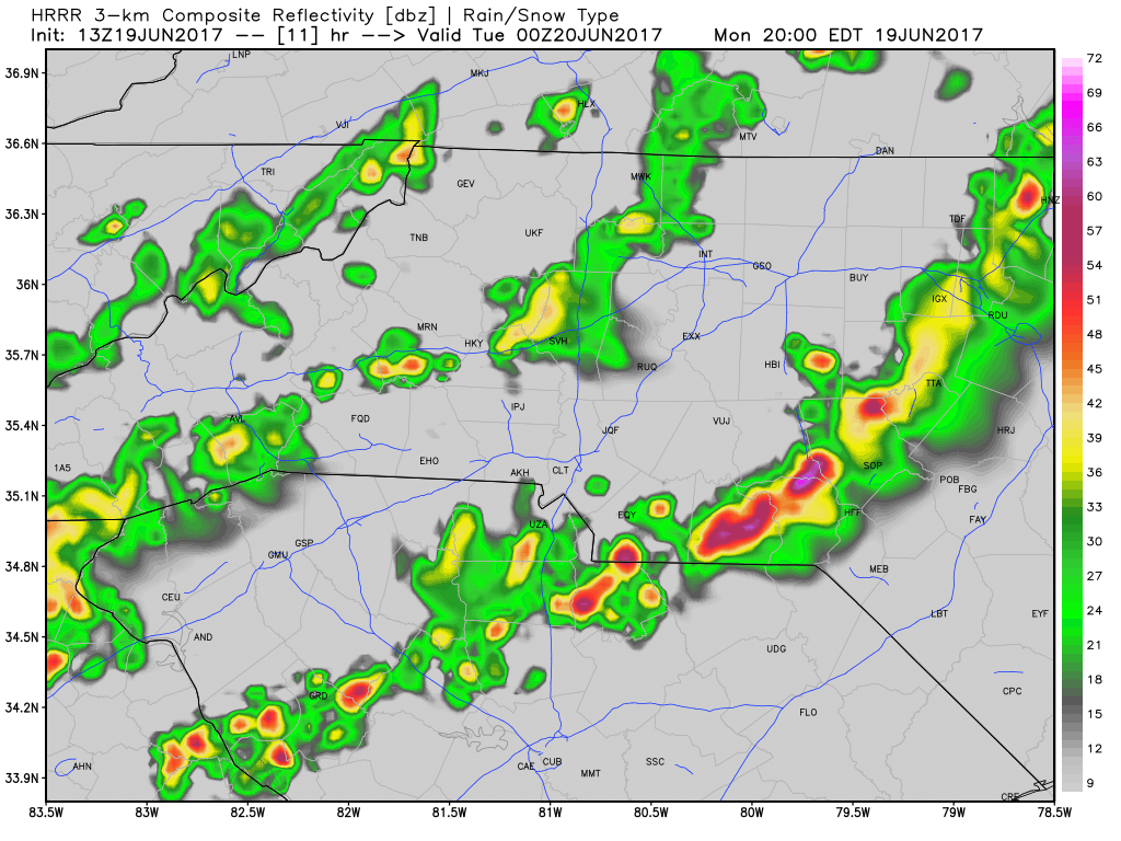
A line of storms is expected to make a run through the mountains and foothills this afternoon before arriving into the county by around 5pm. The biggest concern with the line forming ahead of the cold front will be the instability created that could cause damaging straight line winds. After the first line moves through models are indicating a second line that could impact the county around 8pm
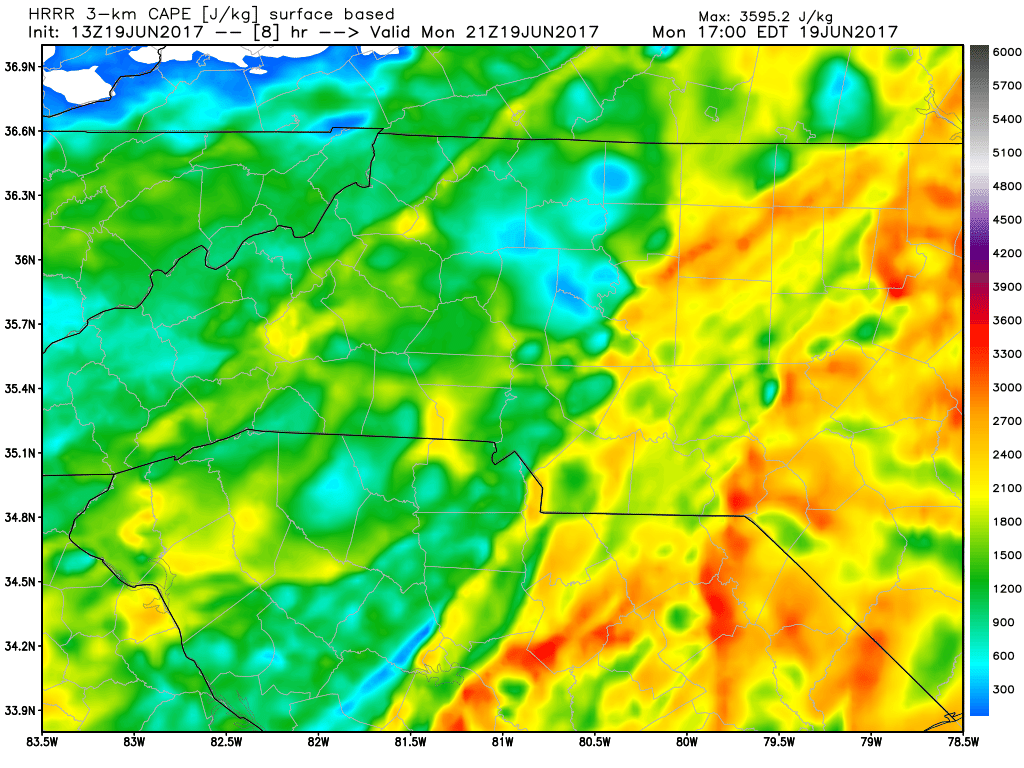
CAPE Levels will be escalated as these storms start to push through the county. This will be the ingredient that will help these storms continue to be strong to severe. I will continue to monitor these levels as we move thorough the day and into the afternoon and evening hours.

Accumulation of around 1 half an inch to an inch is possible by the time we reach midnight tonight. I will of course keep an eye on things and provide updates right here and on social media throughout the day and into the evening. As always thank you for following Rowan County Weather!
Please let our local sponsors know that you appreciate their support of our blog. Take a moment to visit their website linked at the top of this post.
Share this:

Announcements & Events
Check back often for important announcements and events that I'll be involved in!