
Thunderstorms possible later this afternoon
It has been a few days since we have had any rain. Conditions are favorable for that streak to end today. Models are indication rain moving through the county in two waves today. the first wave looks to arrive around 5-6pm tonight. Wave two looks to move in around 11-midnight. The Storm Predictions Center has the entire state under a general thunderstorm risk for the day.

I am not expecting anything severe from these storms based on current model data.
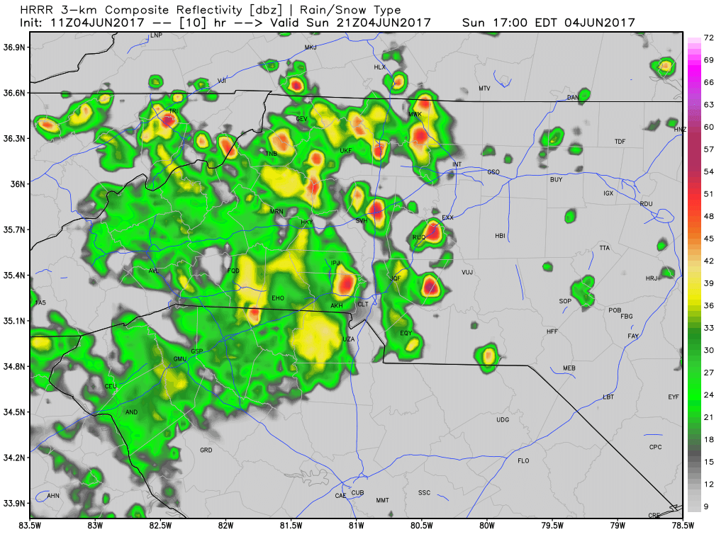
Storms should begin to move into the county between the 5 & 6pm hours this afternoon and evening. They could start out scattered at first before becoming more widespread. The biggest threat from these storms would be heavy downpours with possible localized flooding.

CAPE levels are a little elevated but not enough to give me any great concern. There are just not enough of the other ingredients needed to get storms really firing for severe weather based on model data at this point.
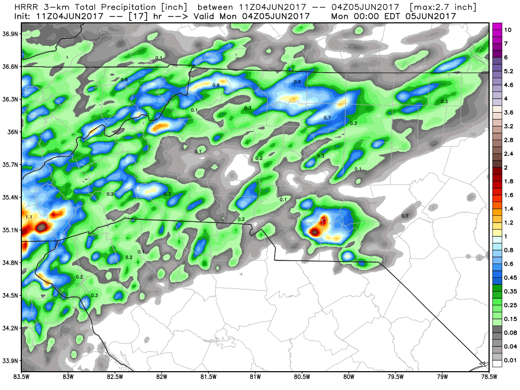
Not looking for much in the way of accumulation before midnight. Maybe a quarter to a half of an inch in some areas. Most of the activity looks light with a few embedded downpours mixed in at times. I will of course monitor the models and radar all day and keep you updated as storms begin to approach the county and move through. As always thank you for following Rowan County Weather!