
The NHC says an above normal Hurricane season is possible this year
Forecasters at NOAA’s Climate Prediction Center say the Atlantic could see another above-normal hurricane season this year.
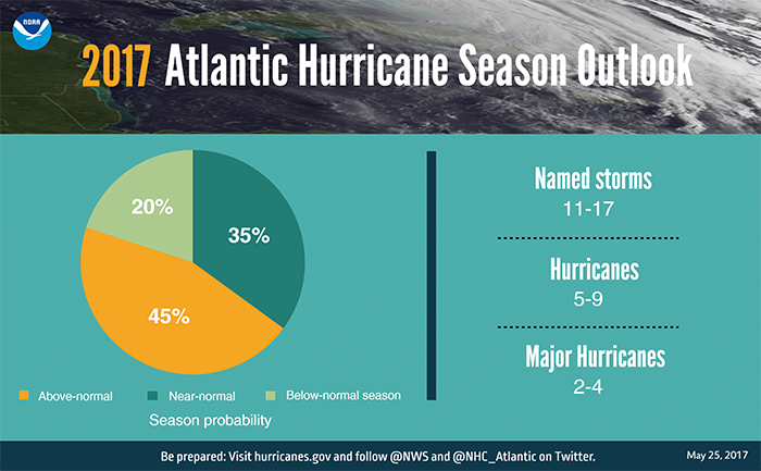
For the upcoming Atlantic hurricane season, which runs from June 1 through November 30, forecasters predict a 45 percent chance of an above-normal season, a 35 percent chance of a near-normal season, and only a 20 percent chance of a below-normal season.
Forecasters predict a 70 percent likelihood of 11 to 17 named storms (winds of 39 mph or higher), of which 5 to 9 could become hurricanes (winds of 74 mph or higher), including 2 to 4 major hurricanes (Category 3, 4 or 5; winds of 111 mph or higher). An average season produces 12 named storms of which six become hurricanes, including three major hurricanes.
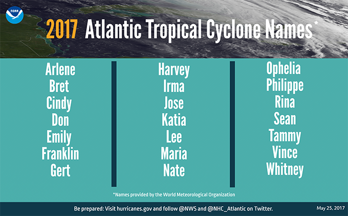
These numbers include Tropical Storm Arlene, a rare pre-season storm that formed over the eastern Atlantic in April.
The outlook is based on the expectation of a weak or non-existent El Nino
Strong El Ninos and wind shear typically suppress development of Atlantic hurricanes, so the prediction for weak conditions points to more hurricane activity this year. Also, warmer sea surface temperatures tend to fuel hurricanes as they move across the ocean. However, the climate models are showing considerable uncertainty, which is reflected in the comparable probabilities for an above-normal and near-normal season.
NOAA brings exciting new observing, modeling, forecasting and communications tools to the table this year to improve hurricane warning capabilities and aid public readiness:
Even before its final positioning, the sophisticated camera on NOAA’s new GOES-16 satellite will give our hurricane forecasters a sneak peek at its greater image resolution, sharp detail and rapid-refresh rate. One of the powerful instruments aboard GOES-16, the lightning mapper, will allow forecasters to see lightning strikes that build within tropical cyclones – a possible signal of strengthening.
The combination of two high-resolution hurricane models will improve forecast guidance for the National Hurricane Center this season. The upgraded Hurricane Weather Research Forecast model adds better representation of storms at higher vertical resolution, and has advanced data assimilation and improved physics. With these upgrades, the model can improve intensity forecasts by as much as 10 percent and track forecasts by as much as seven percent. NOAA’s Environmental Modeling Center also is replacing the Geophysical Fluid Dynamics Laboratory Hurricane Model with a new hurricane model called HMON, for Hurricanes in a Multi-Scale Ocean-Coupled Non-Hydrostatic, which has superior track and intensity forecast skill.
NOAA’s National Hurricane Center is providing a suite of new forecast and communication tools this season. Forecasters there will issue Storm Surge Watches and Warnings operationally this year, in addition to issuing advisories, watches and warnings for disturbances that aren’t yet a tropical cyclone but still threaten land with tropical storm or hurricane conditions within 48 hours. The center added a new experimental visualization tool so the public can easily see when damaging winds are forecast to reach their community. Also, beginning this year, the public will be able to click on the hurricane track cone graphic and see how far outside of the cone hurricane and tropical-storm-force winds extend, which can be hundreds of miles.
NOAA will update this outlook in early August, just prior to the peak of the season. Of course I will also be right here and on social media providing updates throughout the Hurricane Season. As always thank you for following Rowan County Weather!