
Severe Weather threat is possible tonight.
As we kickoff the long Memorial Day Weekend we have a threat for severe weather in the county. There are a few concerns I have with storms that move through the area and the county tonight so lets outline them here for you to prepare.

The Storms prediction Center has our entire area under a slight risk for severe weather. If there are conditions that cause a shift to the east today we could see us placed in the enhanced risk. I feel that will depend on how long we have the full sunshine we are enjoying outside right now. That is making the atmosphere unstable the longer it hangs around with us.

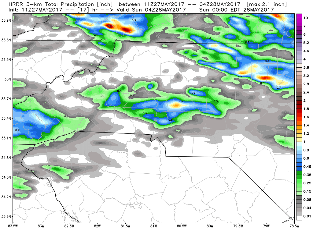
My current concerns deal with a cell the models are indicating that could pass through the county late this evening between 6 & 7pm. This cell looks to bring with it some heavy rainfall, hail and damaging winds based on some of the data coming back with it. The ground is already saturated around us so strong gusty winds will bring down trees and power lines if they occur.
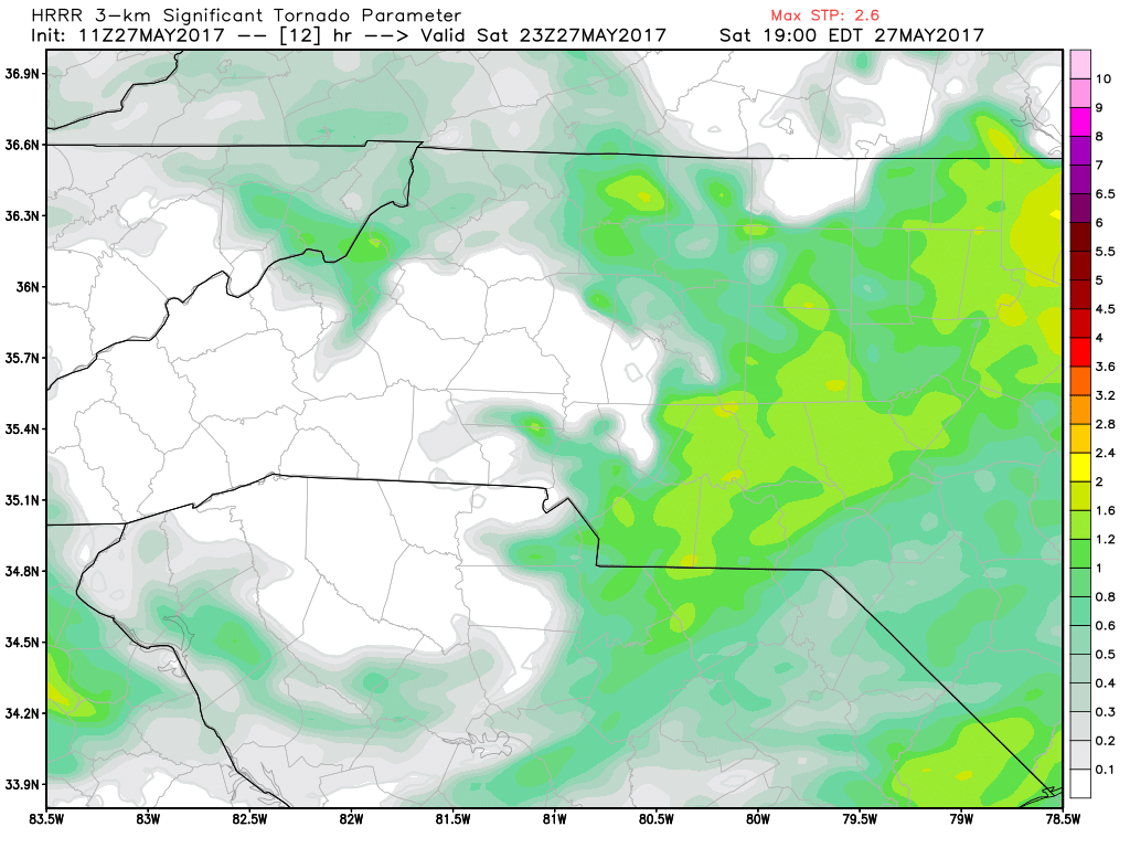
There is an elevated risk for a Tornado to occur but I feel that threat is to our east and southeast. Our biggest threat from this will be damaging winds either from a Microburst or strong straight line winds.
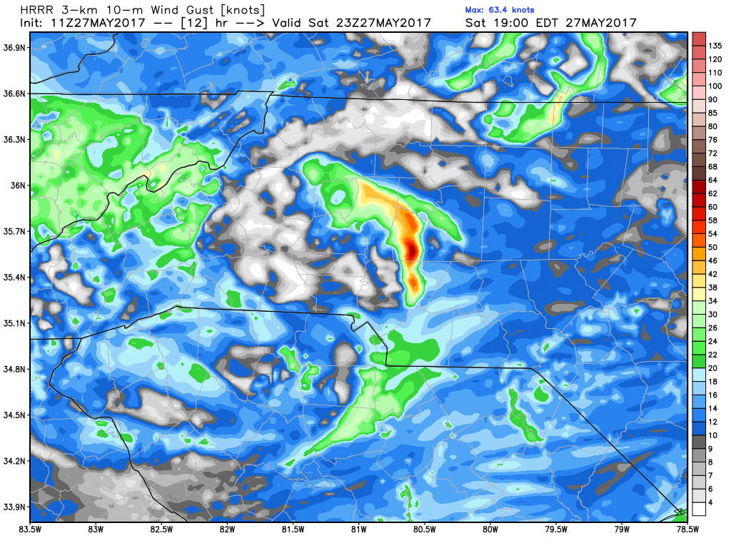
We could see wind gust in excess of 70 miles per hour in the county later today if these storms do materialize. That will of course increase the threat for downed trees and power lines.
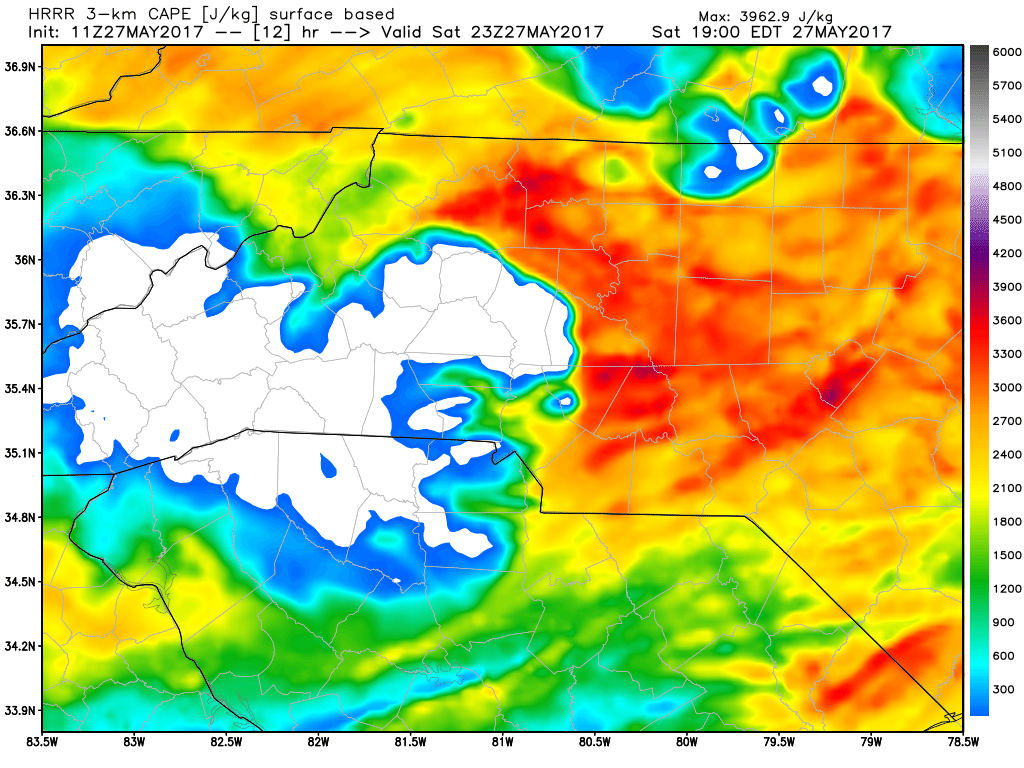
The CAPE levels look to be extremely elevated by the time these storms move in later this evening. If so that will definitely increase the threat for a strong and damaging wind event around the county. Again the key will be how long the sunshine stays with us.
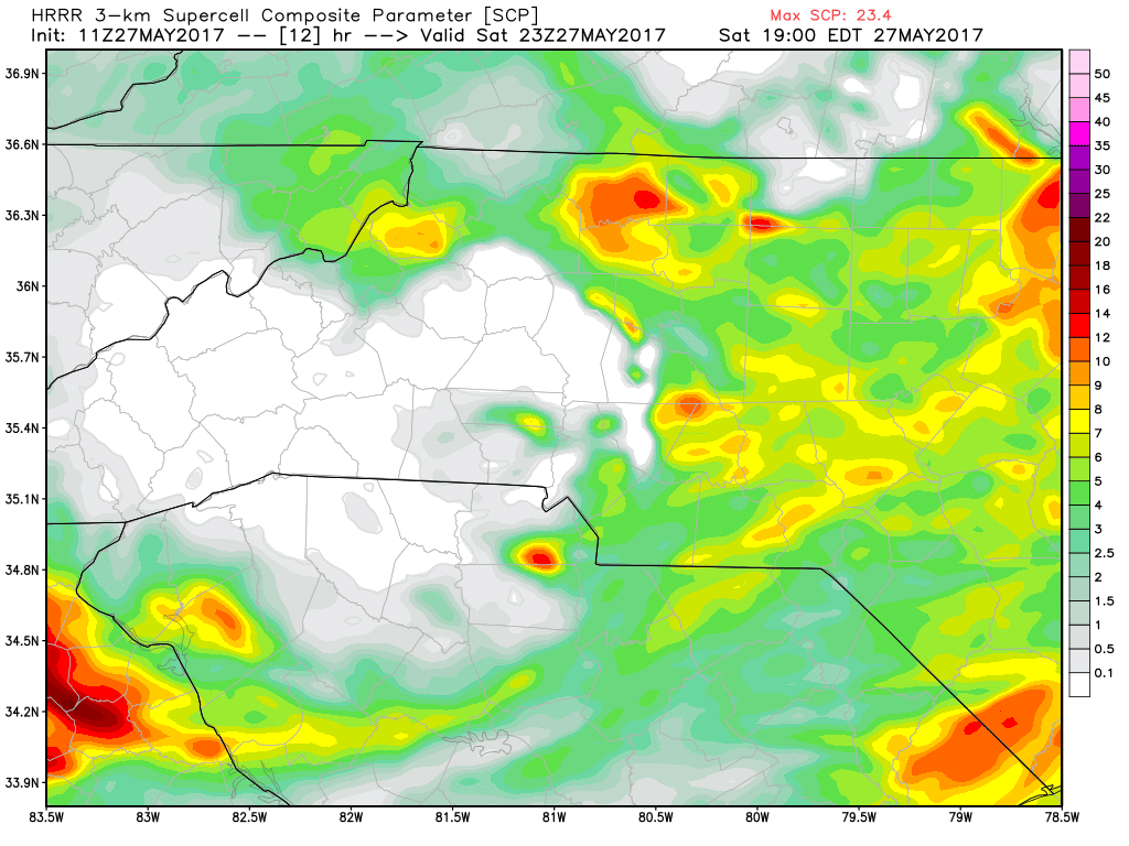
Super cell chances are a little elevated for the timing of the arrival of the storms. I think based at this point we are likely to see a severe thunderstorm watch and possibly a warning later this evening. The National Weather Service will do their part in issuing those if necessary. I will do my part for all of you and keep an eye on the model data throughout the day.
These storms will be moving fast based on the data so rainfall will be an issue for localized flooding but the real bite form these storms will be the wind. So please prepare your outdoor items by tying down any loose items for this evening.
I will continue to monitor the model data throughout the day and keep you posted right here and on social media. As always thank you for following Rowan County Weather!