
A wet pattern is starting
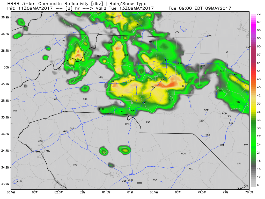
Rain moves back into the county today and this will be the beginning of a wet remainder of the week. There is a chance we could see some strong thunderstorms this afternoon. I explain more below. Rain will move through the county off and on throughout the day with some strong storms possible later this afternoon and evening.
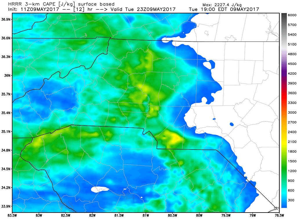
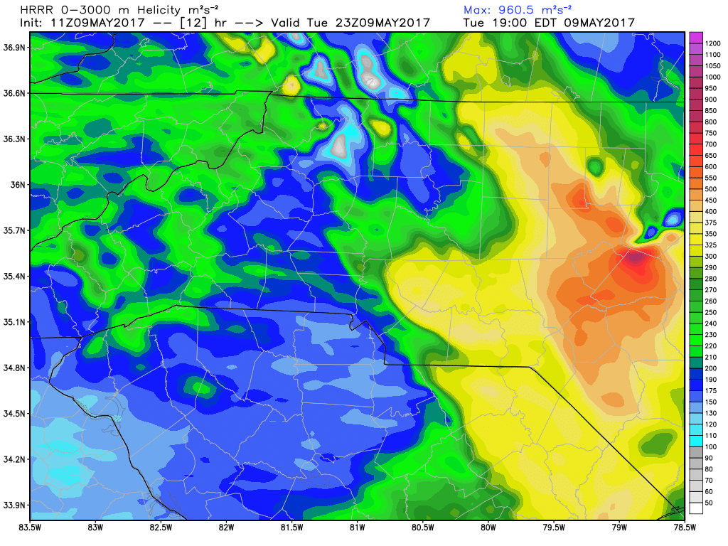
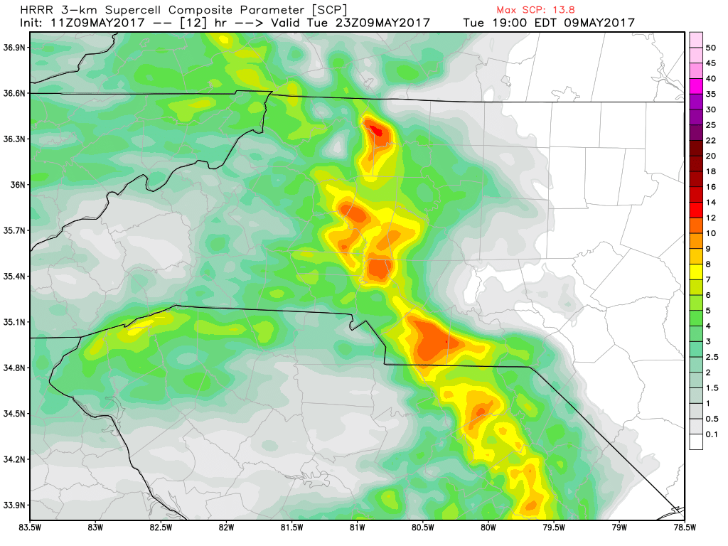
As we continue through the day CAPE Levels, Helicity Levels and Super cell possibilities start to increase. (See the model data below)
My biggest concern with these storms today will be the chance for strong winds. Otherwise threats seem to be low. We could see some accumulation from this showers and storms today total out at around a quarter to a half of an inch depending on if you get under a heavy downpour during the remainder of the day and this evening.

I will monitor the models and keep you updated on what we can expect throughout the day right here and on my social media outlets. As always thank you for following Rowan County Weather!