
Severe storms possible this evening.
Off and running for another work week and storms may play a part in the evening commute. The system that has been wreaking havoc on the Midwest areas and the panhandle section of the country will make its way through our area tonight. I am not expecting to see the kind of damage that Texas, Mississippi and places in Alabama have received. However, I do feel you need to keep your guard up.
As you can see from the title picture for this article above. The county is under a slight risk of severe weather today while an enhanced risk is in place just to our north. If we see things start to shift south today then Rowan County could easily be placed in the enhanced risk area.

Based on current model data I am expecting the strongest part of these storms to be moving through the county right around the evening commute. So right in the 4 - 6 pm timeframe. Now don't get stuck on just this timeframe as the possibility of showers and storms moving through the county exist all day long. I will of course keep you updated as things begin to occur.
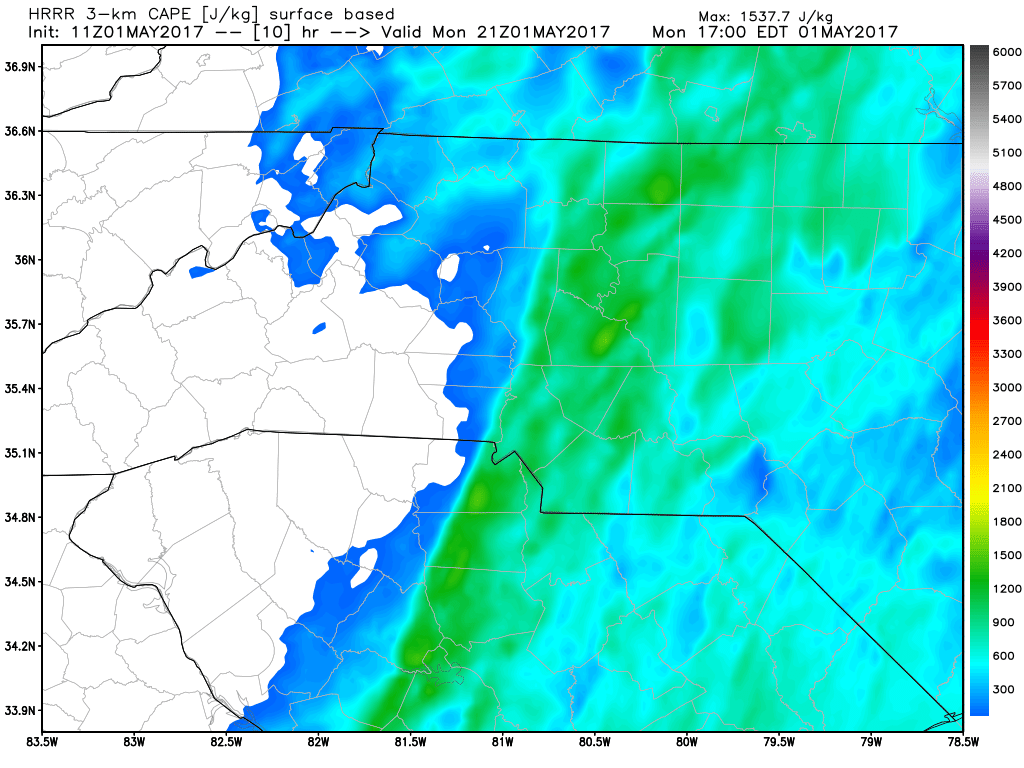
The CAPE levels for this afternoon and evening look to be a bit elevated. That will certainly help in storms that develop strengthen and we will have to watch for any chance of a quick little spin up in the area and county.
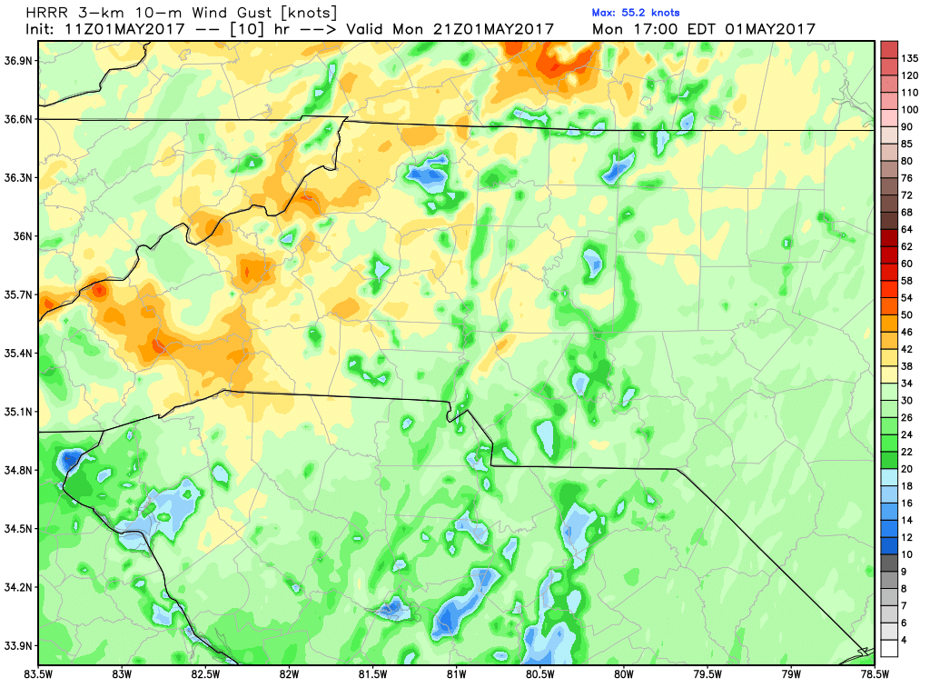
We could see some strong winds this afternoon and evening with gust of around 40 miles per hour which are certainly strong enough to do some damage to trees and buildings around the county. So please take the time right now to go get anything out of your yard that is a concern for being blown away.
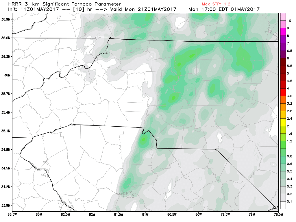
Significant Tornado Parameters are slightly elevated. Again just enough that we will have to monitor closely for any quick spin ups that could occur around the county and in the area. Just be ready to act on your emergency plan if you need it.
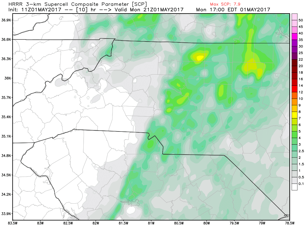
The chances for super cells to develop over the county later this afternoon and evening are also a bit elevated. based on all of the data above my biggest concern for the county right now is localized flooding, strong winds that could do damage. and a chance for a brief tornado to touch down. I will certainly monitor the data and radar throughout the day and keep you updated right here and on social media. Please stay weather aware today and as always. Thank you for following Rowan County Weather!