
Things are starting to look up for us.
Wednesday, April 5, 2017 - 8:28pm
So some changes are occurring with the models. We are not totally out of the woods yet but I am seeing some improvements.
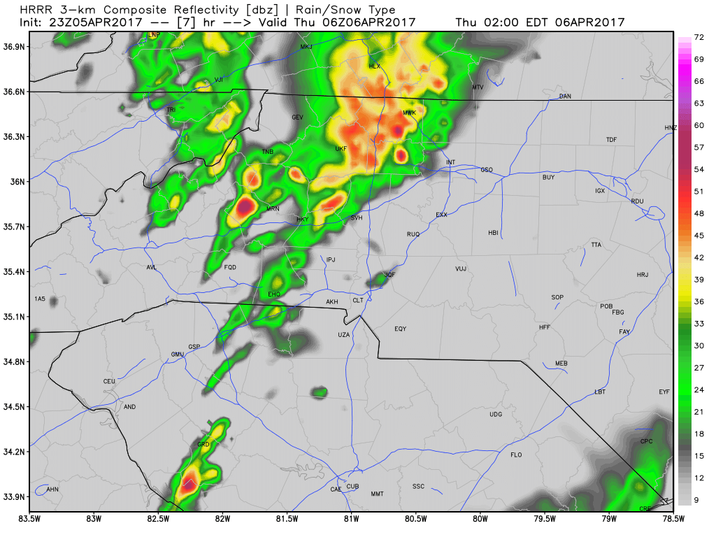
The models are showing a line of storms approaching around 2am.
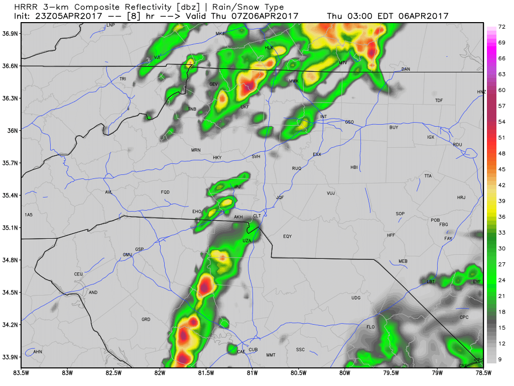
Then they seem to split and fall apart. The 3am run shows things clear over the county.
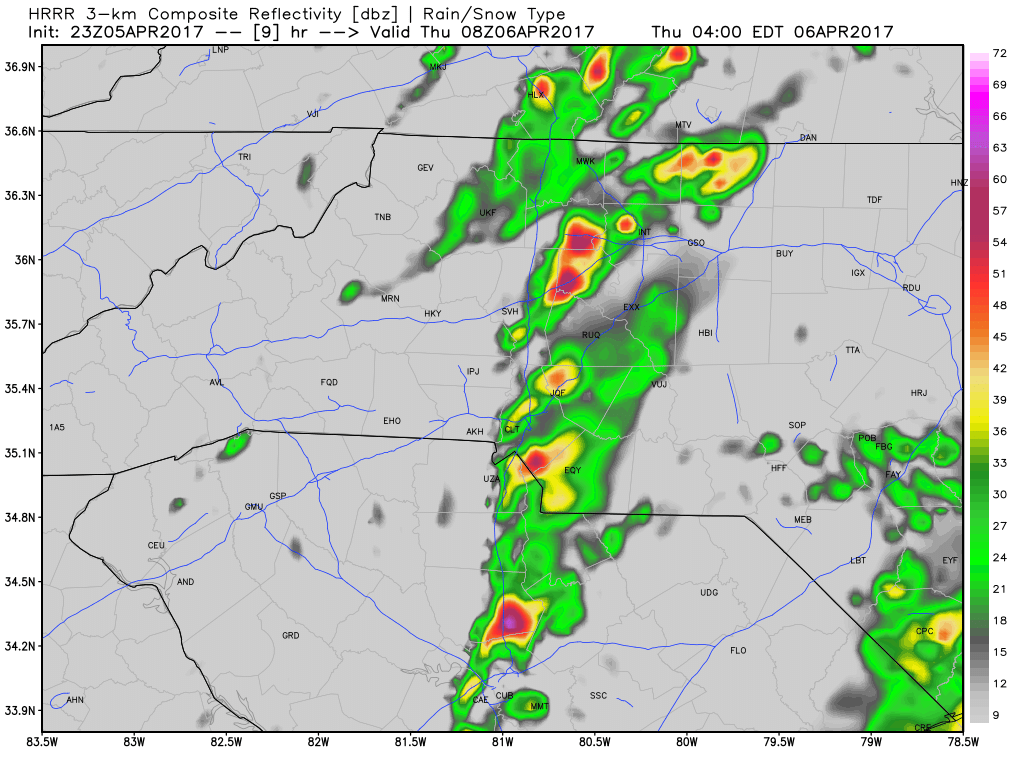
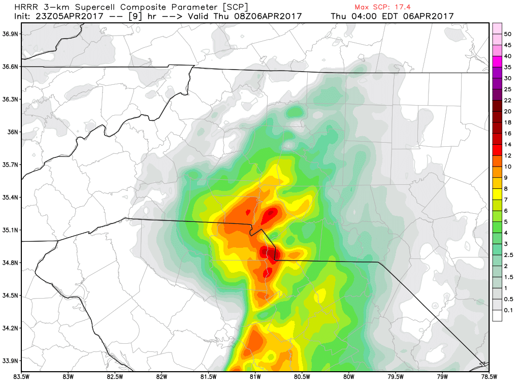
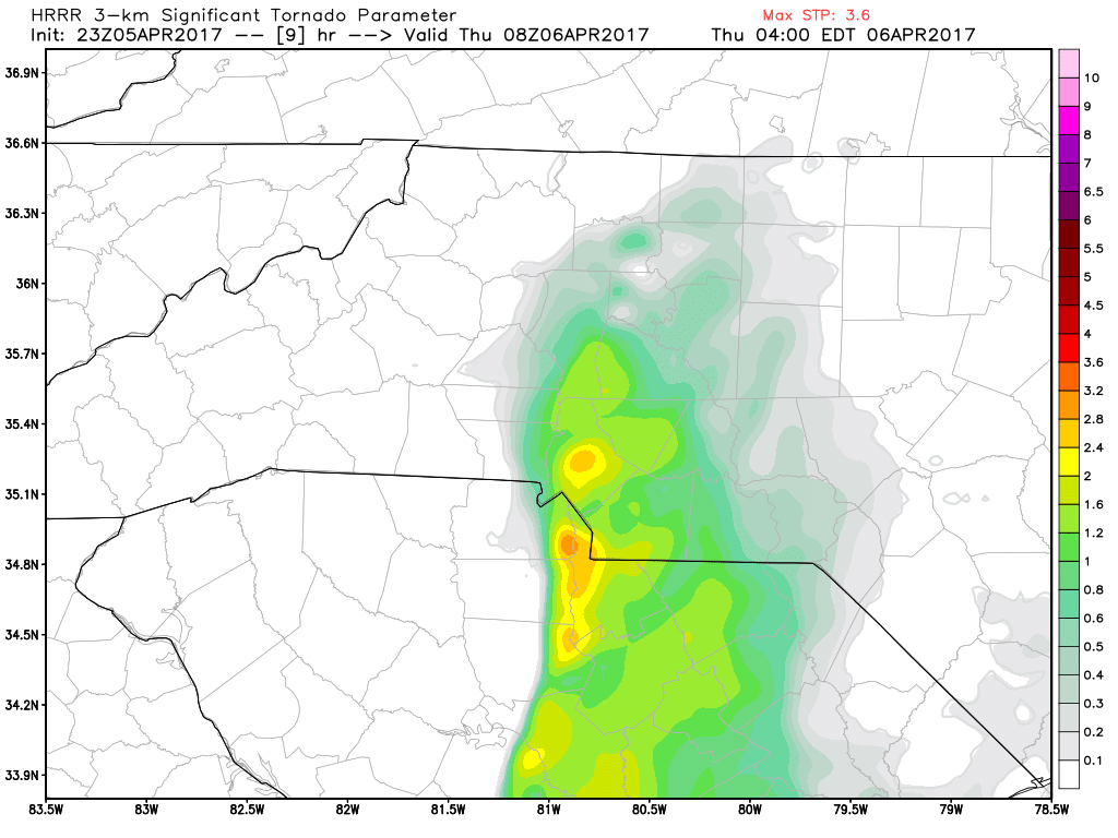
However, the 4am shows what appears to be an outflow boundary that fires up a chance for one last hurrah of severe weather.
It does bear watching as the super cell values for that time are a little elevated and the significant tornado parameter is a little elevated.
I will continue to keep you updated.