

Severe Weather Likely Wednesday Night Into Thursday Morning
After yesterday's storms we now have to gear up and prepare for another bout of severe weather tomorrow. The big difference in these storms are they will arrive at night and the most severe sections of the storm will come through during the overnight and early morning hours on Thursday.Here are my thoughts on timing so far and what we can expect.

Rain will start to move into the county just after lunchtime on Wednesday and will be just that to begin with nothing but rain. However, as we head through the afternoon and evening things will take a turn toward severe weather with the most severe of the storms likely arriving after midnight Thursday morning.
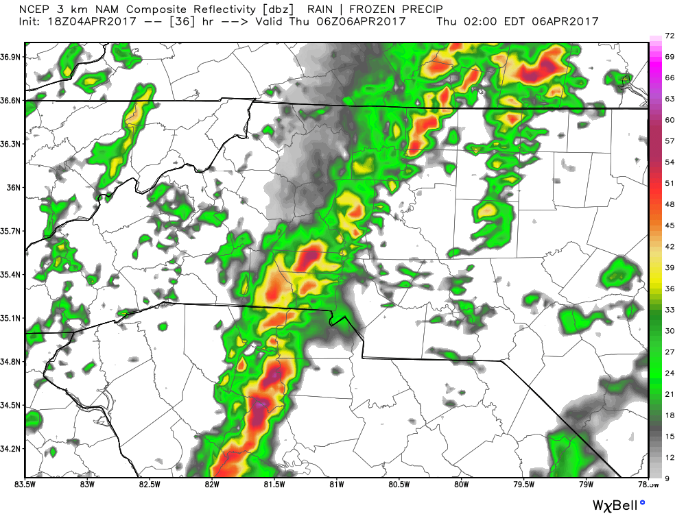
I am expecting a squall line o develop and move through the county just after 1am Thursday morning and this could bring some very strong winds and concerns for a chance of an isolated tornado near the county. Hail is likely with this squall line and localized flooding is possible as well.
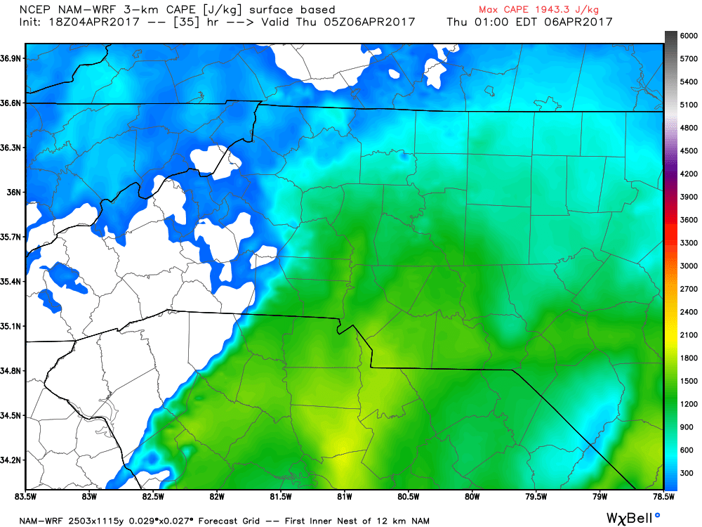
CAPE levels on Thursday morning when the squall line appears to develop and move through the area look to be very high. Unlike yesterdays storms we certainly have a much better chance for some strong to severe storms moving through the county.
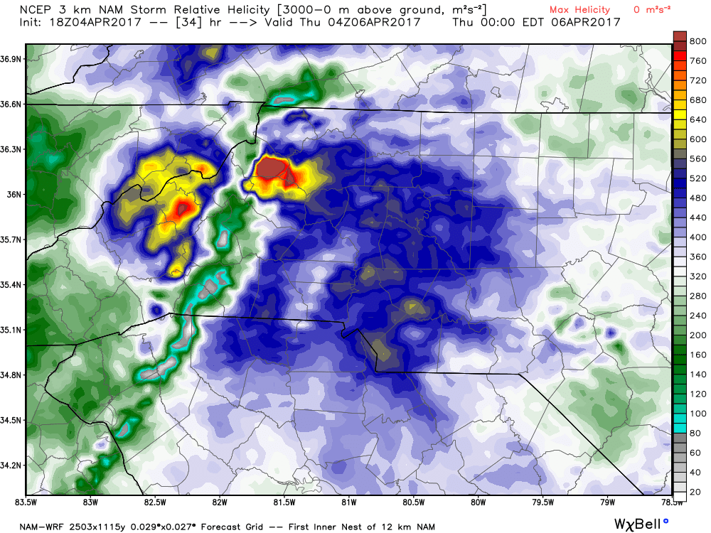
Helicity values will be pretty high during the overnight hours just after midnight. This shows a potential for some pretty strong shear in the atmosphere and will certainly bring with it some strong winds and the concern for an isolated tornado.
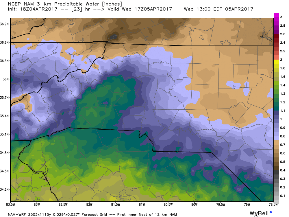
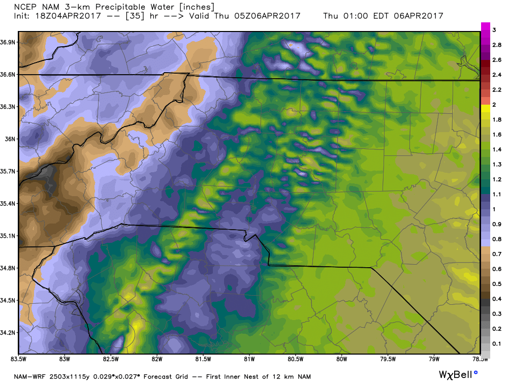
Precipitable Water levels in the atmosphere go form around 1 inch at the start of these event to around 2 inches by the time the strongest storms move through. That's where the concern for some localized flooding comes into play as there could be an area that takes a pretty heavy downpour in a short period of time during these storms.
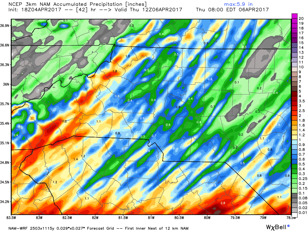
Accumulations of around an inch are possible once all is said and done. However, we can't rule out the possibility of an area somewhere in the county getting more than that. It is possible we could see an area of the county get closer to an inch and a half to two inches of rainfall during these storms.
I will continue to monitor the models and provide you with updates right here and on social media throughout the day tomorrow. As always thank you for following Rowan County Weather!