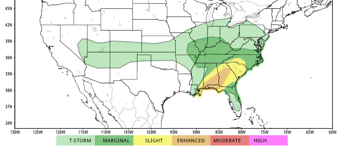
Severe Weather Moving into the county later
I gave you an update late last night about the chance for severe weather in the county today. The models continue to trend that direction. The timing for these storms to arrive is around 2 - 3pm this afternoon. These storms bring with them the chance for gusty winds of 40 miles per hour or more. Hail up to one inch in diameter. Localized Flooding and the chance for tornadoes to our south and west.

I am expecting the storms to arrive around 2-3pm today and there will be a chance for the development of super cells with this storms. Those will be the storms that could bring the biggest threats for us today.

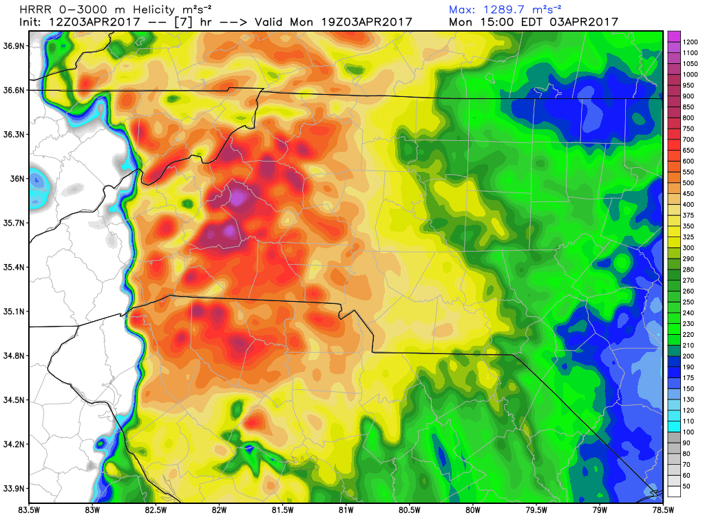
The Helicity levels I am seeing in the models are a bit concerning considering the amount of shear and rotation they are suggesting in the upper levels of the atmosphere. I think if you are traveling today and you are down along the NC/SC state line in western NC you could see a few tornadoes spin up. Here in the county that threat seems to be low but certainly bears watching.
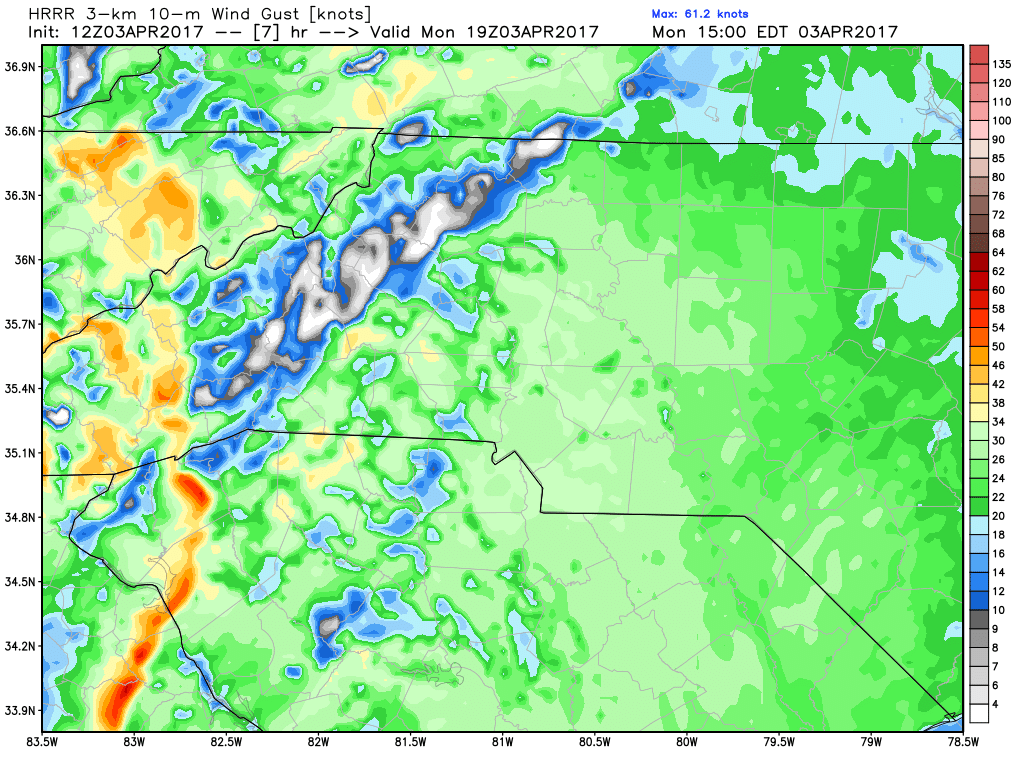
The winds will be strong with this system and we could easily see gust of 40 miles per hour or more. Power outages will be a concern.
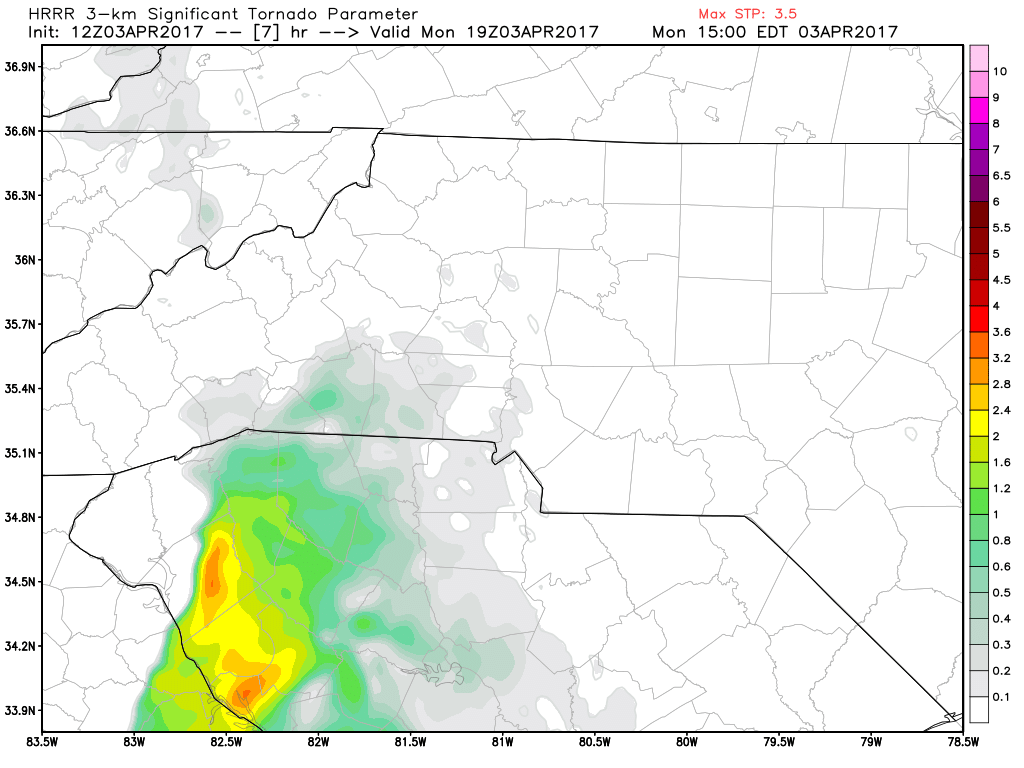
For the late afternoon hours the significant tornado parameters are elevated to our southwest. i will continue to monitor the models for changes throughout the day.
Please stay weather aware today and I will provide updates right here and on social media throughout the day concerning this severe weather threat. As always thank you for following Rowan County Weather!
Please let our local sponsors know that you appreciate their support of our blog. Take a moment to visit their website linked at the top of this post.
Share this:

Announcements & Events
Check back often for important announcements and events that I'll be involved in!