
Next Round of Thunderstorms to come Sunday
We certainly had some interesting weather around the county last night with quite a bit of hail, lightning and gusty winds. We face our next round of Thunderstorms this coming Sunday. There are still a few questions to be answered by the models but enough evidence for us to know rain and some thunderstorms are coming. Let's take a look at what the two main models have to offer and then we will look at the ensemble models to see how they see things shaking down.
THE GFS
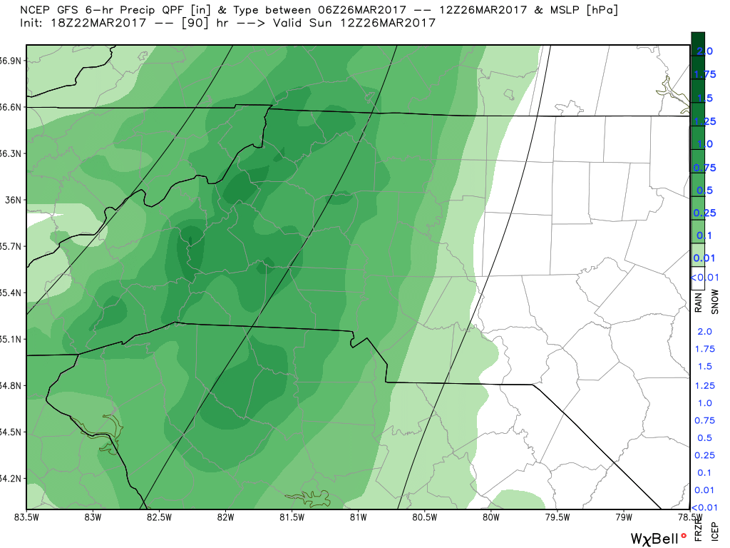
The main factor that is still up in the air is the timing on when showers and storms will move into the county. This is where all of the models show a variation and do not agree. The GFS Model image above has the rain moving into the county by around 7am Sunday Morning.
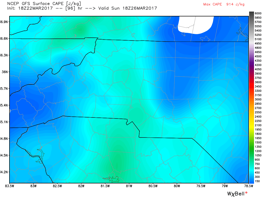
The one thing we will have to monitor with the storms this Sunday are the CAPE Values both models from the image above and the cover photo for this article show some elevated CAPE Levels. CAPE stands for Convective Available Potential Energy. Or Thunderstorm Fuel if you want to make it something easy to remember. These levels are close enough to keep an eye out for the possibility of severe storms in the county this Sunday.
The GFS always inflates the total accumulation numbers and based on the model above we could see a half to three quarters of an inch of rain on Sunday. I think this is a bit elevated.
The European
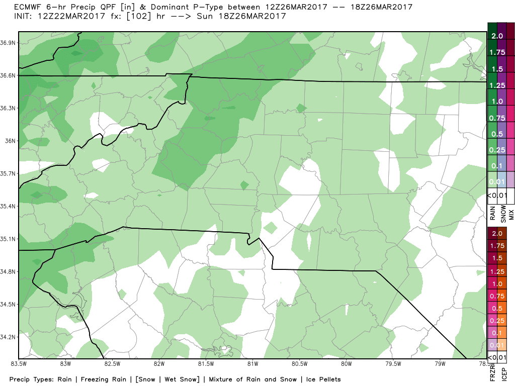
The European Model has the rain arriving a bit later in the day on Sunday with an arrival of right around 1pm. This is the big thing the models are having trouble agreeing on. The timing and how much accumulation we could get.
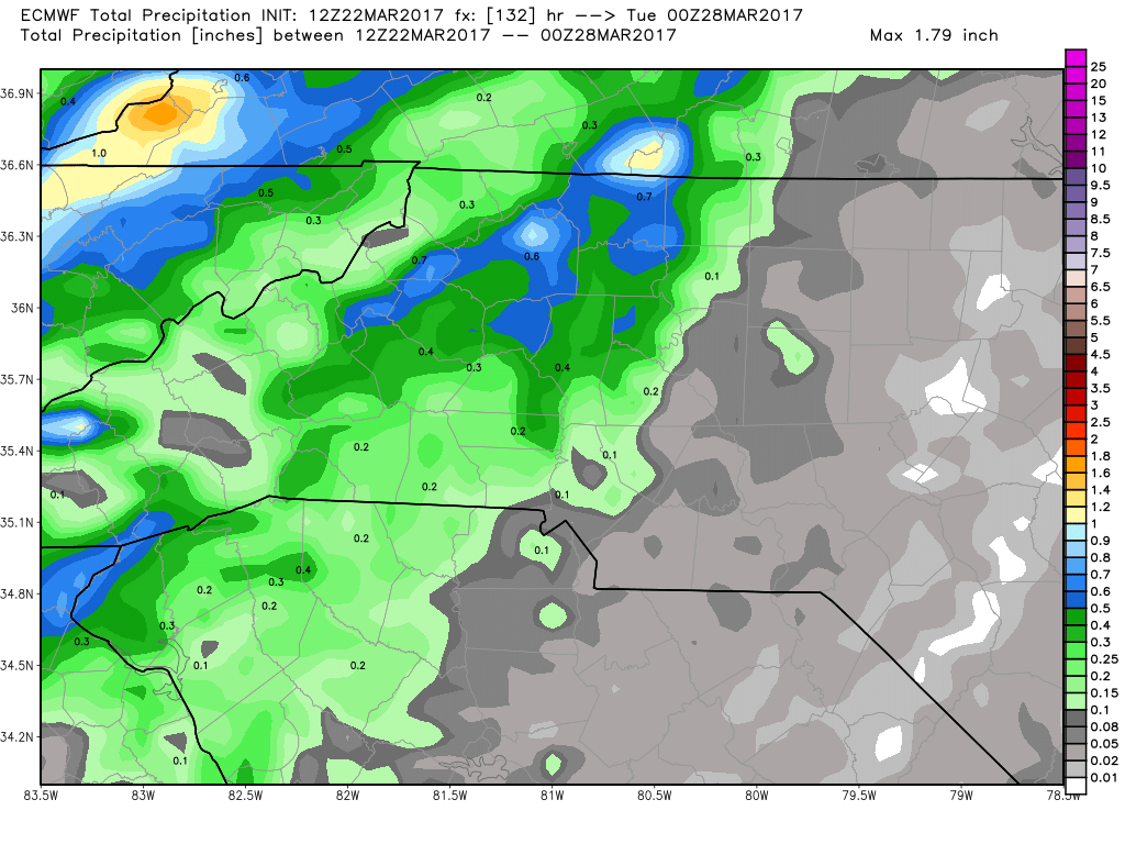
The European Models is only thinking we will see around a quarter of an inch of rain in the area on Sunday.
The Ensemble Models
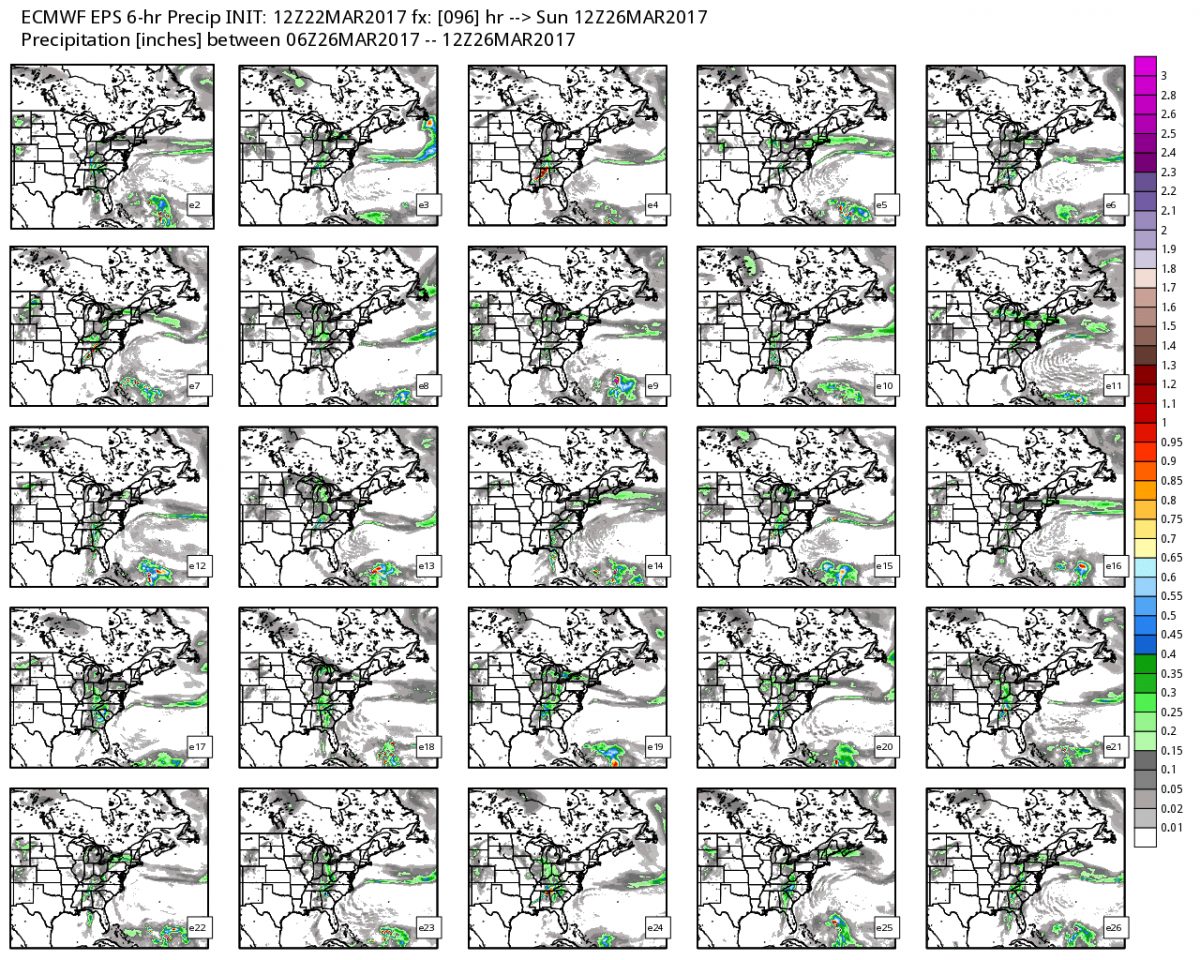
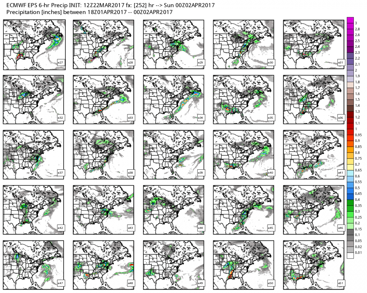
As you can see form the 53 members of the Ensemble Models above there is a lot of inconsistency on timing and when the showers and storms will arrive into the county. Combine this along with the inconsistences on how much precipitation we could get are some answers we will still be looking for form the models over the next 36 - 48 hours. I will continue to keep an eye on the information as it comes in and I will provide updates right here and on social media.
Thank you as always for following Rowan County Weather!