
Chance for Thunderstorms Tuesday Night
As we begin to look ahead to our next round of rain that will move through the area. The models are indicating we could see some thunderstorm activity with them as well. I am not looking for anything severe from these storms at this point but I do want you to be aware of them so you can plan accordingly for any outdoor activities you may have. The timeframe I am looking at is between 7pm Tuesday evening and 1am Wednesday morning. I have two models I am looking at as well as a blend of all of the models to see what we can expect.
Lets start with the GFS Model. As I have stated before this is a good model to get an idea of what kind of precipitation we may see. The issue with this model is it always tends to overstate the total amounts.
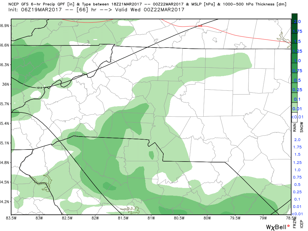
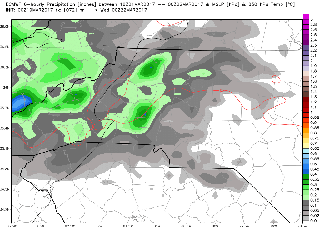
The above image is from 7pm Tuesday night and the model is indicating we will see some precipitation moving into the area from our west.
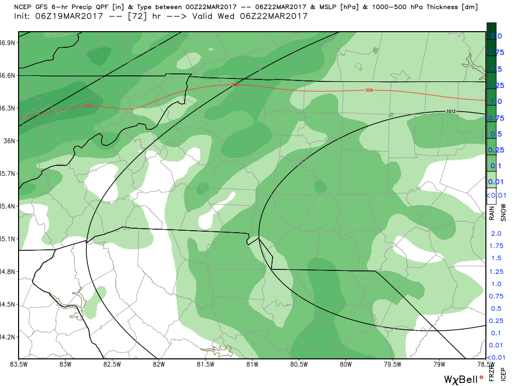
The image above is for 1am Wednesday morning and as you can see the model is indicating some heavier precipitation moving through the county. Now if we look at other ingredients to determine if we may see thunderstorms during this event I will check the CAPE (Convective Available Potential Energy) levels to see how high they may be forecasted for that specific timeframe.
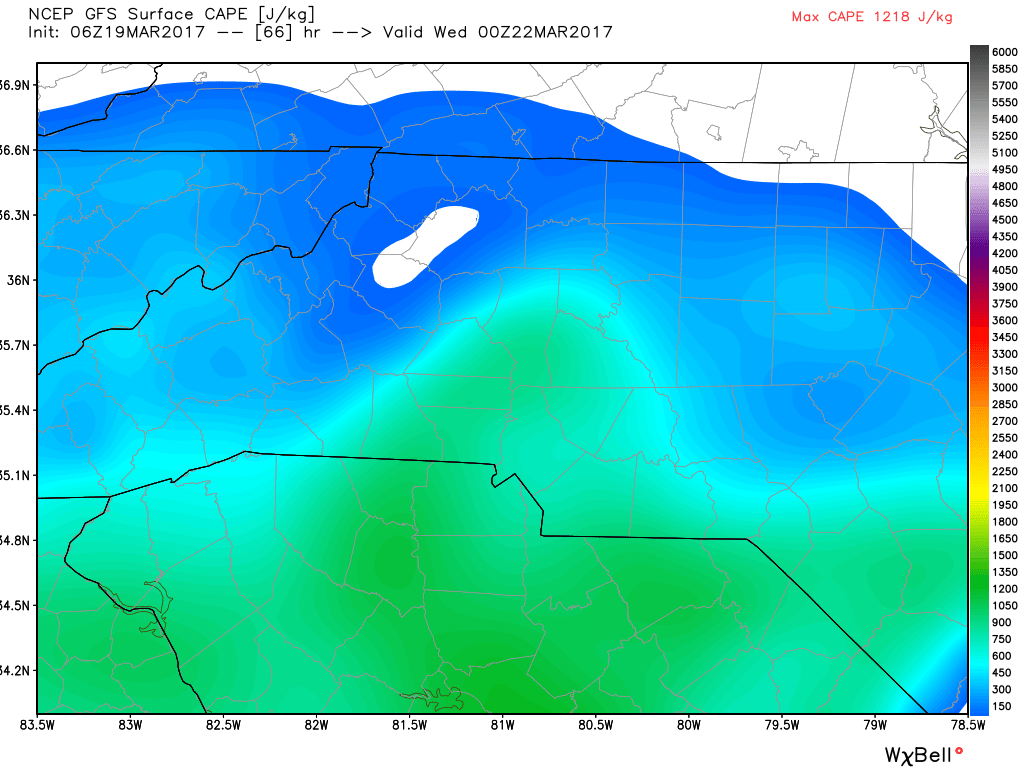
The levels look a little elevated in terms of what is currently being predicted by the models for 7pm Tuesday evening. I am not to concerned with those levels at this point and as we continue to look through the model data I will explain why.
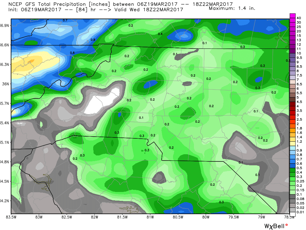
The GFS Model is looking at a possibility of around a quarter of an inch of rainfall by the time these showers and storms pass through the area.
Now lets take a look at what the European Model is thinking about the potential for thunderstorms Tuesday evening.
The above image is form 7pm Tuesday evening. As you can see the GFS and the Euro are pretty close in what both models are expecting for precipitation in the area on Tuesday evening. Now as we bounce ahead to 1pm Wednesday morning with this model.
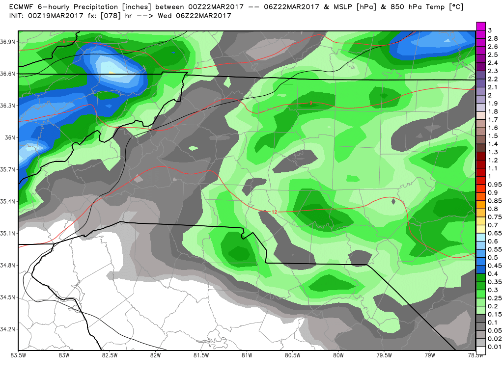
We see an almost exact image with what the GFS is predicting for that 1am timeframe Wednesday morning as well. As far as accumulation total from the European Model go.
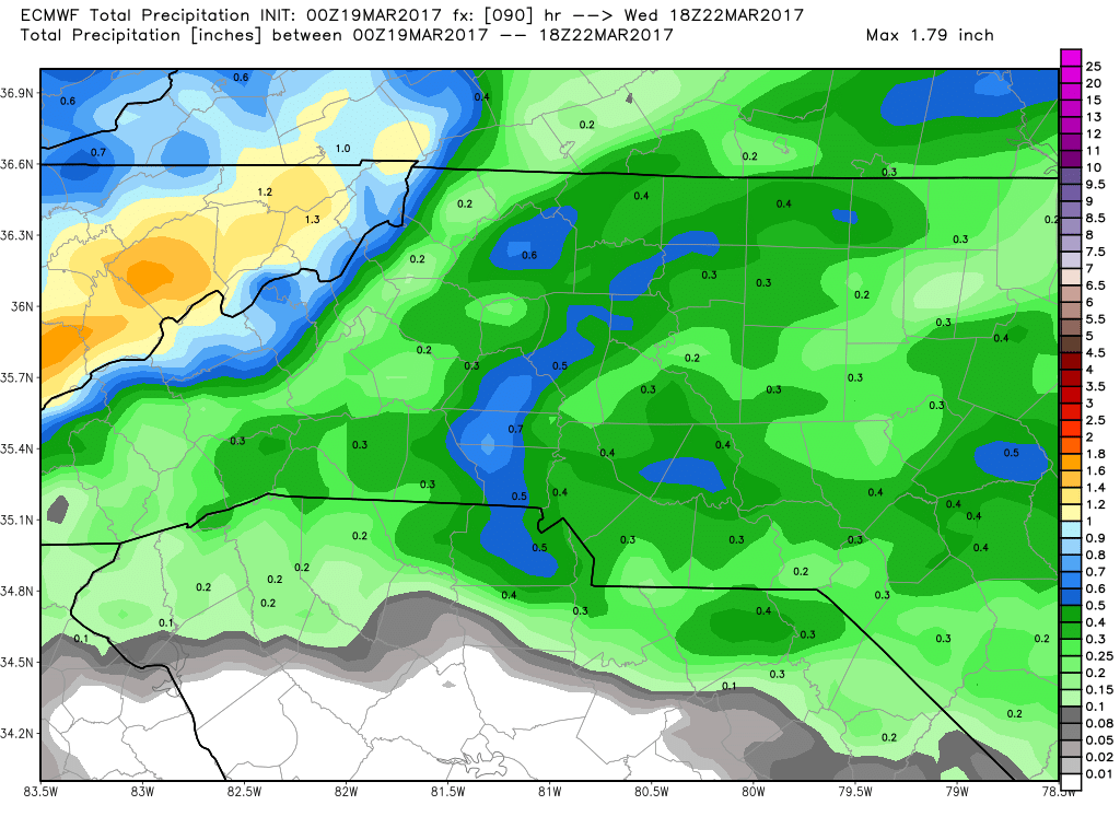
We are looking at the possibility of around three tenths of an inch of rainfall by the time the system moves out during the overnight hours on Wednesday morning.

Winds do not look to bad at this point for that same timeframe with gust of around 22 miles per hour as a possibility around the county.
One last thing I like to look at is a blend of all 53 members that have model information. This is one reason why I am not expecting any severe weather at this point.
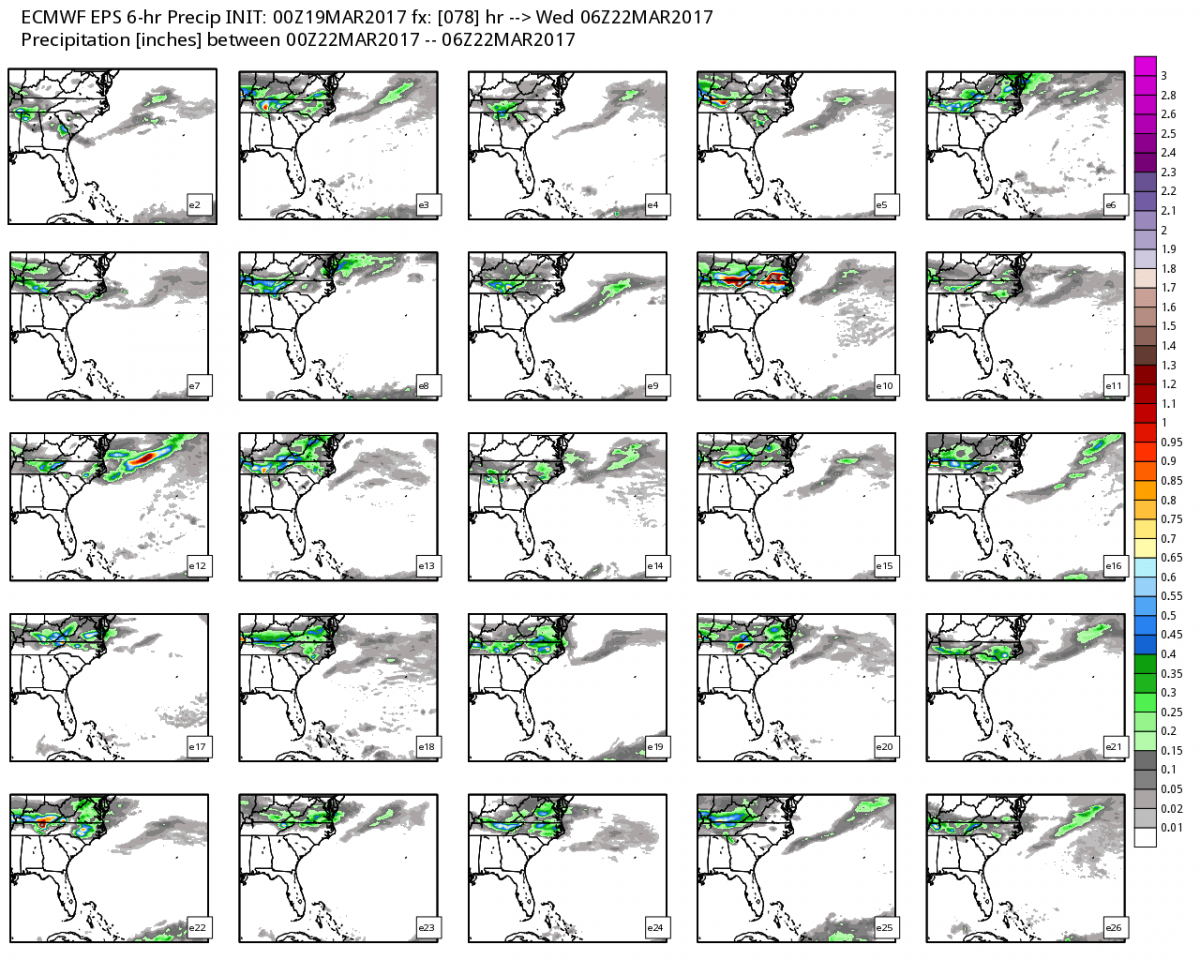
The image above is a blend of all 53 members of the available models that are out there. Out of all of these images I only see one member that shows the chance for severe weather around 1am Wednesday morning and would say based on that information the odds are in our favor to avoid any thing more than the average run of the mill thunderstorm in the area with some lightning and thunder but that's about it.
As for now heres what I am forecasting.
- Showers and storms could move into the area and the county by around 7pm Tuesday evening.
- These showers and storms will continue into the overnight hour of Wednesday morning.
- The possibility is there that we could see a strong thunderstorm late Tuesday and early Wednesday however I am not expecting anything severe at this point.
- Accumulations of around a quarter to a half of an inch are possible.
I will continue to keep an eye on the models over the next few days and provide you with updates The updates will be posted right here on the website as well as on my social media outlets.
Enjoy your Sunday everyone! As always thank you for following Rowan County Weather!