
Update on Winter Weather Chance for Sunday
There been a lot of chatter going around on social media about the chance for a winter storm this weekend in the area. I have provided some updates as this forecast started to break on how I feel we are more likely to see a cold rain. Most of the model data all week has continued to point me in the direction of could rain over the county. There are a lot of red flags in the model data that make me feel like we are not going to have enough cold air a loft to get a decent snowfall. Take into account the soil temperatures currently around the county. Even if we got a decent amount of snowfall during the overnight hours Saturday into Sunday most of the snow would evaporate or melt on contact. Sounding data continues to point to warm air aloft as well. Let's take a look at the latest model data.
The GFS
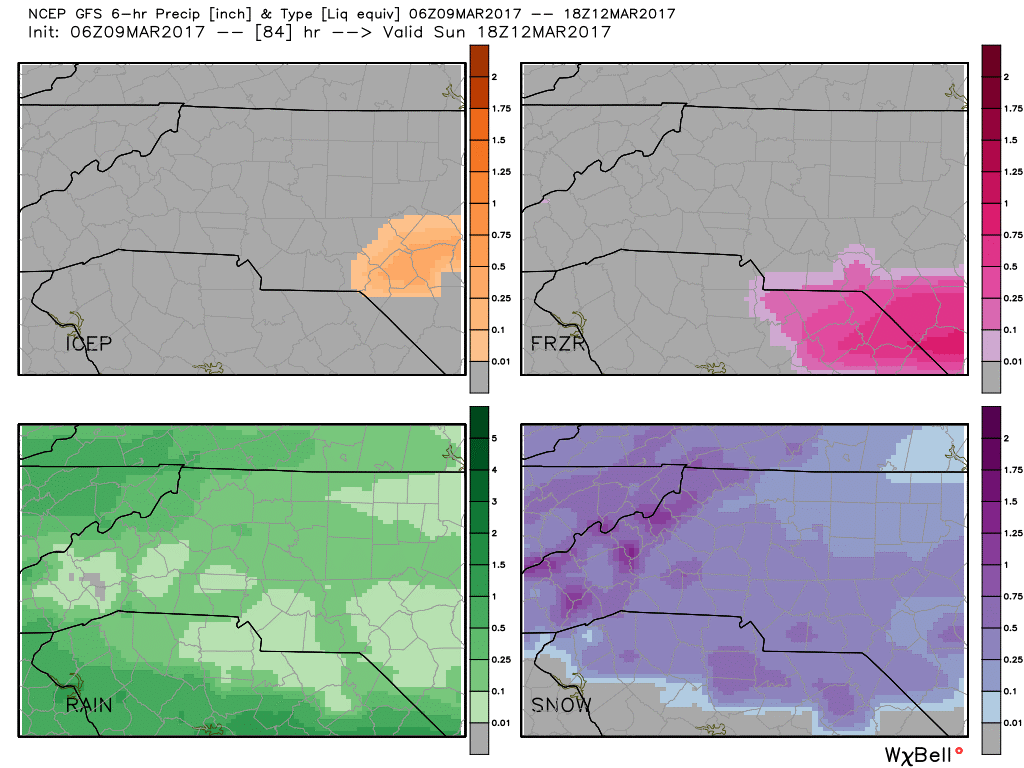
The model data from the GFS above indicates that our best chances for precipitation during the overnight hours Saturday into Sunday are for a mix of snow and rain. I believe we will see some snow mixing in at times but just such a tight gradient of warm air and cold air that the ingredients are not there screaming snow to me on this one. The low that is bringing the moisture is going to be to our south. The high that is bringing the cold air will be well to our north. The best chance of seeing any snowfall out of this is going to be for residents living north of Interstate 40 and along the NC/VA border.
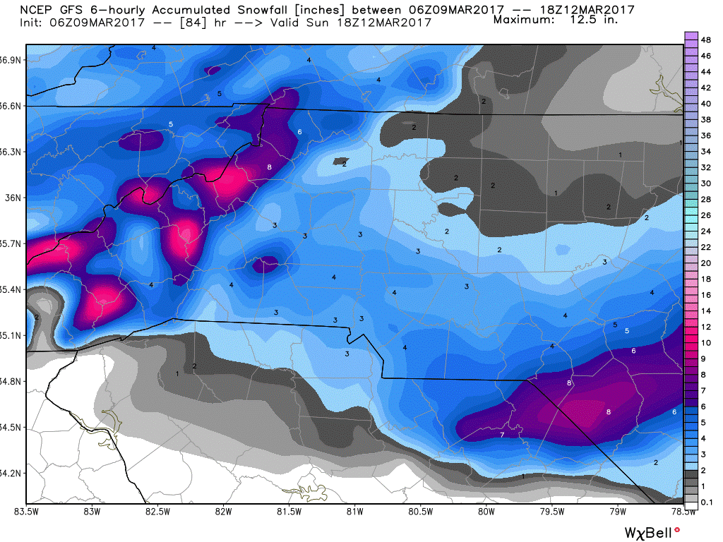
The interesting thing is the snowfall totals the GFS is predicting. They have been all over the place. Yesterday they were showing snowfall totals higher to the north and now the higher totals are to the south. This is a clear indicator to me the model does not have a decent grasp on the data at this point.
The European
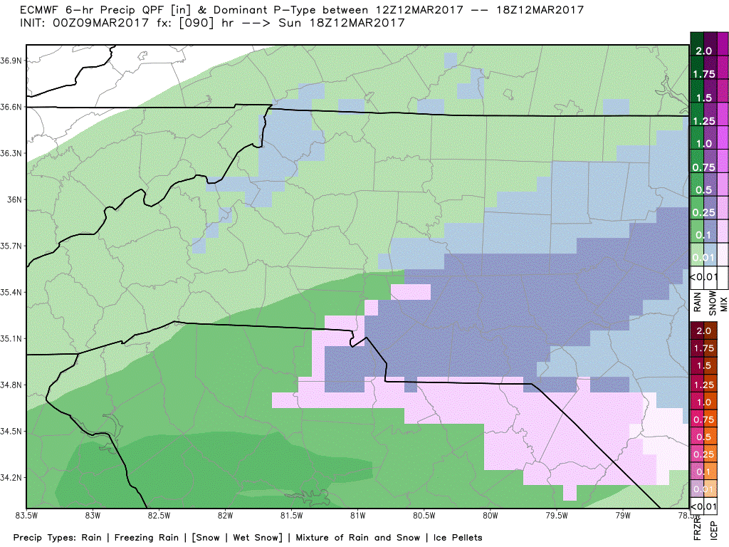
The European Model Data above is showing a chance for a rain snow mix to briefly move through the area and the count during overnight hours from Saturday into Sunday. The best chance for this to be all snow is from just after midnight to 4am Sunday morning. Then it looks like a rain snow mix for a brief period before all rain. Again the low to our south and the high well to our north.
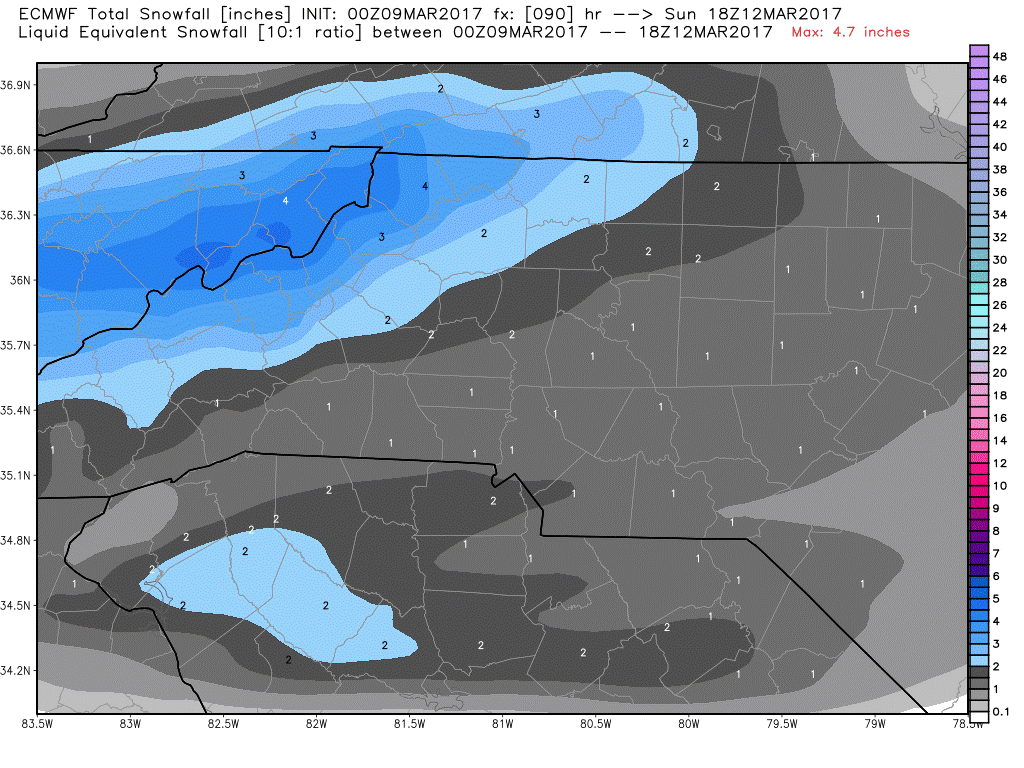
Now look at the huge difference from the European Model to what the GFS predicted on snowfall totals. Most of the snowfall is contained in the mountains. This is a more likely scenario with this storm as the cold air will be shallow enough in the upper levels of the atmosphere the mountains do stand a better chance.
What to plan for.
- Saturday night 70% Chance of rain as the low approaches the area.
- Sunday from midnight to daybreak 60% chance of a rain/snow mix (Mainly Rain) with accumulation possible on elevated surfaces but not very likely at this point
I will continue to post updates right here and on social media as we get closer to the weekend. As always thank you for following Rowan County Weather!
Please let our local sponsors know that you appreciate their support of our blog. Take a moment to visit their website linked at the top of this post.
Share this:

Announcements & Events
Check back often for important announcements and events that I'll be involved in!