

Wednesday Weather Update
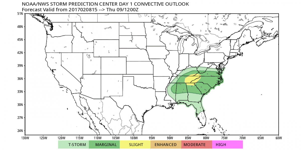
Severe weather is likely in the area today but I think it stays west and north of us. The SPC is showing a marginal risk for us but the threat is a little higher in eastern TN.
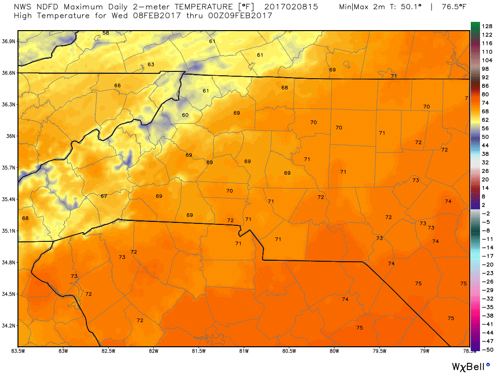
The real story for us today will be the winds. I will get to that in just a moment. The high today will top out at around 69º
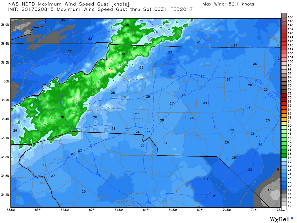
The winds will be the biggest threat to us today even if we see little to no rain around the county. The wind gust today will be around 27 miles per hour.
I would not be surprised for a storm to move through the county later this evening. However, as I have stated the better chances for severe weather are to our west and our north. Rain could move through the county late this evening around 9 or 10 pm.
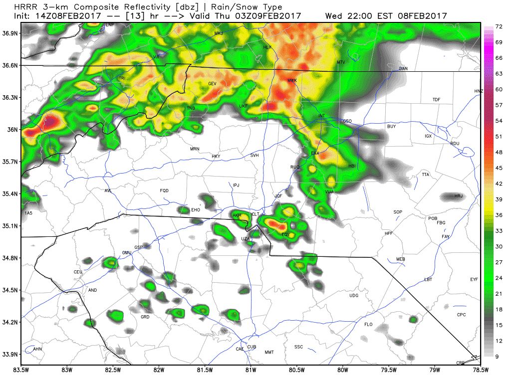
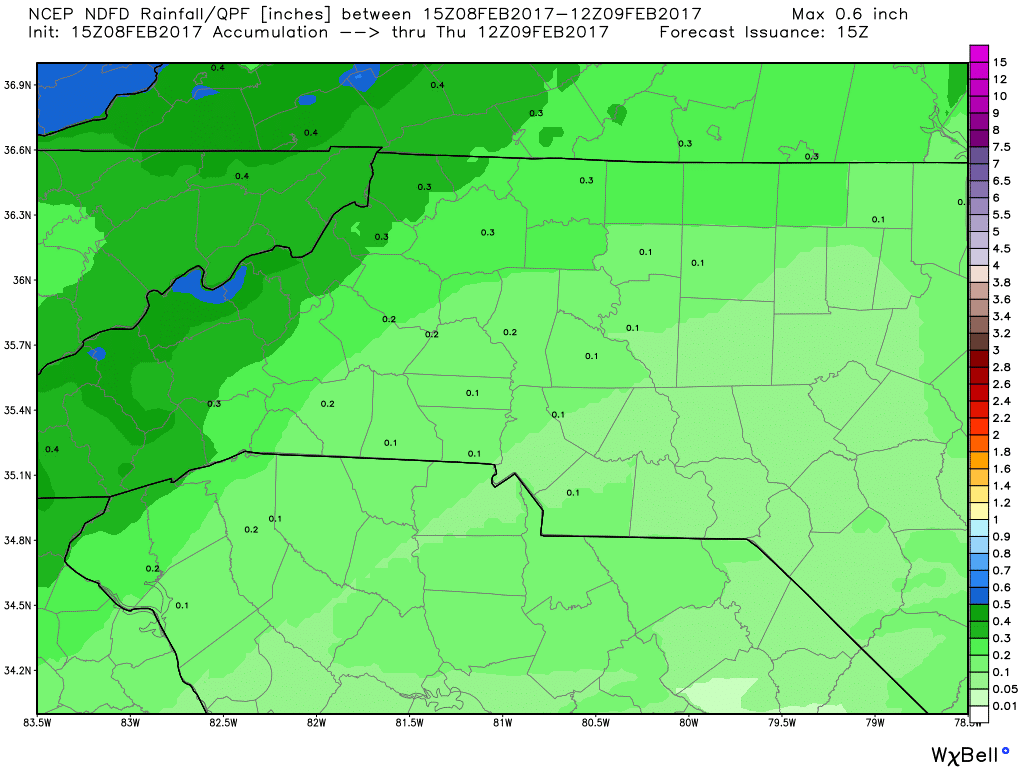
Because the rain will arrive so late and will most likely move through quickly I am only expecting around a tenth of an inch around the county with a few isolated areas getting a little more.
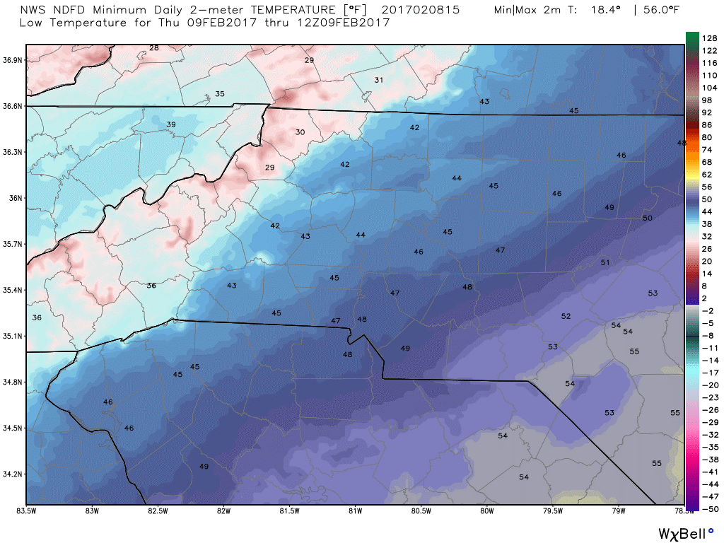
The low tonight will bottom out at around 46º
I will provide updates throughout the day and into the evening hours as rain and storms approach. Enjoy your Wednesday everyone! As always thank you for following Rowan County Weather!