
A Wet Weekend Ahead
As we close in on the weekend we will see rain chances start to amp up. There is a chance we could see some severe weather on Sunday as well. I wanted to take a few moments to break it down for you. With information on what to expect as far as rainfall totals and the factors for severe weather on Sunday. I had a question asked of me earlier today concerning some weather outlets predicting and forecasting 4 inches or more of rain by mid week next week. I have looked at the models and I am not seeing totals that high. I am looking at the following based on model data that is available at this point.

The model data above is from the European Model through 1am Monday morning. This model is showing anywhere form 1.5 - 2 inches of rainfall around the county form late tomorrow through 1am Monday.

Now the above model is the GFS through 1am Monday as well. This model is indicating the chance of 2 - 2.25 inches of rainfall around the county form late tomorrow through 1am Monday
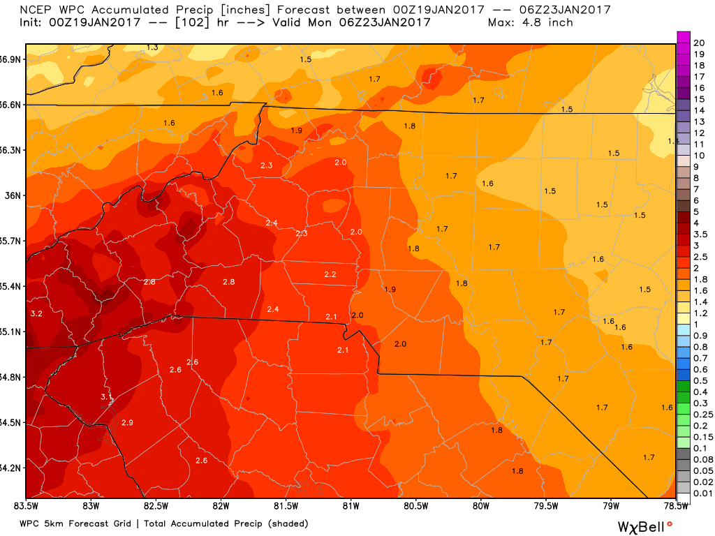
The above model is form the Weather Predictions Center based on the same timeframe and it is indicating anywhere from 1.5 - 2 inches of rainfall for the same time period of late tomorrow through 1am Monday
Based on the data I have saw so far I think it is a safe assumption that we could see 1-2 inches of rainfall around the county by the end of the weekend. However, there is nothing in the models at this point that would lead me to believe we will see the 4 inch ranges being forecast by others.
The chance for Severe Weather is likely on Sunday. It is likely we will certainly hear rumbles of Thunder. This will be due to a cold front that will be closing in on the area causing instability in the atmosphere as warm air and cold air battle it out. My main concern at this point is the winds. They are likely to be very gusty on Sunday afternoon based on data I am seeing.

As you can see from the model above gust of only about 20 miles an hour are likely at this point but we will have to watch for the likely hood of stronger winds this Sunday. I am not expecting any damaging wind event by any means but the winds from the system could spark a few severe thunderstorm warnings in the area and the county as well.
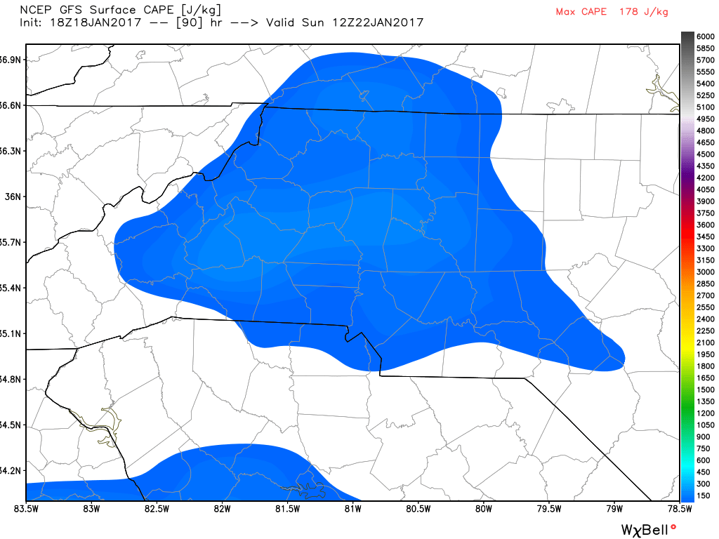
Another thing I am keeping an eye on is the CAPE levels indicated above. CAPE stands for Convective Available Potential Energy. Basically its a fancy word for thunderstorm fuel. These levels are not scary by any means but they are elevated enough based on the model data that the chance is certainly there for severe thunderstorm warnings in the area and the county on Sunday afternoon.
I will continue to monitor the model information over the next few days but umbrella's and rain boot's are necessities starting late tomorrow and right through the weekend. As always thank you for following Rowan County Weather!