
Snow chances on the increase for Saturday.
Good Morning! I have been fielding a lot of questions this morning from people wanting to know about this weekend. I will see after looking at the latest models runs things are starting to look more promising for snow in the county this weekend. I still feel like we will see a window of a brief wintry mix that could occur as the moisture moves in. There is a lot of information coming up in this blog so let's get right to it. Over the past week I have been sharing data with you form the long range models. Now that we are closing in on a 72-96 hour period before the moisture is likely to begin moving in the short range models will start to play a part in the forecasting of this upcoming winter event.
The North American Models are helping to paint a much clearer picture on a possible timeframe for the arrival of the moisture. So let's go ahead and show you that Friday remains off the table for us for any kind of winter weather potential.
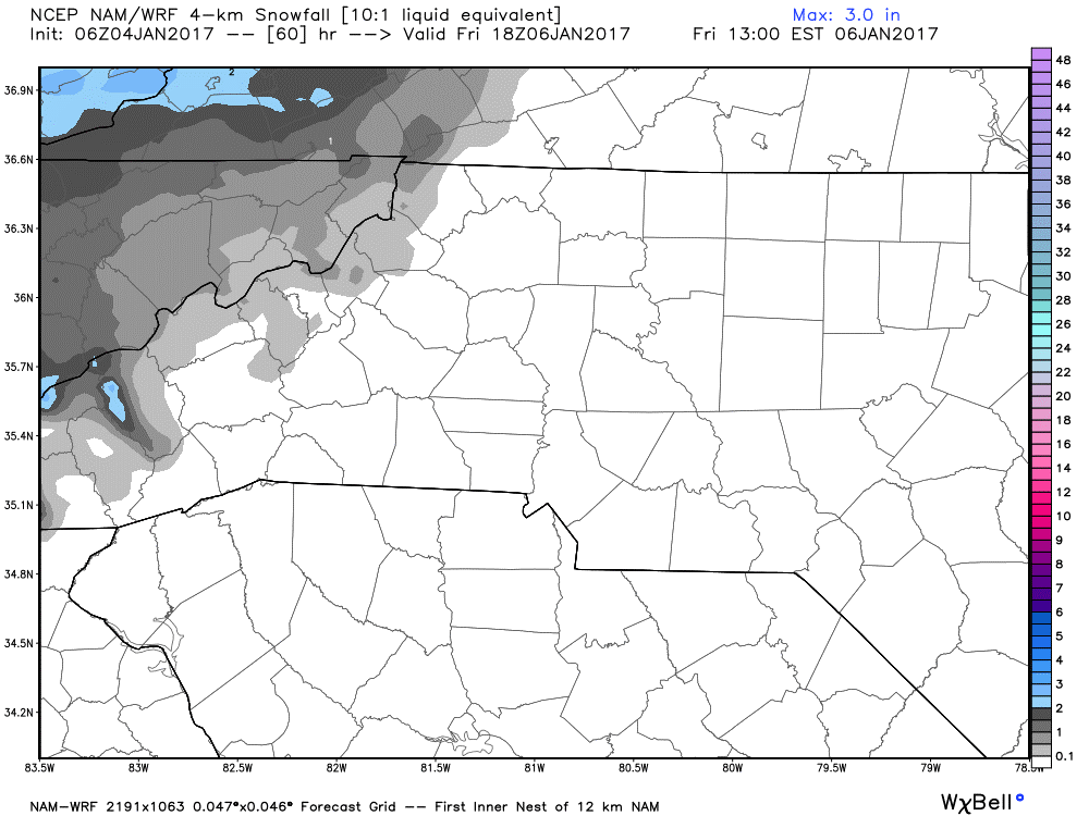
The above model data is from 1pm Friday. You can see where it is possible some snow flurries will be occurring in the western NC mountains but nothing is expected over our area at that time. Now let's jump ahead to 7am Saturday morning.
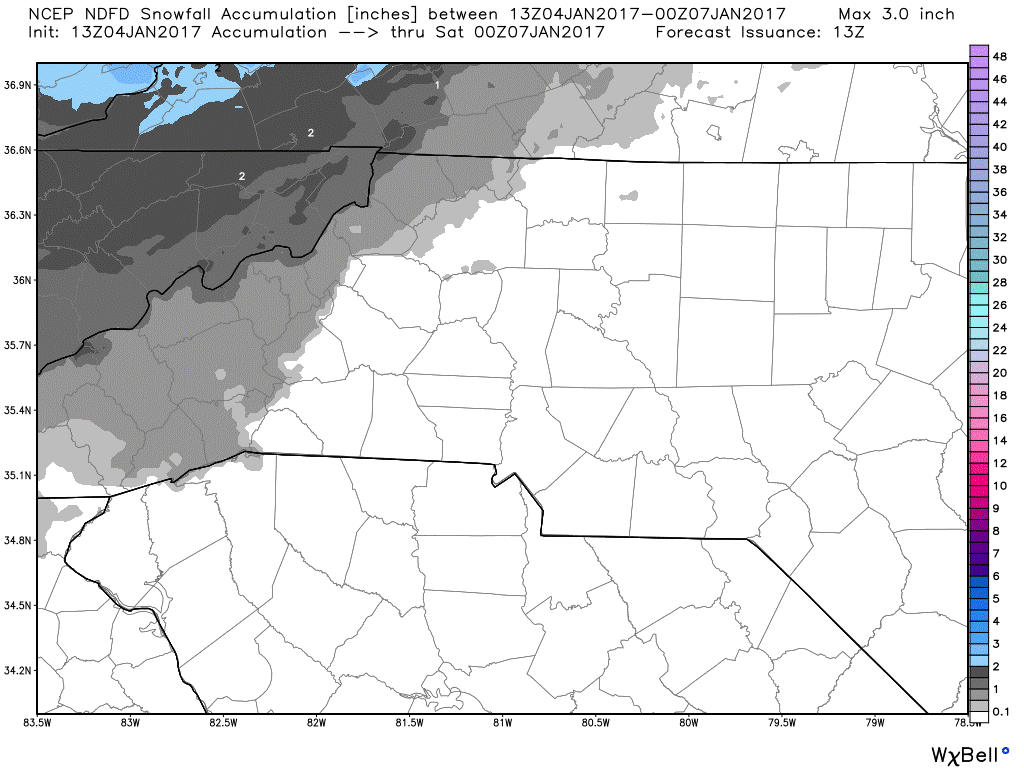
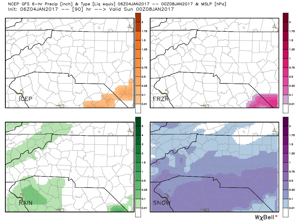
The NAM continues to show that by Saturday morning snowfall still continues to be possible in the mountains but nothing happening in our area.If you stake a look at the GFS precipitation potential for 7pm Saturday evening there is a different picture occurring by that point. It looks as if we will see snow moving through the county sometime between the morning hours on Saturday through at least Saturday evening.
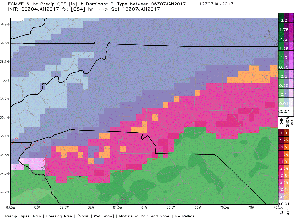
The European Model shows that by around 7am Saturday morning we could see a brief bag of mixed precipitation between rain, freezing rain, sleet and snow.
We know by this point we will see winter weather in the county on Saturday. The majority of the precipitation looks to be snow. The totals are the question at this point. Let's take a look at what the models are showing.Then I will tell you my forecast totals at this point.
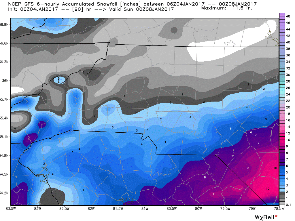
The GFS is hinting at 1-2 inches of snowfall around the county by Saturday evening. I think at this point that is a bit overstated.
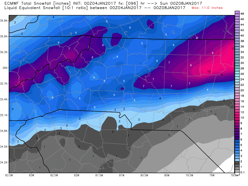
The European Model is showing a possibility of 5-7 inches around the county by Saturday evening. I feel this is way overstated.
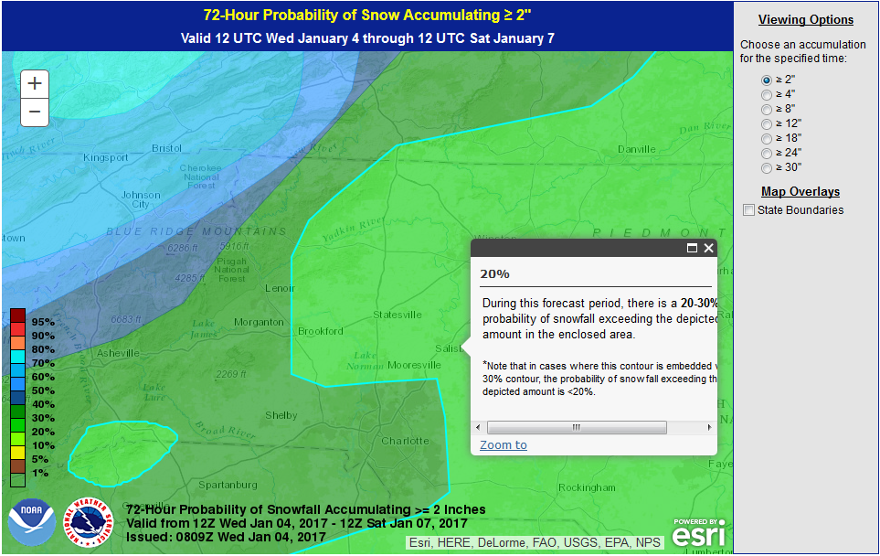
As far as probabilities. There are a few different maps that I use. The first is the image below. Sowing a 20% chance of at least 2 inches of snowfall around the county by Saturday evening.
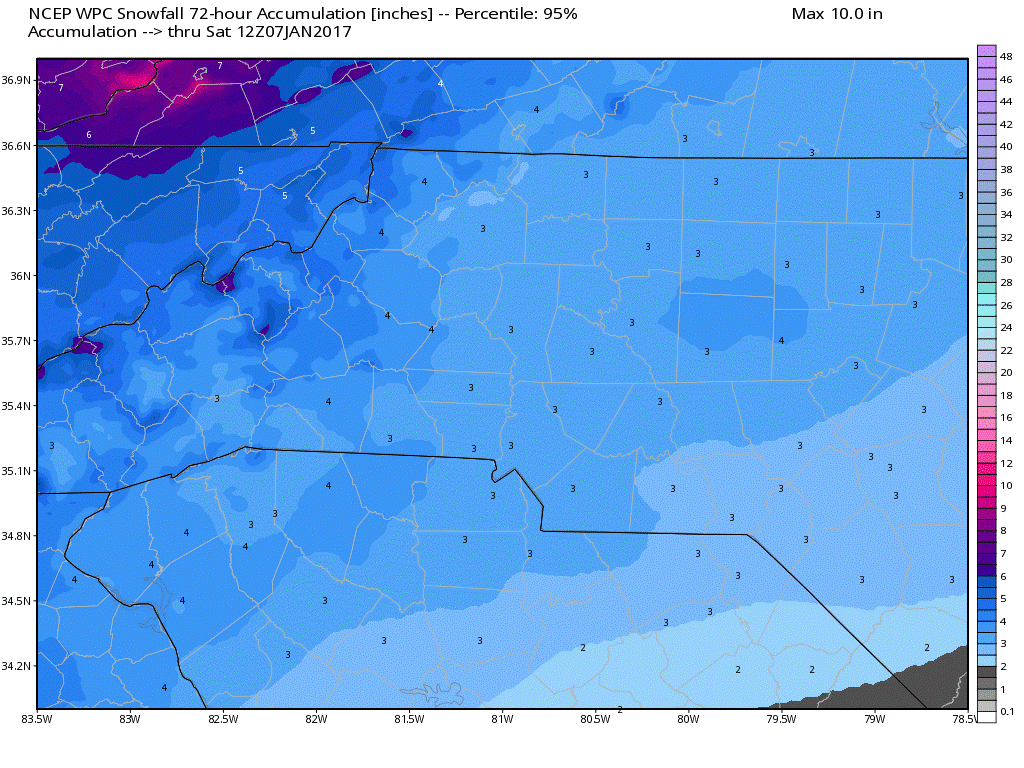
The image below shows a 95% chance of at least 3 inches of snow around the county.
The above is what the models are indicating. These are tools to help in forecasting. They are not always right. However, they are good guidance tools. So here is what I am forecasting for Saturday.
- 40% Chance of a wintry mix early Saturday transitioning to all snow as we move through the day Saturday.
- Accumulation totals of a half of an inch to an inch for snow around the county
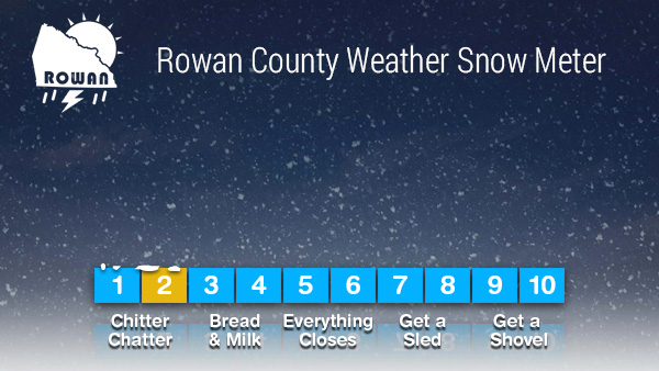
This will change and have to be tweaked several times throughout the next few days. I am keeping the Snow Meter at 2 for now.
This will probably be raised over the next 24 hours as more data continues to come in on the potential. You should at least begin to prepare for the chance of snow around the county on Saturday.
I will provide more updates right here and on social media throughout the day. Enjoy your Wednesday everyone! As always thank you for following Rowan County Weather!
Please let our local sponsors know that you appreciate their support of our blog. Take a moment to visit their website linked at the top of this post.
Share this:

Announcements & Events
Check back often for important announcements and events that I'll be involved in!