
A Wintry Mix Possible Saturday Morning
As we continue to get closer to the weekend the threat for some wintry precipitation is still possible. I wanted to give you all a quick update on what we can expect around the county as we start to move closer to Saturday Morning. The good news is as we are now just a few days out. The model guidance gives a clearer picture of what is likely to occur. If you were banking on something coming in on Friday and giving you an early release from school. I wouldn't plan on leaving school early. We stay dry and cold on Friday. An arctic high will position itself off the Virginia coast late Friday and early Saturday. As the high moves eastward it will pump cold air into the area. A low pressure system will bring in moisture from the Gulf and the Atlantic. The issue will be warmer air aloft. This will take snow chances off the board. However, it does warrant keeping an eye on road conditions early Saturday Morning as we will see a brief period of rain, sleet, freezing rain & maybe a few snowflakes. The accumulation for all of this should be very light as most of the precipitation looks to be light freezing rain or frozen drizzle. I am expecting all of this to occur between 7am Saturday morning and most likely transition over to all rain by early to mid afternoon on Saturday. Let's take a look at two images that I feel are showing a good picture of how things will transition.
Let's start with the European Model from around 7am Saturday Morning.
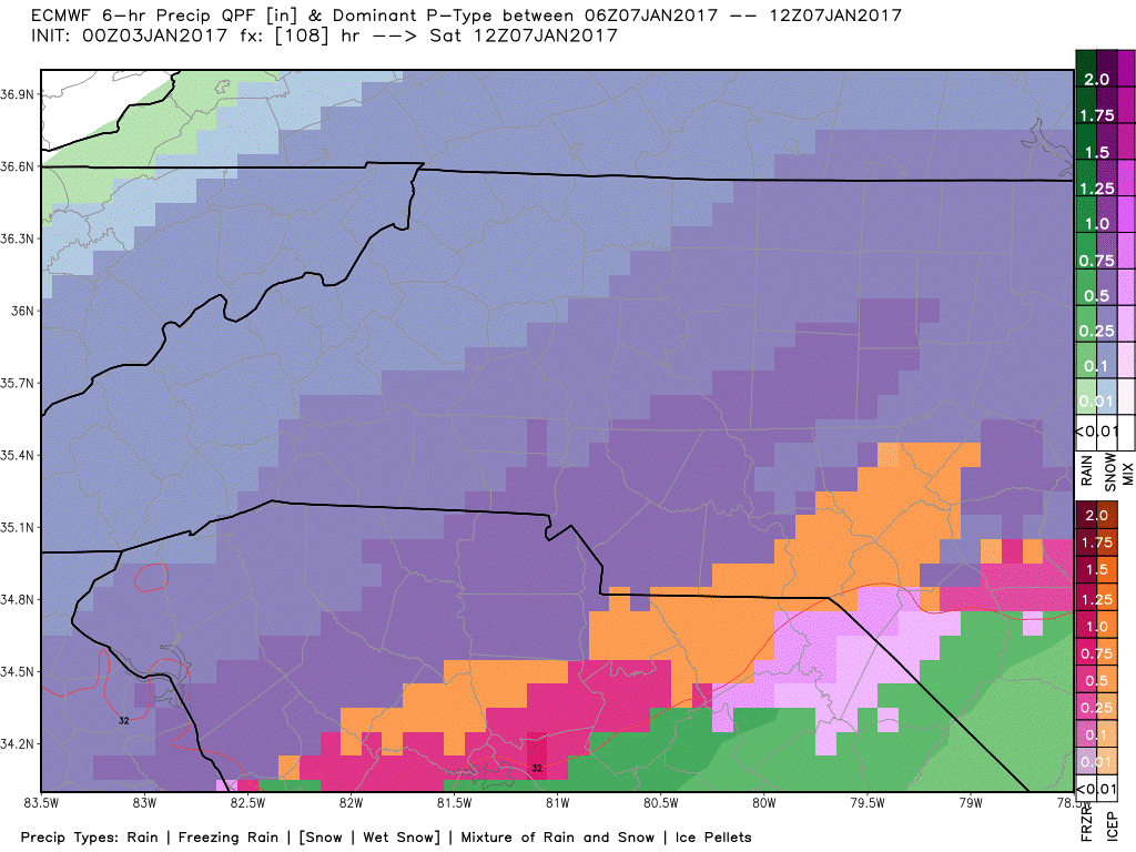
The European Model from above is showing a wintry mix around the area at 7am Saturday. This image is showing more snow than anything however, you have to take into account other factors such as air temperatures above and the general direction the air is being pushed in from at the time the precipitation arrives. Now I could just show you this image like others may do and say "Wow a winter storm is coming get prepared now!" That's not my style. I want you all to have accurate and real information. So only the facts here.
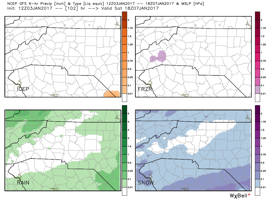
The GFS Image you see above is from around 1pm Saturday. As you can see from this image we will likely be seeing a rain or even a few wet snowflakes around the county as we transition into the afternoon hours on Saturday, Overall I feel it will be a light freezing rain and drizzle event. Accumulations will be light. You should be careful if you have to venture out Saturday morning. It would be best to just stay at home and go out in the afternoon when the air warms up and this is all rain.
I am giving us a 30% chance of a wintry mix for Saturday Morning at this point. I will continue to monitor the models and provide updates right here on the website. As always thank you for following Rowan County Weather!