
Update on Wintry Mix Potential for the weekend
I have been talking about the potential for a wintry mix coming up this weekend. As I have stated in my previous post on this. Its a very slight chance and continues to be something you should keep an eye on but nothing to freak out about. The models continue to show consistency on the possibility of at least a wintry mix for the upcoming weekend. The things that are still uncertain is the timing and how much we could see. Let's take a look at the latest model data and I will give you my idea on what to expect as we continue to march toward the weekend.
The GFS Model as always continues to be very bullish on the accumulations. If you see any post where someone is trying to tell you we will get a ton of snow this weekend. They are just lying to you! The one take away we can get from both the GFS and the European Models right now is that they both continue to show a wintry mix for a brief period of time this weekend. The lows that are bringing the moisture are zipping along in the atmosphere. So when and where they arrive on the east coast will have the determining factor on just what and how much we get.
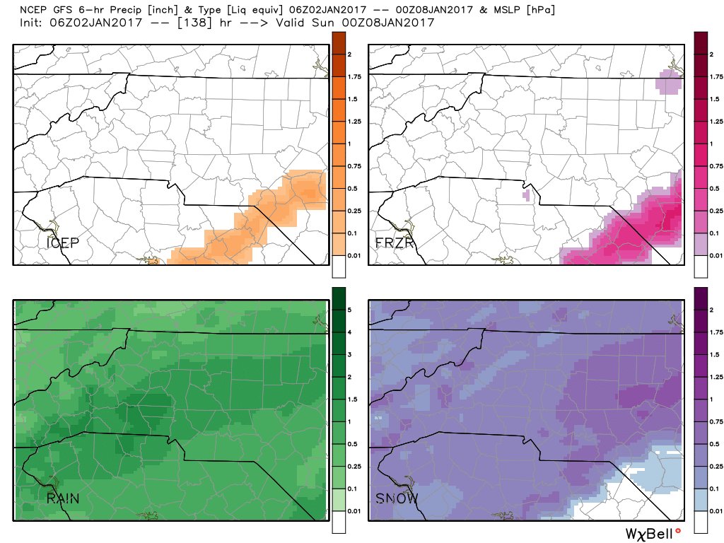
As you can see form the GFS data above the model continues to show at least a rain snow mix at this point. If this turns out to be the case. I would expect very little to nothing in the way of snowfall accumulation around the county. Now this model has been hinting toward all types of precipitation over the past few days. In all of the scenarios it has been some sort of mixed precipitation.
If we take a look at the European Model which does a much better job with precipitation and how much accumulation you could get. Here is what we see as of this morning.
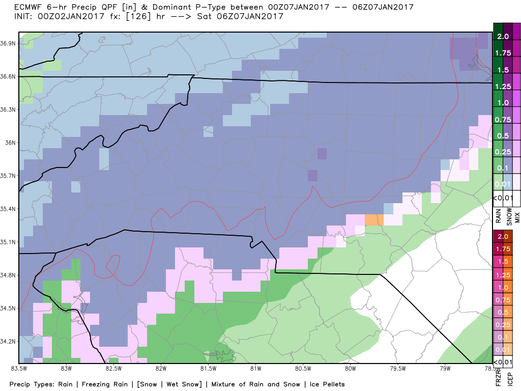
As you can see from this data above. The European model is showing us with a quick blast of snow overnight Friday and early Saturday morning. This is bookend by what appears to be a mix of rain, freezing rain and sleet. If this is the case again very little to no accumulation would be expected in terms of snowfall and ice. The rain would wash it away on both sides of the event.
Again, I can't emphasis enough that this is really something to keep in mind for the upcoming weekend. It is not anything to freak out over at this point. There is not enough data there to support any kind of real meaningful event for the county. I will continue to monitor these data as it comes in and provide updates right here on the website. As always. Thank you for following Rowan County Weather!
Please let our local sponsors know that you appreciate their support of our blog. Take a moment to visit their website linked at the top of this post.
Share this:

Announcements & Events
Check back often for important announcements and events that I'll be involved in!