
Sunday Weather Update
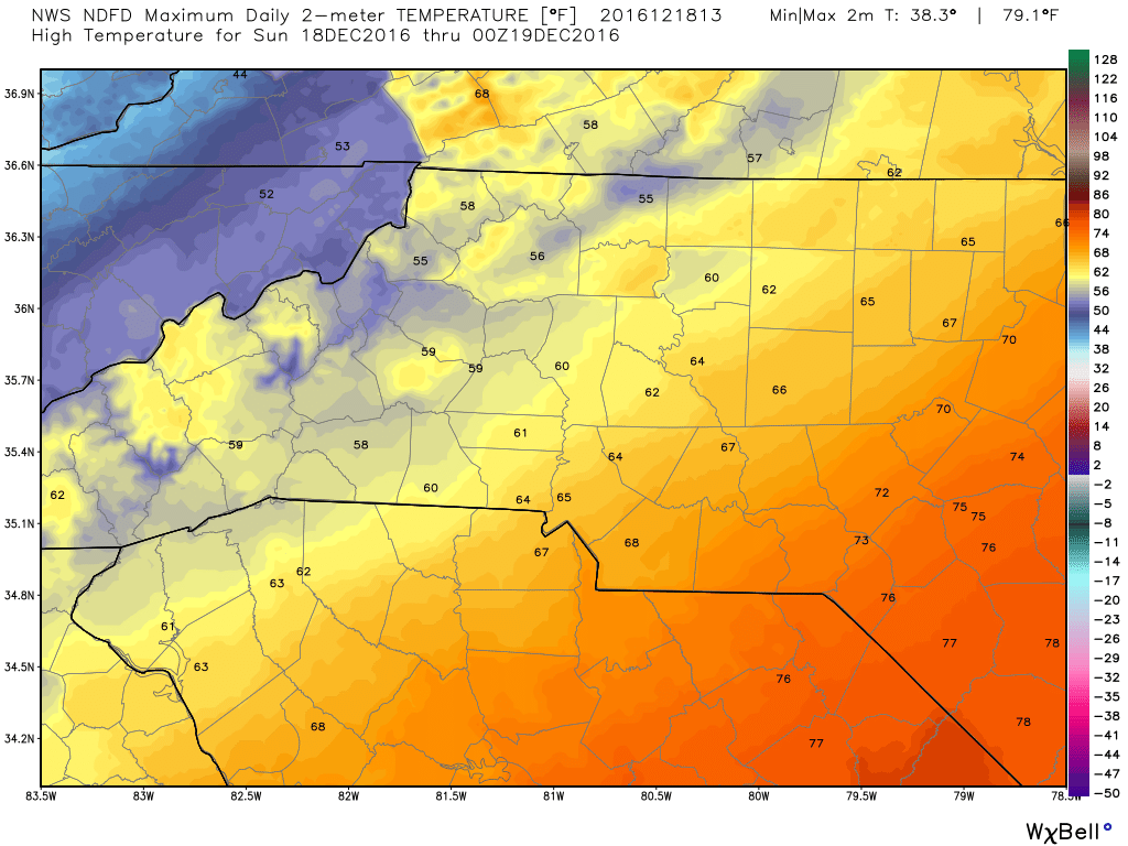
Are you ready for a roller coaster day. This is one of those days where you wake up and the temperatures are as warm as they are going to get. A steady decline will occur all day long as another cold front approaches and the temperatures will plummet from the low 60's to the mid 30's in the span of about 14 hours. Keep the rain gear handy and have a coat for later today. The high today will top out around 62º
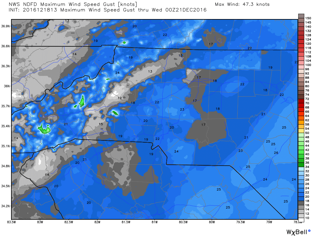
As you probably already can tell. The winds will be gusty with gust of around 23 miles per hour at times. This is due tot he rapid change in temperature we have had and will have throughout the day.
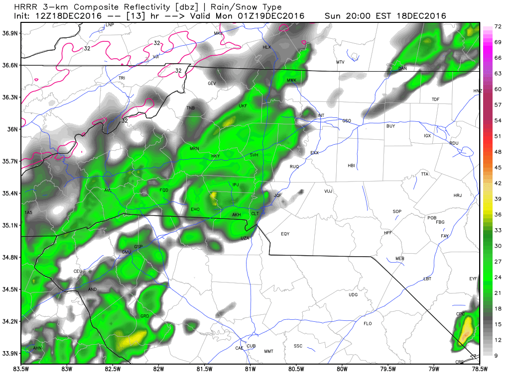
The rain is going to be one of the big stories of the day as well. I expect showers to start moving into the county around midday. and they will continue off an on in the first of 2 possible waves through around 6pm.
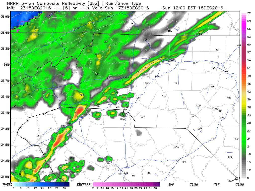
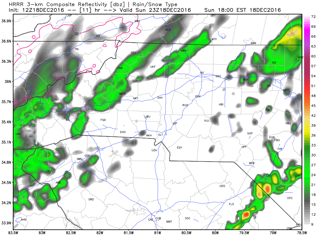
The second wave I am watching for looks to move into the county right around the time you are putting the kiddo's to sleep. The good news is these showers appear to be nothing but showers. So you don't have to worry about the littles ones running to you at the rumble of thunder.
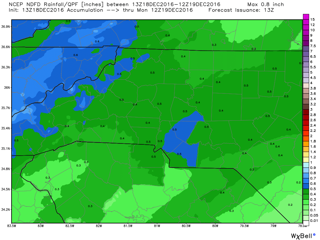
By the time we reach midnight it is possible we will have around a half of an inch of rain. Some areas in the county could see a little more.
As the day starts to come to an end things are going to be quite chilly outside as the lows will bottom out around 35º

Please remember as it starts to get cold again. Check on your elderly neighbors and loved ones. Please also remember those outdoor pets. If you are cold when you go outside. They are cold as well! I will provide updates throughout the day right here and on social media. Enjoy your Sunday everyone! As always thank you for following Rowan County Weather!