
Freezing Friday Weather Update and will we see any ice?
We are finally moving into the weekend. The weather for this weekend has been a hot topic all along. I have consistently stated we will not see any frozen precipitation here in Rowan County. I am still maintaining this will be a cold rain event for us. There is a lot to talk about in the post so let's dive right in. The next 24 hours is going to be very interesting and it all starts with today's weather.
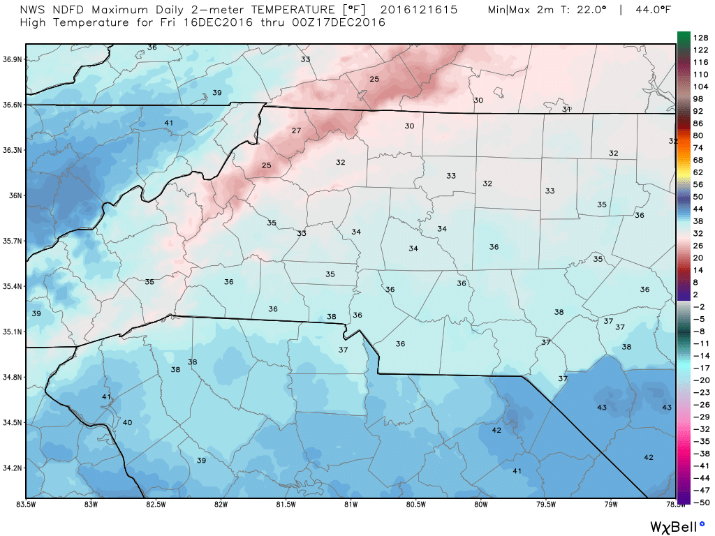
The high today will only top out at around 34º
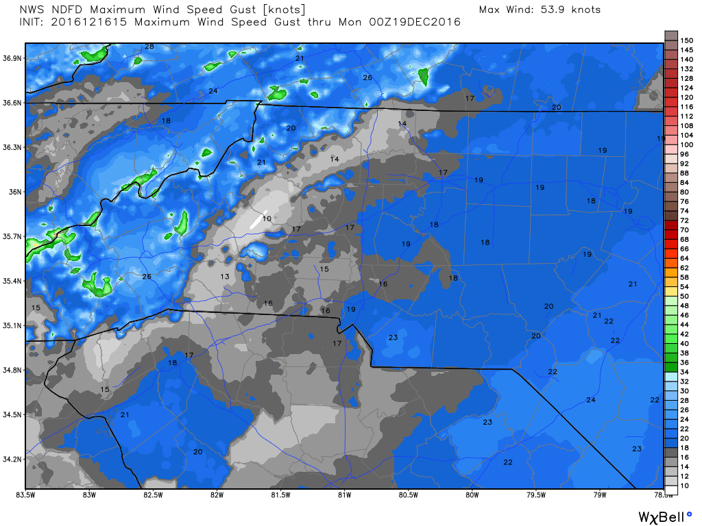
The winds will be a little gusty at times. Gust of around 19 miles per hour are possible.
Now here is where we are going to get into the real meat and potatoes of the forecast for today and later tonight. Talk all week long is that we would se some sort of wintry precipitation this weekend. As we have gotten closer to the weekend the chatter was about freezing drizzle. I am sticking to my guns that this is not likely. A very cold rain is the most likely scenario here. Let's take a look at some key factors on my decision.
The GFS Model
This is the model that has been very consistent. The only difference in the last 24 hours is the precipitation has taken a big swing to the east. My gut feeling is that the air here is going to be too dry while it is cold enough for moisture of any kind to reach the ground. I think by the time the air is saturated enough the temperatures at the ground will be warm enough for just a cold rain.
The NAM Model
The NAM model has been a model that has been very aggressive with the precipitation. This model is really good for temperatures and other varying factors but does not handle precipitation very well. This is the model that many are looking at for the potential for icy accumulation.
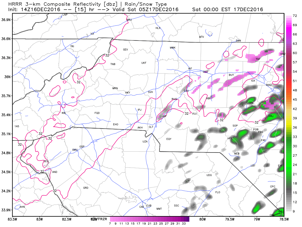
The above model image is form the HRRR at midnight tonight showing most of the moisture off to the east. The temperatures from midnight to early morning are likely to be cold enough to support frozen precipitation but without the moisture being there its extremely unlikely.
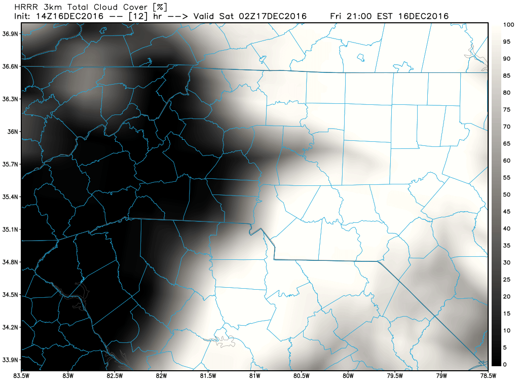
Another factor I am looking at form the HRRR is the cloud cover. If we get enough cloud cover it will act as a blanket and could trap some heating from the day in keeping those ground temperatures above freezing.
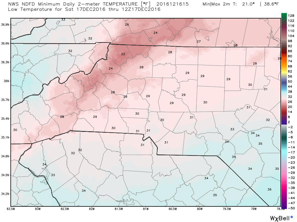
The low tonight will bottom out around 29º cloud cover could keep us a little warmer. The biggest threat today and tonight is the cold air. I still feel confident in not forecasting anything other than a cold rain. There is just not enough moisture here when the temperatures will be favorable for freezing rain. I will post another update later this afternoon and evening concerning the weekend weather. As always thank you for following Rowan County Weather and have a great day!