The tropics continue to heat up
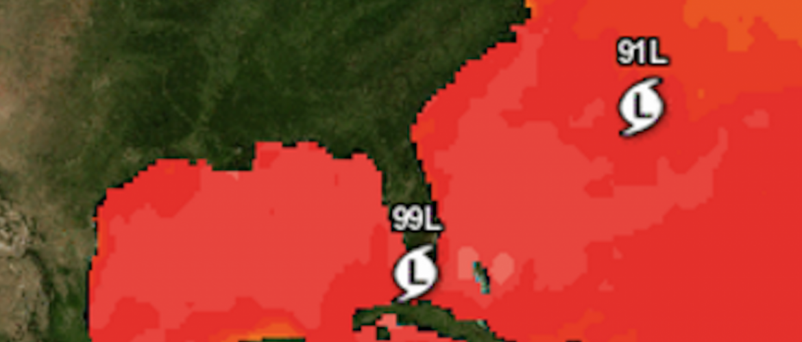
The tropics are continuing to be active. There are two systems out in the Atlantic that I wan to focus on simply because they are the closest areas that could provide some sort of weather to the southeast United States. One of which cold bring some rain to our area if it takes a certain track. Don't get too excited about it though as we will not have any direct impact from either of these storms.
Let's start with the storm that has had the most buzz on social media.
Invest 99L
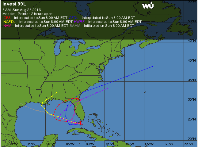
As you can see from the plots pictured above this system could move into the Gulf and impact Louisiana which is a state that certainly needs a break form heavy rains. Some of the plots are showing the storm taking a northeast turn and moving across the state of Florida. The biggest thing to note from Invest 99L is the fact that it certainly has an opportunity to strengthen in the warm Gulf Coast waters and it most likely will. If this storm tracks far enough to the west it is likely we could see some rainfall move through the area and quite possibly the county over the next week or so. I wouldn't get too excited about this as there is still a lot of uncertainly from this system.
Invest 91L
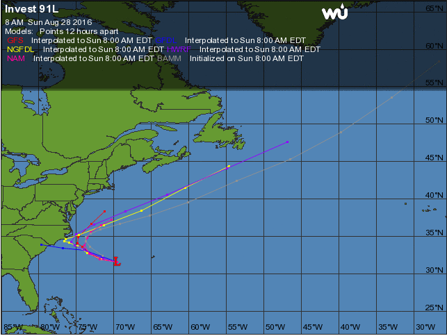
Invest 91L has not gotten as much buzz and Invest 99L has but it certainly deserves some attention. This system is much closer to the Carolina coastline and could certainly strengthen as it moves this way. This system will most likely buzz the Carolina coast and then move out to see. This will mainly be a fish storm. One thing to note from this system is it has created the westerly flow we are seeing that brought us storms yesterday that moved from east to west across the county. It is possible that we could see isolated showers and storms from moisture being pulled in off the Atlantic as this system moves closer. Here in Rowan County we will not have any direct impact from Invest 91L
So there you have it. I just wanted to give you some insight on what's current;y going on in the tropics and how these two closest systems could have an impact on our weather here at home. As these systems continue to develop and details update on them. i will provide updates right here and on social media. As always thank you for following Rowan County Weather!
Special thanks to Weather Underground where the images above came from