
Thursday Weather Update
The Flood Watch continues for today. There is a lot of precipitable water in the atmosphere. Basically same type of situation as yesterday. If a shower develops over you it may move very slowly or not at all until it rains itself out. The highs today will be in the mid 80's. Dew Points once again will make the air feel oppressive. Let's take a look at the highlights.
The high today will be 86º
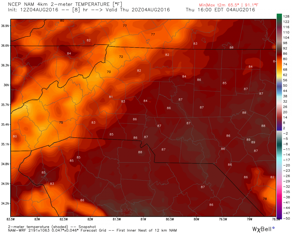
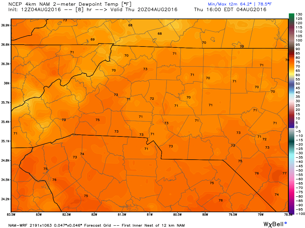
Dew points will be in the low 70's making the air feel oppressive.
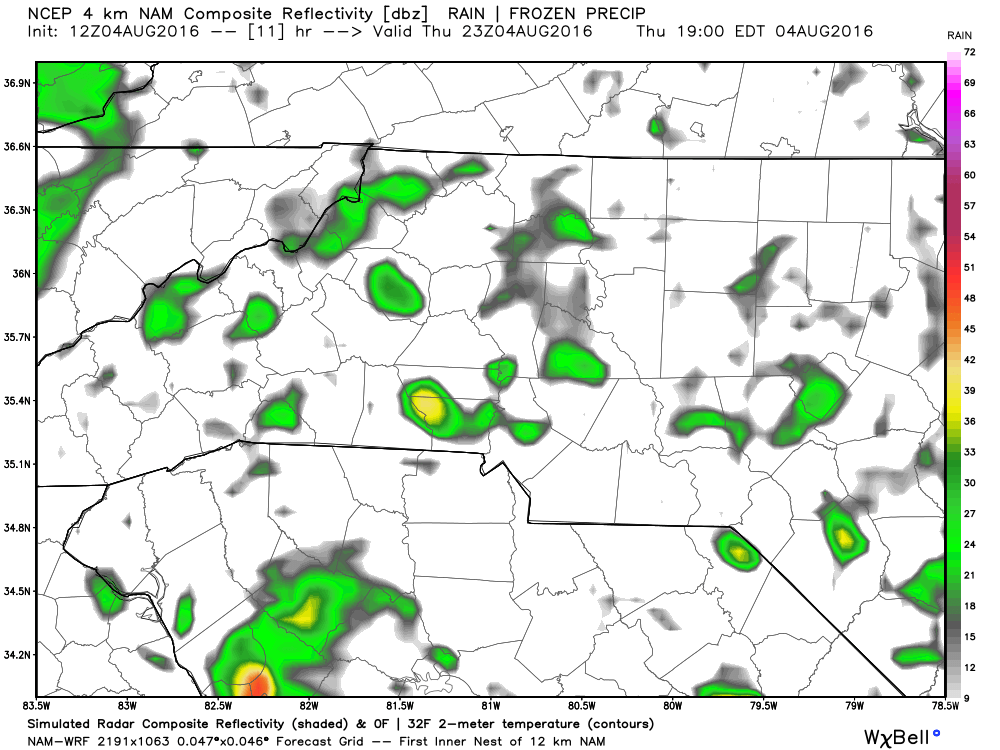
Showers will be isolated in nature and hard to predict timing wise. the showers will basically develop in an area and may have very little or no movement They will simply stay and rain themselves out.
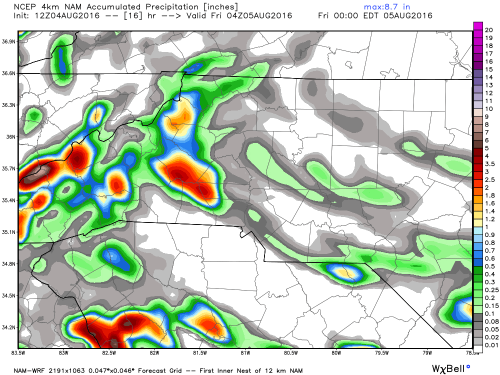
As far as potential accumulation goes. The models are indicating around a quarter of an inch possible with most of the higher accumulations staying in the mountains.
If a shower does develop over your location. Please don't let your guard down. We could easily see a situation like Statesville saw yesterday where showers develop and dump a ton of water in a short period of time. If you come across a flooded roadway. Please turn around and find another way.
I will provide updates here and on social media throughout the day. As always thank you for following Rowan County Weather!
Please let our local sponsors know that you appreciate their support of our blog. Take a moment to visit their website linked at the top of this post.
Share this:

Announcements & Events
Check back often for important announcements and events that I'll be involved in!