
Friday Weather Update
The main thing everyone should keep fresh on their minds today is to stay hydrated! Today is going to be extremely hot and could also bring the threat of strong to severe thunderstorms around the county again. I have some concerns we could see a straight line wind event later today and possible into this evening. There are a few things that still need to come together for this to occur so I will be paying extra attention to the radar and models throughout the day.
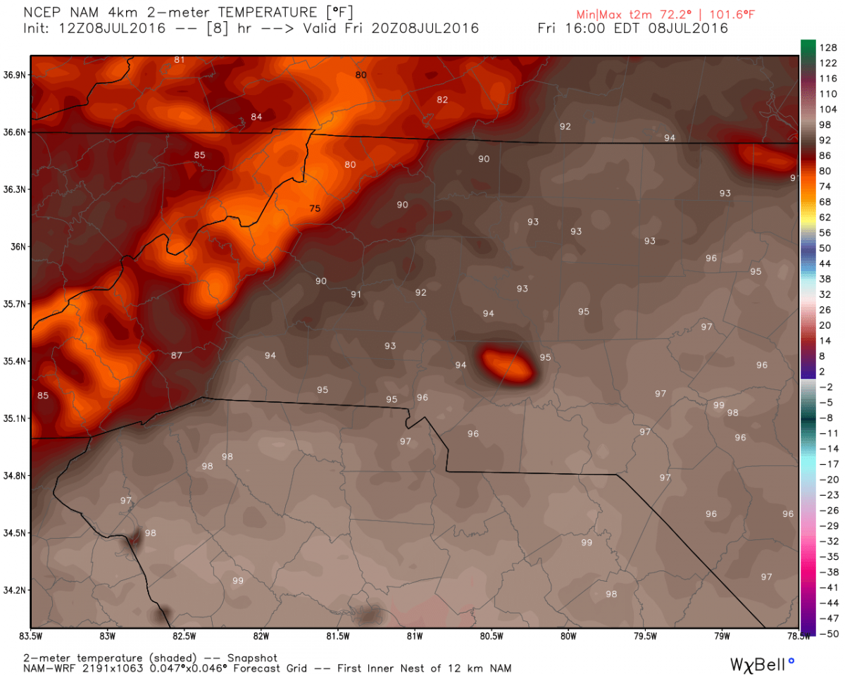
First let's get to the heat. Highs today will be in the mid 90's looking at 94º around the 4pm timeframe.
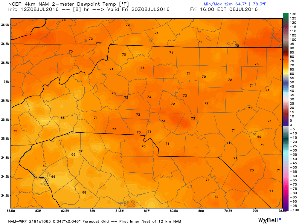
Dew Points are going to be oppressive yet again in the low 70's.
My biggest concern with the storm chances today is the elevated CAPE levels in the area.
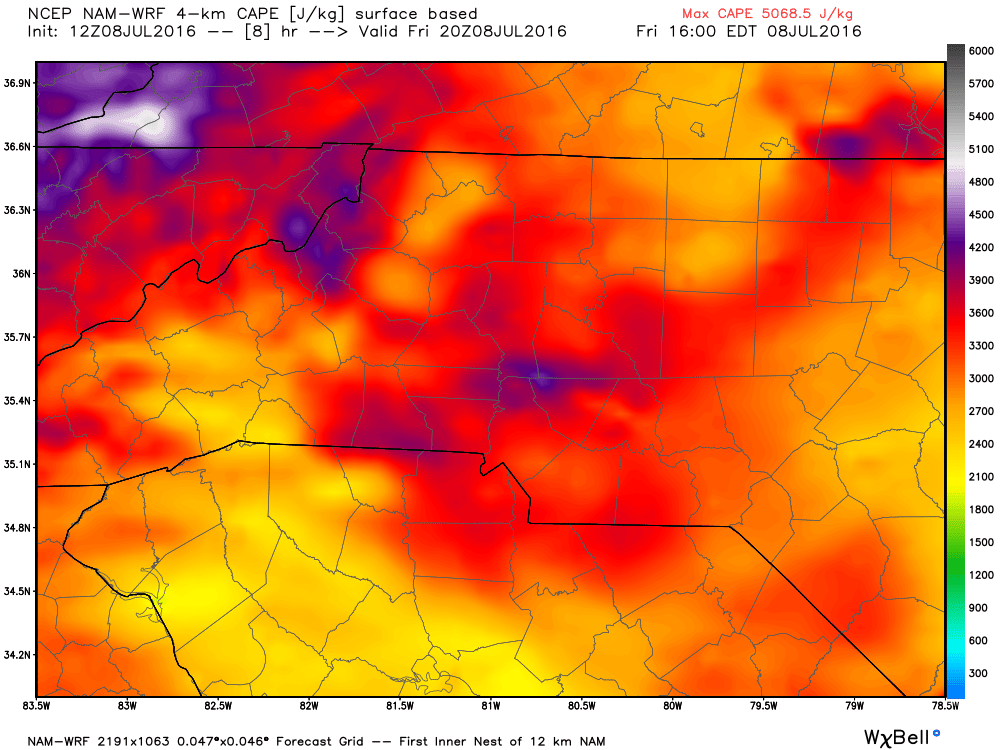
If storms fire up later this afternoon the atmosphere will be pretty ripe to help get them strong and possibly even severe rather quickly. Main threats would be damaging winds, frequent lightning and small hail. I will continue to monitor things throughout the day and post updates as things develop. As always thank you for following Rowan County Weather!