
Possible Microburst hits Unity Church Rd. Area
This past Saturday we had some isolated storms and showers move into the county and pass through between the hours of 8 and 11pm. While covering weather on site for the Pops at the Post event I was actively on radar keeping up to date on storms as they approached the county. As we began to approach the 9:30 timeframe a pretty strong storm was working it's way into the southwest portion of Rowan County. I remember being in Salisbury at the event I was attending when my wife called me from our home located in the Atwell township. She said "We are getting a really strong storm here with lightning and thunder. The wind is blowing really hard! Do we need to seek shelter?" Of course seeing what I had been observing on radar and knowing that there was no rotation whatsoever in the storm I advised my wife it was a really strong storm but it would be best not to panic and just remain where she was in our home.
I of course continued to monitor the situation not only for the southwest area of the county but for all other areas in the storms path. I advised officials at the Pops at the Post event it would be my recommendation to end the event early so attendees could make it to their vehicles safely. The Pops at the Post did end a bit early so everyone could get home.
On my way back to my home Saturday night I did of course observe the typical obstacles you see generally lying in the road after a strong storm. Sticks the occasional branch of a tree but nothing that lead me to believe it was nothing more than a strong storm.
Then of course I pulled into my driveway and noticed something a little unusual. Our porch swing was not where it typically resides it was lying in our front yard but about 25 feet from where it has always been sitting. Once I got inside and began to check data form the weather equipment at my home which of course is also what I refer too as the (Rowan County Weather Center) I was stunned to see a max wind gust of 59mph.
On Sunday Morning I woke up early and went out to pick up the garbage can that was knocked over and of course place my swing back in its usual resting place. Then I noticed that my well house was gone..... Literally no where to be seen until a few hours later a neighbor from two houses over and a small line of woods separating our yards advised me my missing well house was lying in her front yard.
This got me taking more of a look at the weather data to see what may have occurred. Was it a short lived straight line wind? Was it just some really strong gusty winds for a brief moment? Or was it a microburst?
I then received a call from a family member about some residents along Unity Church Rd. who had sustained some pretty significant damage to property around their homes. I went over to take a look at the damage and quickly realized this appeared to be a classic microburst event. I also wanted to ensure I was not over or under thinking this so I spoke with my friend and weather partner Brad Panovich from NBC Charlotte and we both agreed based on data and some of what I was seeing that this appears to have been a microburst.
Just to give you insight a microburst is a localized column of sinking air (downdraft) within a thunderstorm and is usually less than or equal to 2.5 miles in diameter. Microbursts can cause extensive damage at the surface, and in some instances, can be life-threatening. There are two primary types of microbursts: 1) wet microbursts and 2) dry microbursts. Wet microbursts are accompanied by significant precipitation and are common in the Southeast during the summer months.
Imagine if you took a ball and slammed it into the ground at an angle. Anything the ball hit along the path it takes is going to be moved , knocked down or possibly destroyed. This is pretty much what occurred to all of the items pictured below.
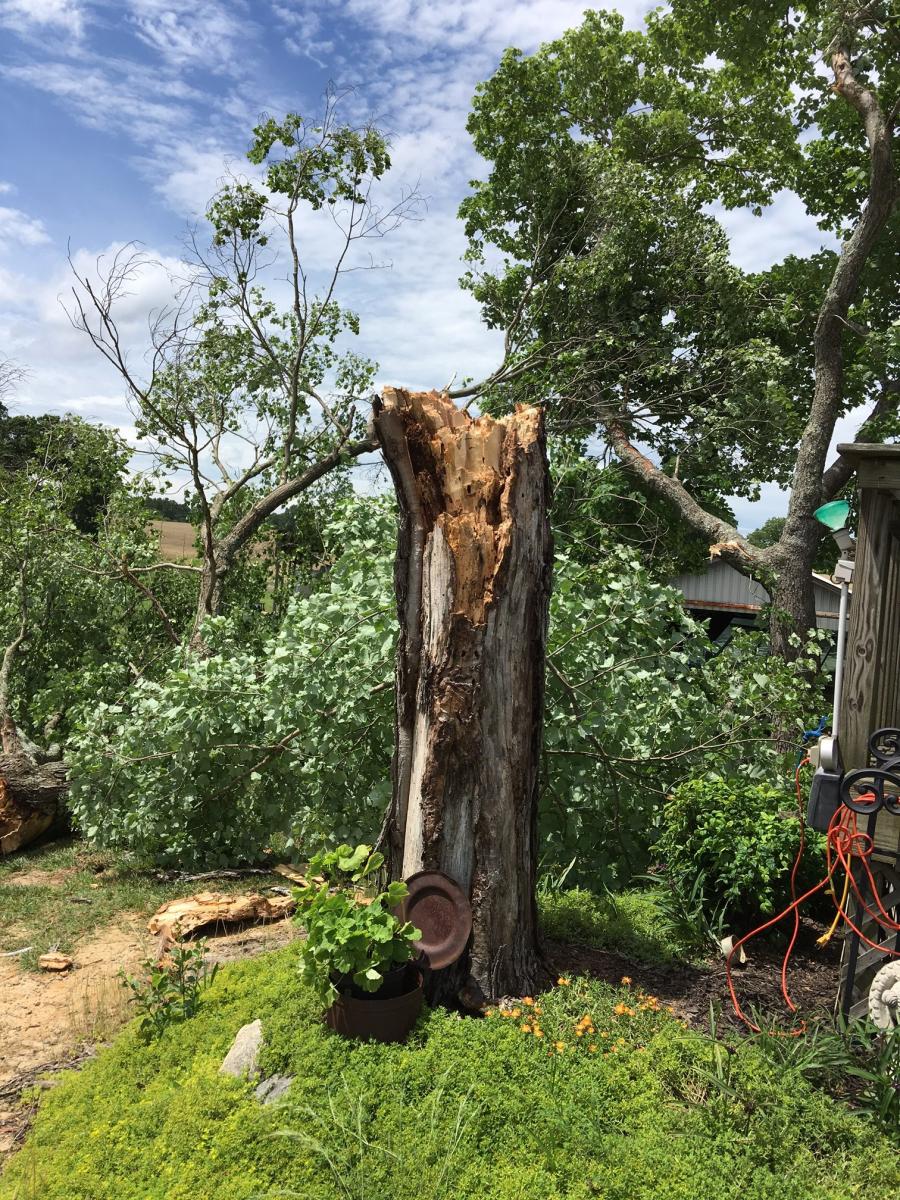
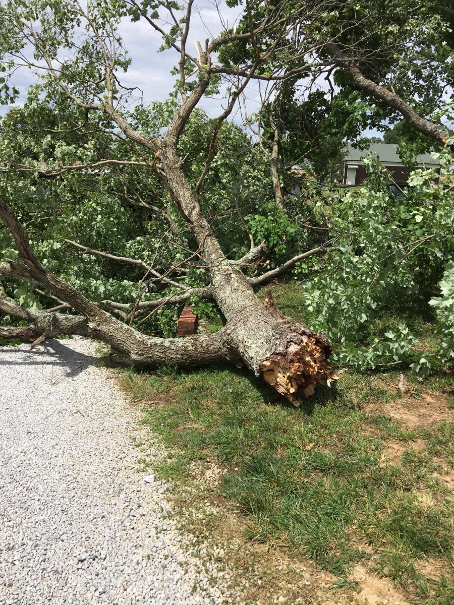
The location of this tree seems to be where the force of the microburst was coming to the ground breaking the tree off from the top. The photo below is the top portion of the tree lying on the ground.
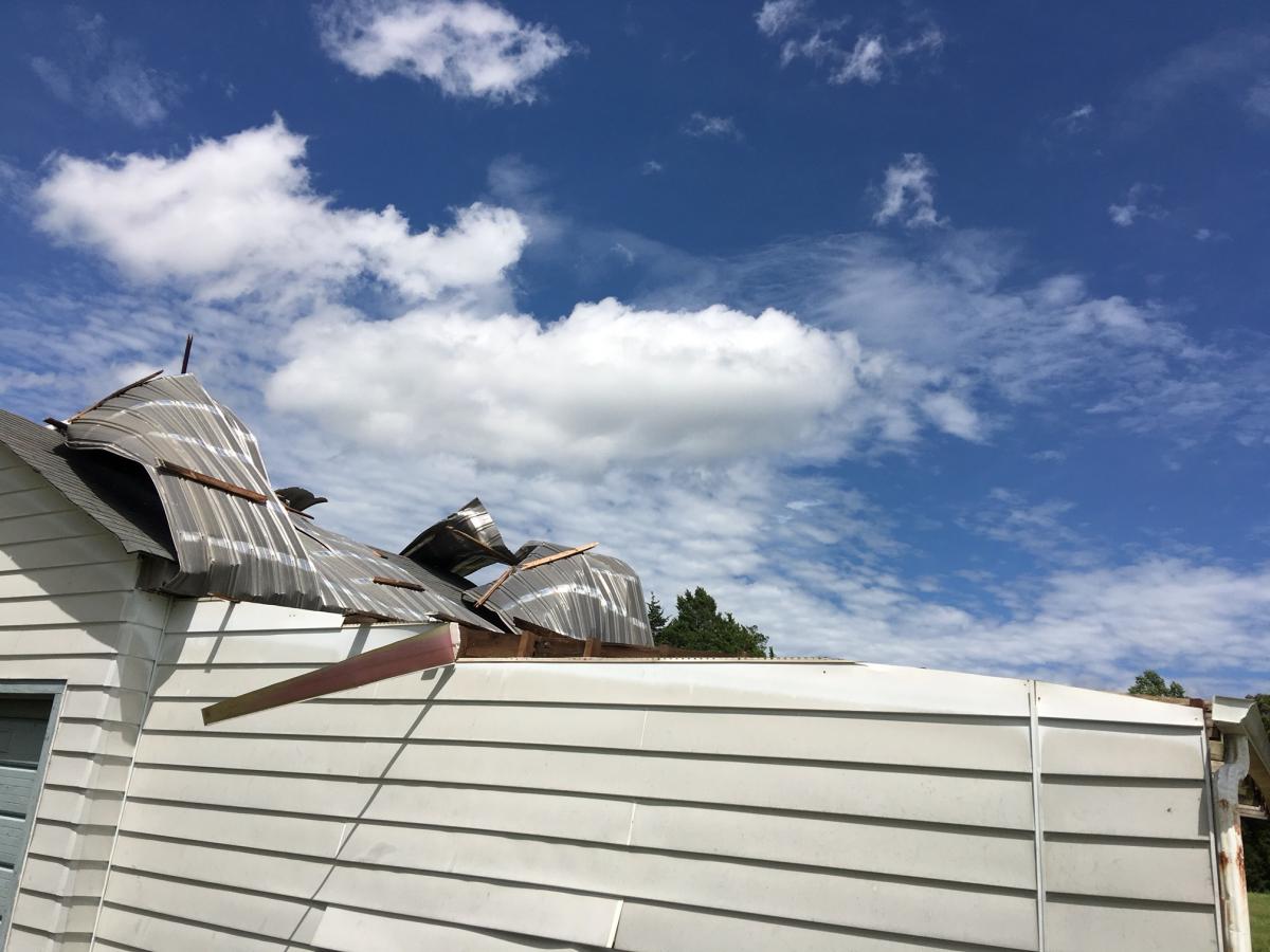
The next property I stopped at literally across the street from where you saw the broken tree pictured above had some pretty significant damage to some sheds and out buildings. You can see where it is likely the winds may have hit 70mph in this area.
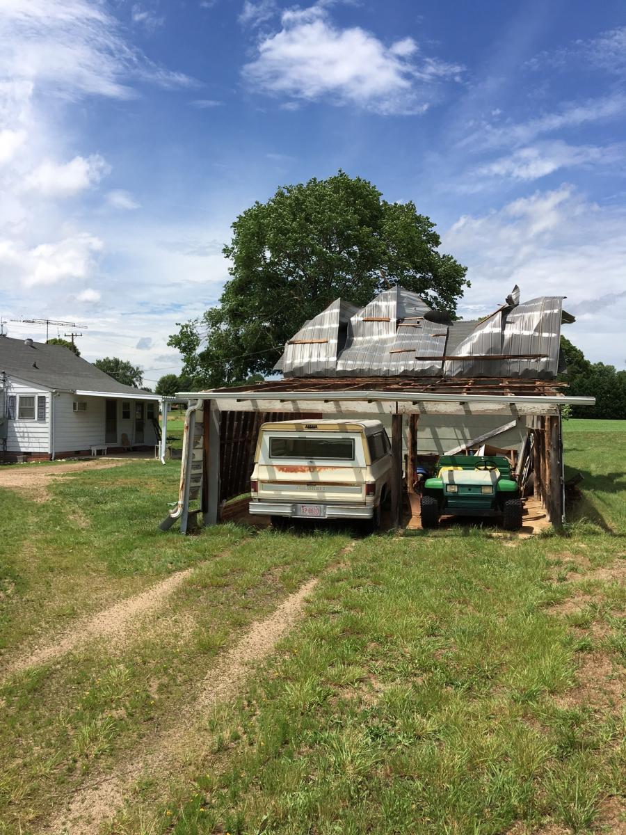
The roof was ripped and peeled back off of this carport as the wind blew straight into the carport but had no where to escape.
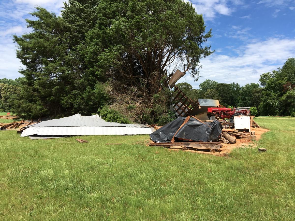
The building below is on the same property and was completely leveled by the force of the winds.
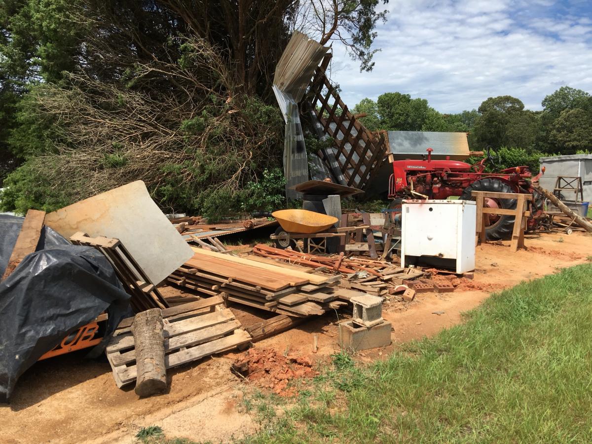
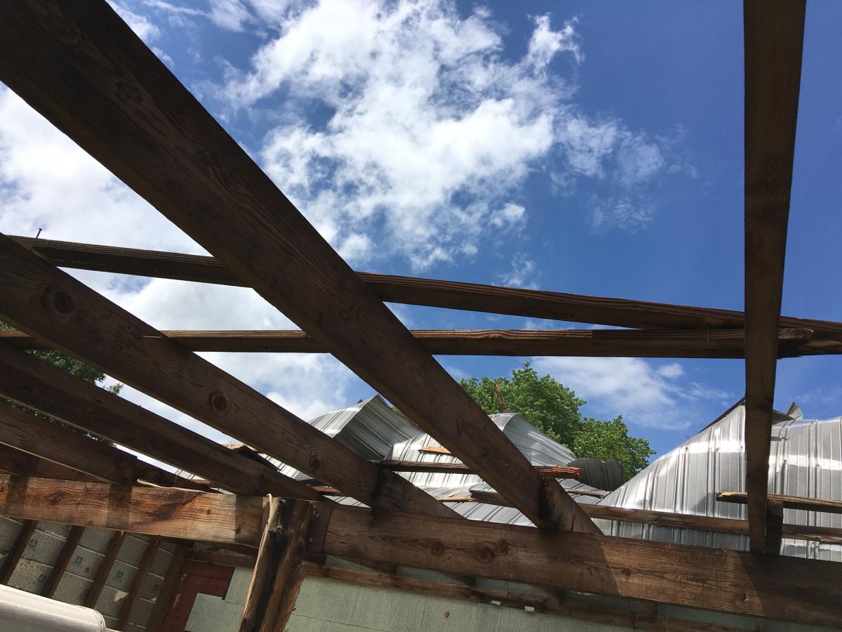
The hole pictured here is significant. This is what the post of the building were buried into. The post of this building were essentially telephone poles buried 18 inches into the ground. They were ripped out of the ground in tact from the force of the wind.
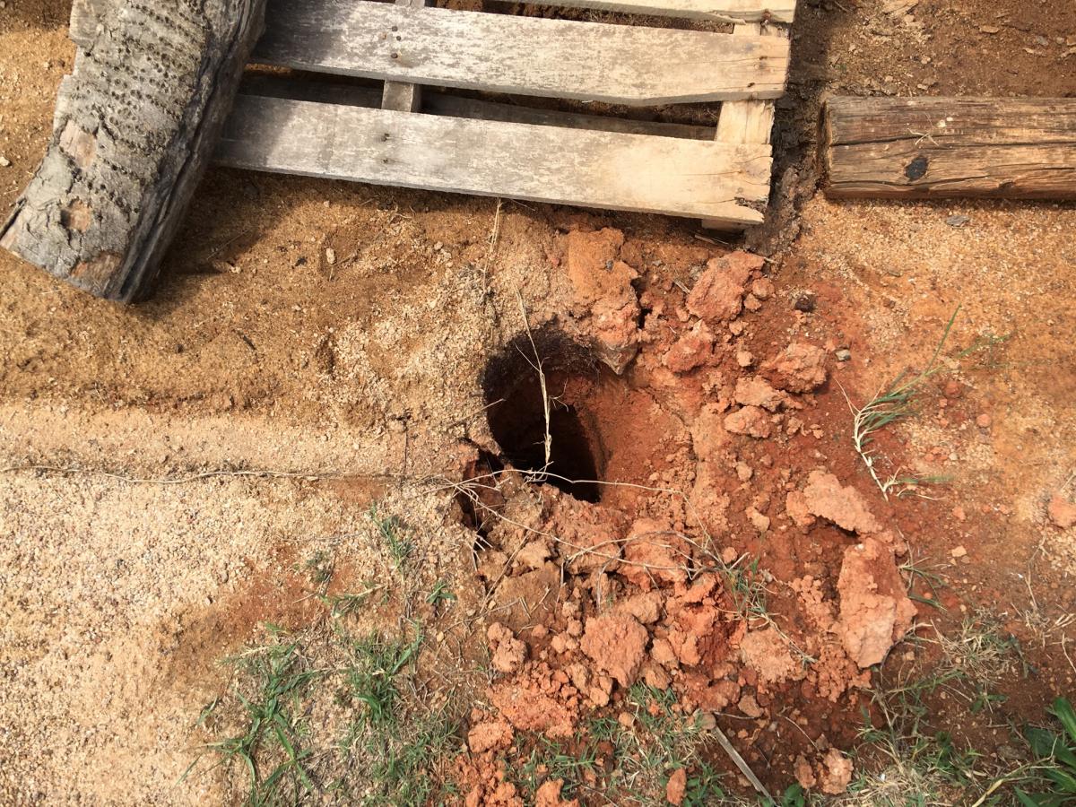
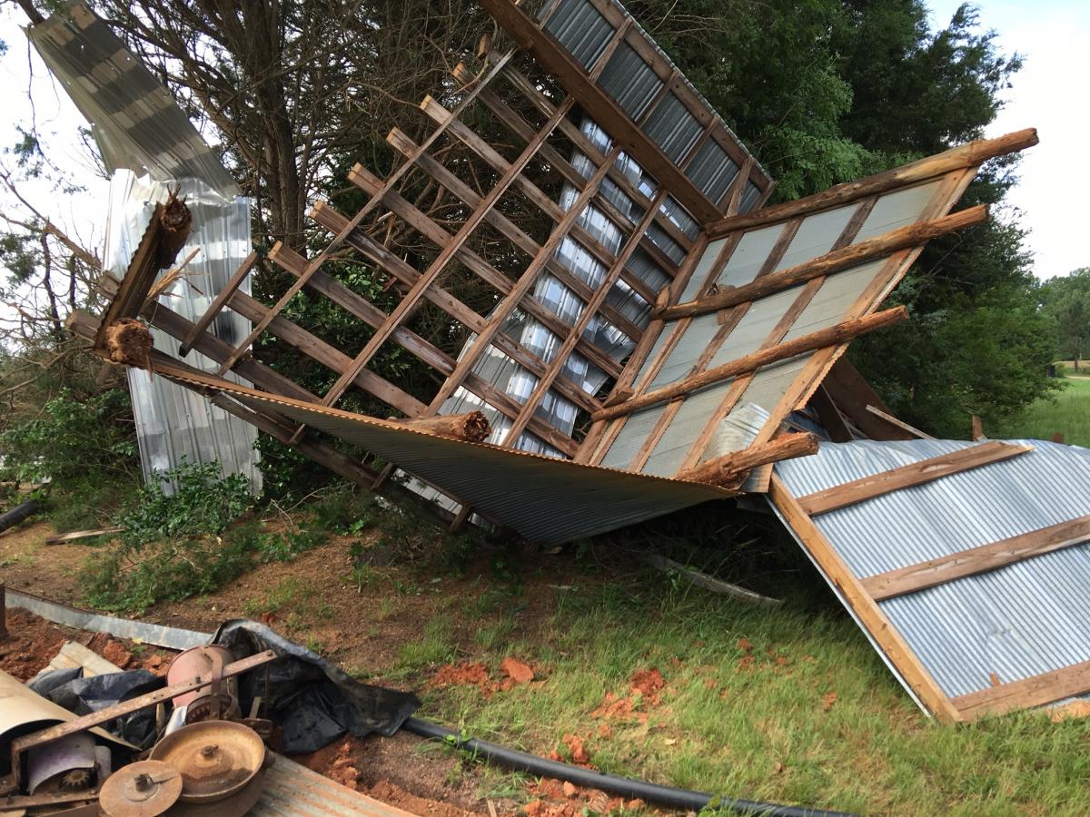
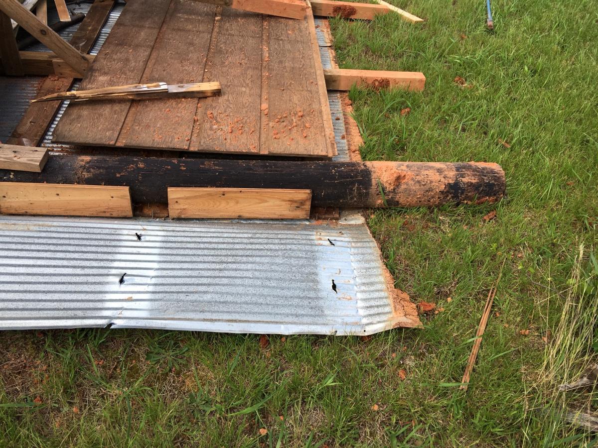
See the post pictured above? You can see the line form where it was buried in the dirt again this was 18 inches and this is a building that appears to have been up for sometime.
I have been in conversations with the National Weather Service in Greeneville/Spartanburg and they are looking into the data to confirm if this was in fact a microburst or some other weather event. Once I hear back form their investigation I will post an update.
Just a brief reminder of how quickly weather events can take something from you in the blink of an eye. Remember things are replaceable you are not! As always thank you for following Rowan County Weather!