
Memorial Day Weekend Storm
All eyes right now are pointed to the Atlantic Ocean and Invest 91L The storm itself is really unorganized and making its way through the Atlantic Ocean. If it gets a name is will be Bonnie. However, don't worry about the name and where the center of circulation will make landfall. We know at this point it's likely to impact the SC/GA coast when it makes landfall. The impacts will be felt up and down the east coast though. The main impacts form the storm will be rain. So if you are going to the beach this weekend. I would go. It's rain and it's going to rain at some point when you're at the beach anyway so just go.
Now onto what to expect at this point.
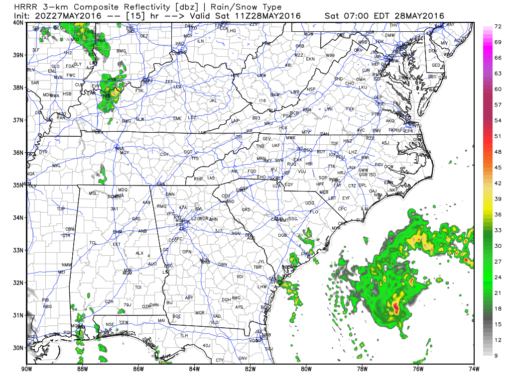
As you can see by Saturday night at 8pm most of the rainfall is still occurring off the coast. So you can certainly plan on enjoying your Saturday at the coast.
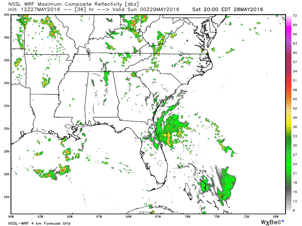
As you can see from above Sunday will be the day that's going to be wet. Not only will it have an effect on the coast. The storm could have an impact on the Coke 600 here in the Charlotte area as well. By 7 pm Sunday night we are looking at the possibility of a half of an inch of rain. Being that it takes two hours to dry the track this could be problematic.
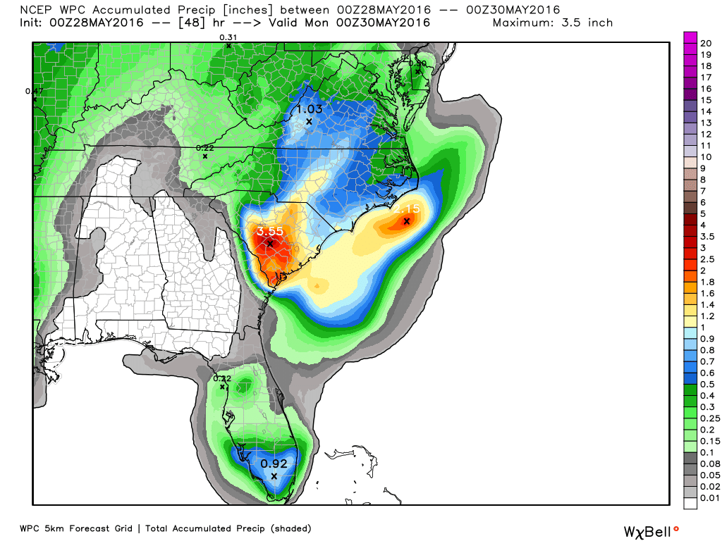
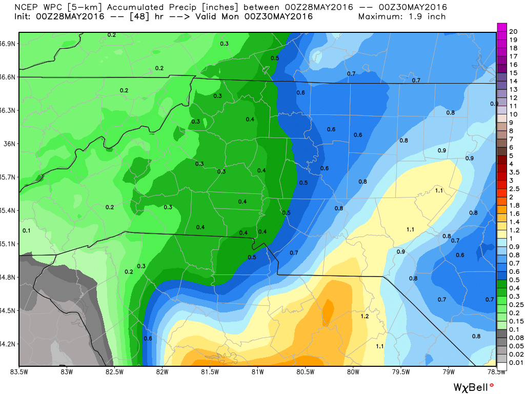
The above model is from 10 pm Sunday night. Rainfall amounts could be form a quarter of an inch to an inch around the area and the county. Areas along the coast could see as much as 7 inches of rain on Sunday.
Just a closer view of the area and the county Sunday night at 7 pm again a half of an inch of rain is possible by that point. Rainfall will move through the area overnight Sunday and into the day on Monday.
I will continue to monitor the system as it closes in on the coast and provide updates.
As always thank you for following Rowan County Weather!